


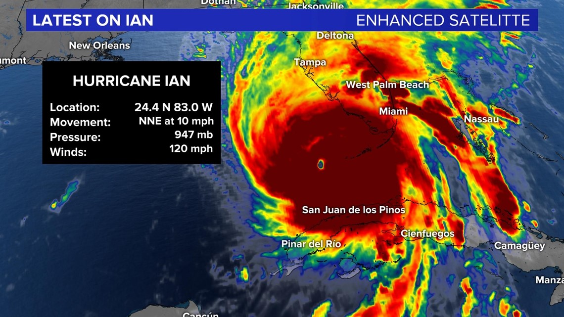
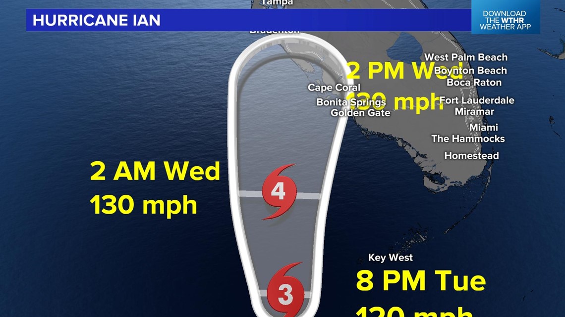
INDIANAPOLIS — All eyes have been on the path of major Hurricane Ian. It is a Category 3 hurricane with winds of 120 mph.

Hurricane force winds are expected along southwest and west central Florida Wednesday morning.

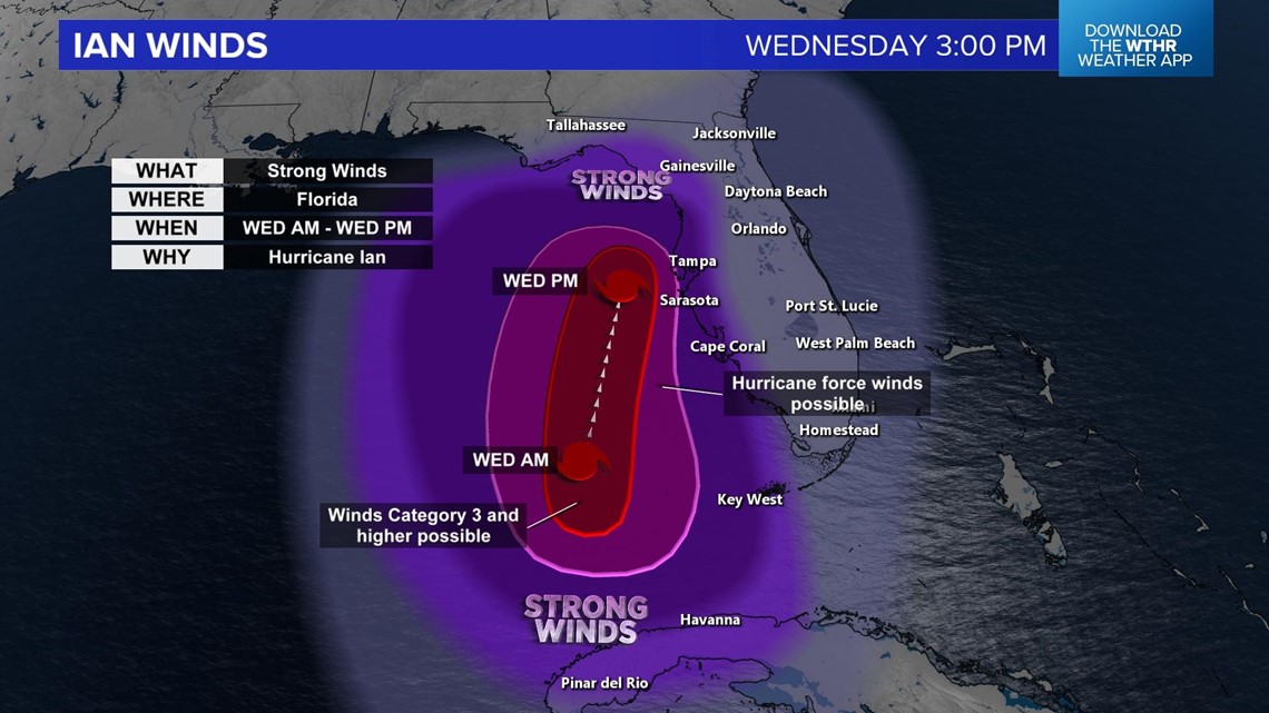
The strongest winds will be as the hurricane is approaching, especially in the right front quadrant. The timing now looks mid to late morning Wednesday through Wednesday evening.
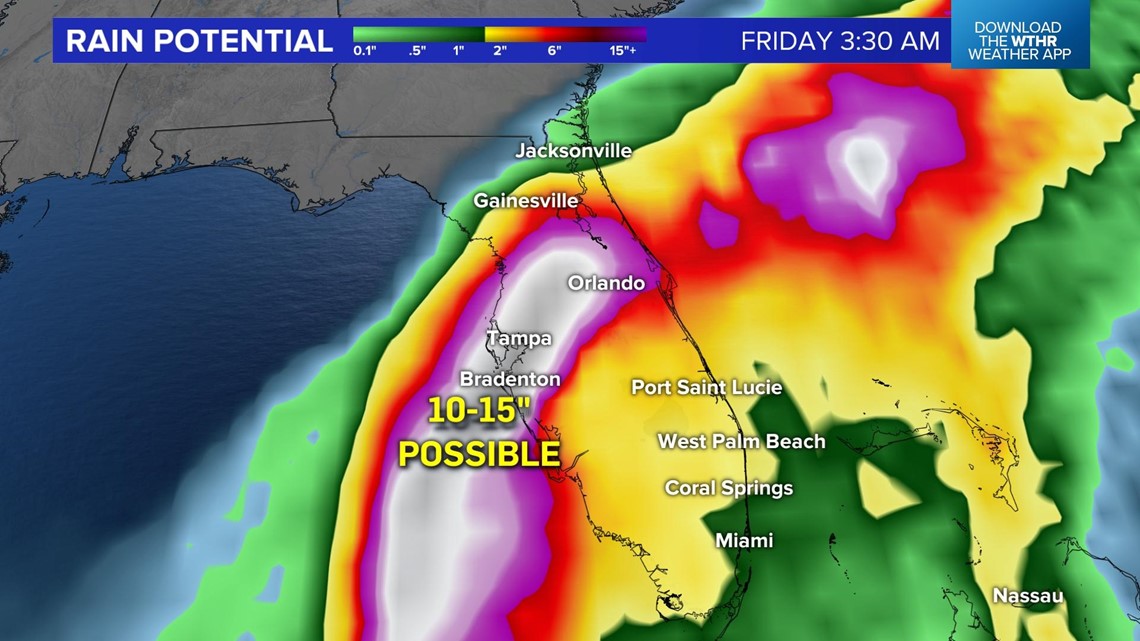
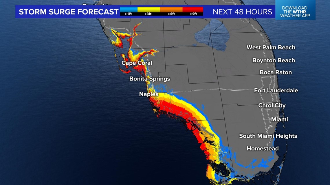
Flooding rains will be another threat with Ian. Flash flooding and stream flooding will be a major concern. Computer data models are calculating 10' to 15" of rain by Friday morning. Storm surge is another concern with this storm system.

Some areas from southwest Florida to west Florida could have storm surges over 9 feet.

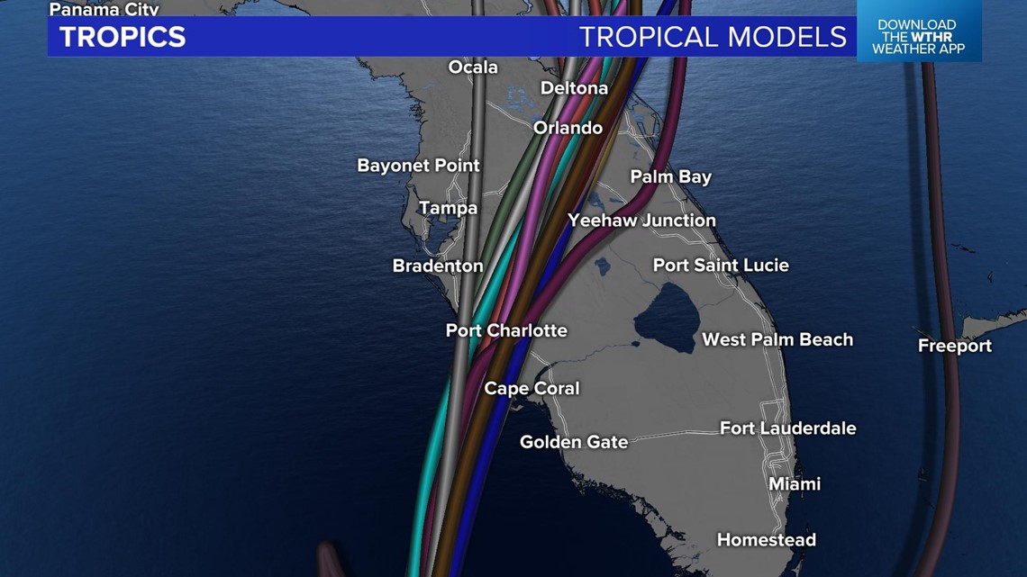
The areas between Tampa and Fort Myers is where the brunt of the storm is on track to hit. The spaghetti models (many different computer data model runs) have the main track right over or just north of Fort Myers.

.Here is the projected track of the hurricane.


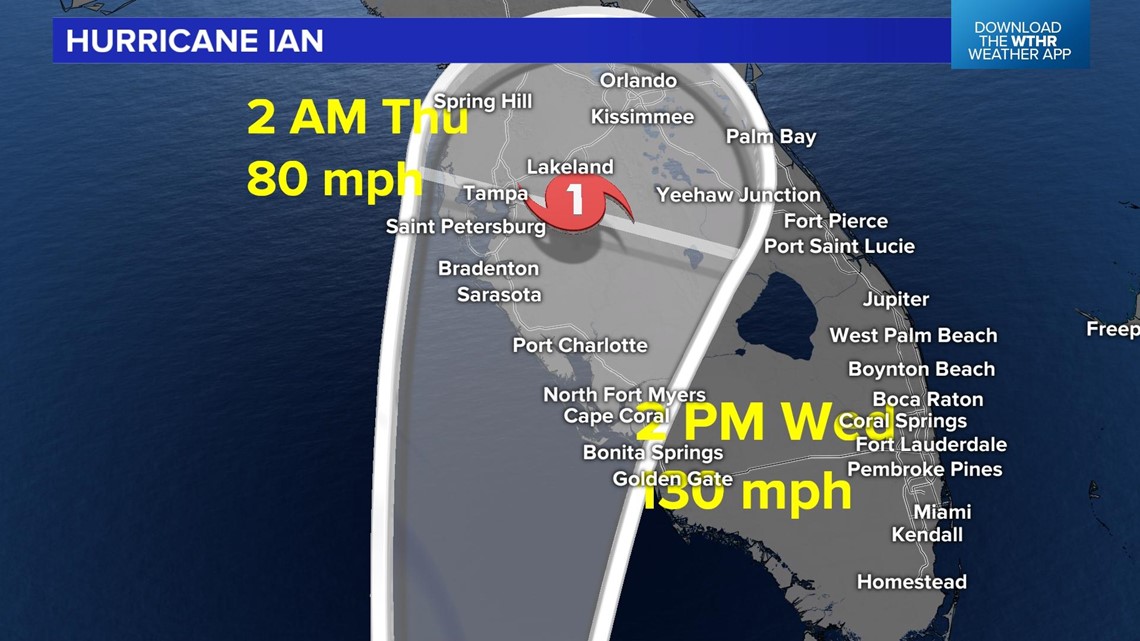
The strongest impacts of this storm will be on Wednesday but lingering rain and gusty winds will be around on Thursday and Friday.
What other people are reading:
