
INDIANAPOLIS — Indiana experienced severe weather Friday evening with heavy rains, damaging winds and even a confirmed tornado in Jay County. A Flash Flood Watch was also issued for parts of central Indiana until 10 a.m. Saturday morning.
Stay weather aware with 13News, the WTHR app and here at WTHR.com.
Live Doppler 13 Radar:

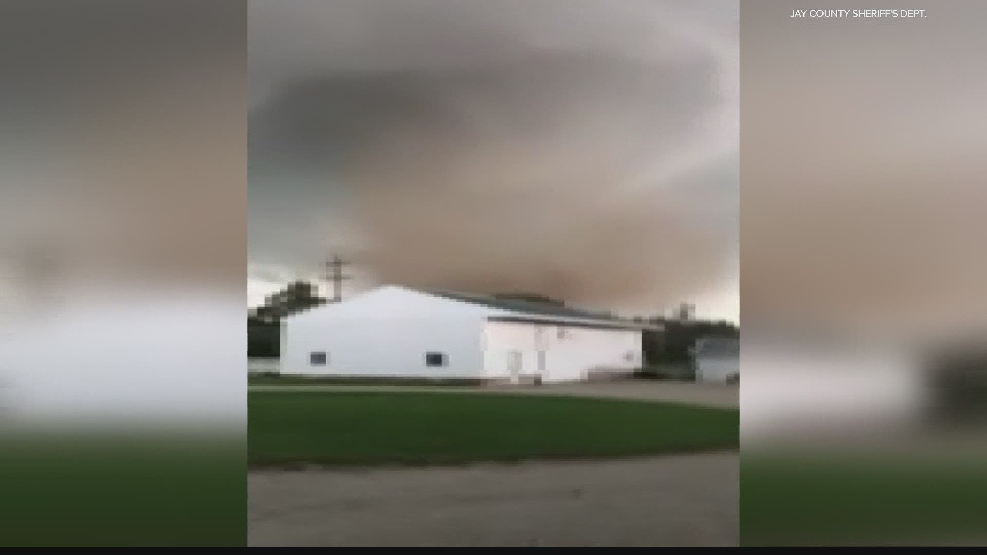
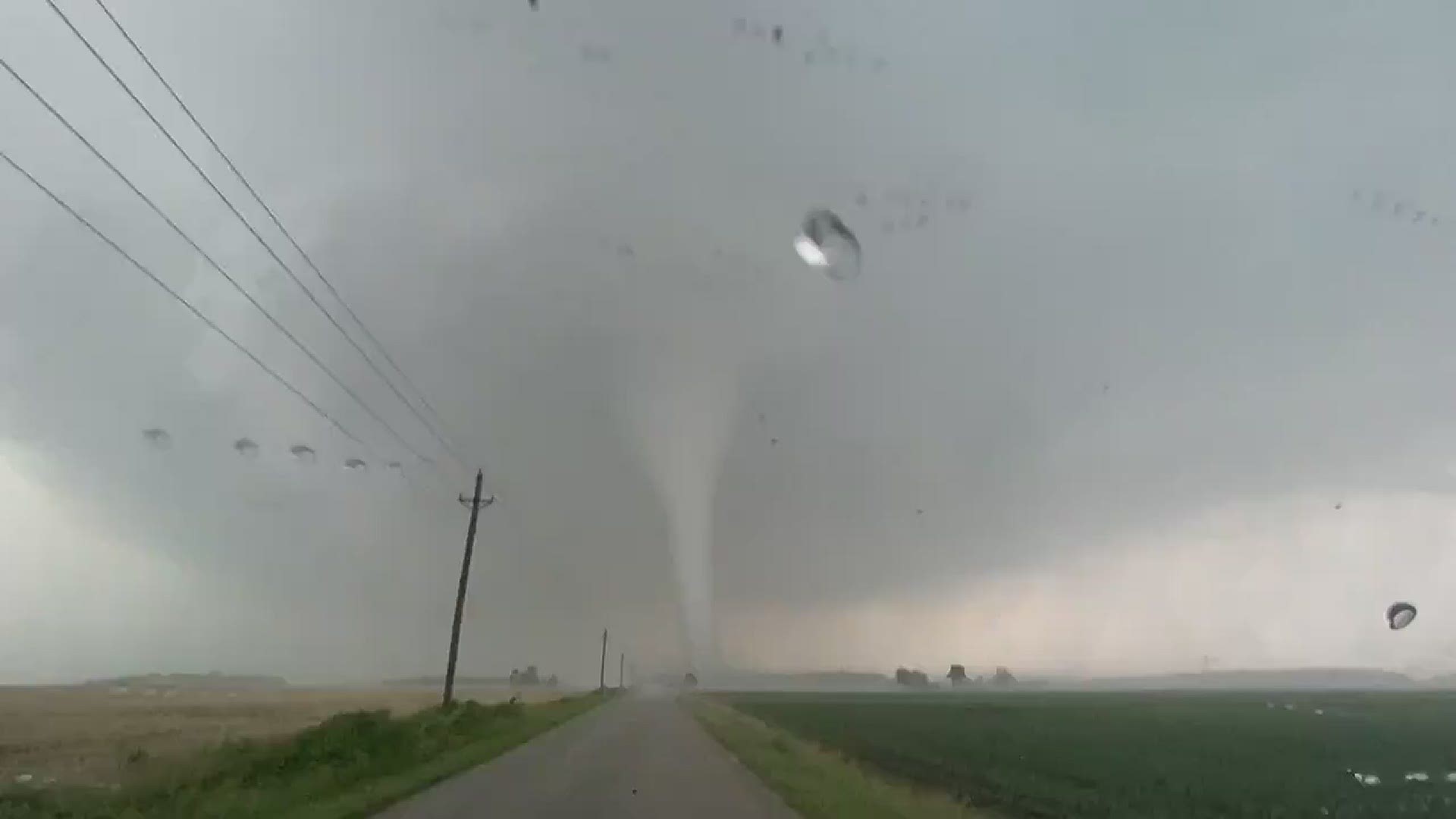
Video of tornado in Jay County
Courtesy: Aaron Hoevel
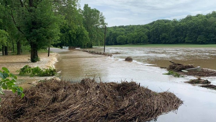
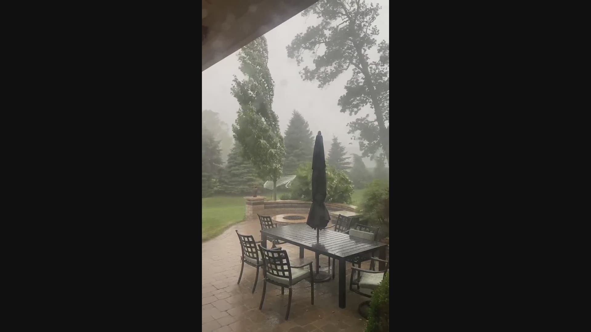
Storm images:
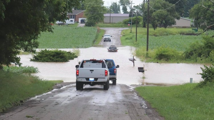
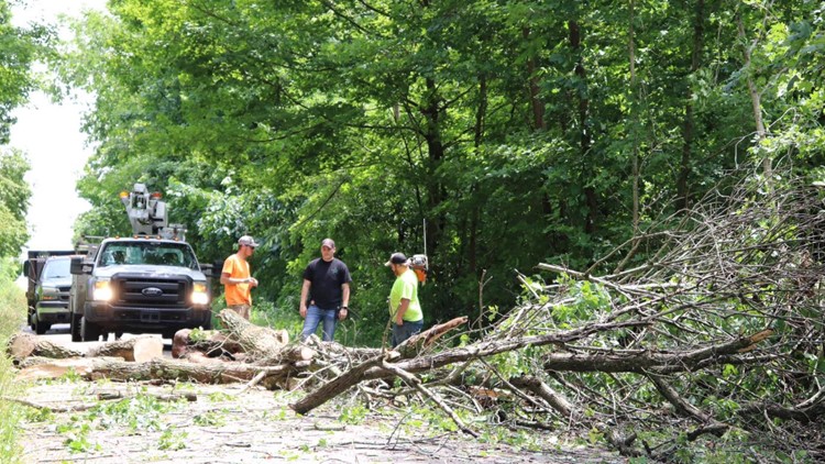
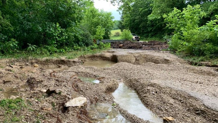
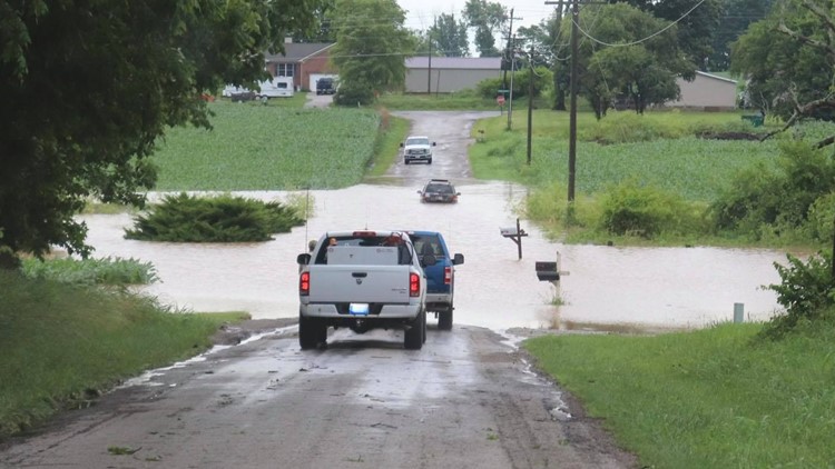
Storms sweep through Owen County downing trees and flooding roads


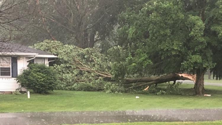
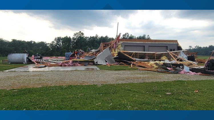
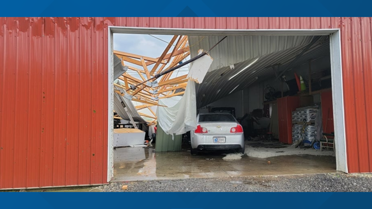
Hail and storm damage from severe weather in Indiana June 18, 2021


Live blog:
2:53 p.m. - The power was out at Fourwinds Lakeside Inn and Marina in Bloomington Saturday and the road leading to the hotel and marina was blocked by a downed tree and power lines.
The resort hoped to have the road open by 4 p.m. Saturday. WTHR reached out to the resort after 4 p.m. and, at the time of this publication, hasn't heard back about whether the resort is still blocked.
The resort said it is unclear when the power will be restored.
2:20 p.m. - Owen County was hit hard by severe weather Friday night and on Saturday first responders and highway department staff worked to clean up the mess left behind by the storm.
Owen County Councilman Anton Karl Neff thanked the entire Owen County Highway Department staff and the central dispatch team for their work.
Crews were working to clear road obstructions that required immediate attention.
He said broader damage assessment is in-process. If you have encountered a blocked roadway, that can be reported to 812-829-4874, option 1.
1:00 p.m. - Owen County has declared a local disaster. The declaration comes from Emergency Management Director Jack White, and was posted by County Councilman Anton Karl Neff:
“Due to the severe damage to Owen County roads caused by recent heavy rainfall, the Owen County Commissioners have declared an “Emergency Declaration of Local Disaster”. Part of the declaration declares a local travel advisory, “Watch”. Owen County roads have suffered severe damage, 23 culverts have been washed out and 2 bridges have significant damage. In all, over 30 Owen County roads are closed. Owen County officials are discouraging travel on county roads, except when essential.”


12:10 p.m. - Power outage updates
- AES reports 1,313 customers without power scattered throughout Indianapolis and Marion County. The largest single outage involves more than 300 customers in Meridian Hills.
- Duke Energy is reporting 930 active outages throughout the state, affecting more than 28,500 total customers. Monroe, Lawrence and Vigo counties account for more than 15,000 of those customers.
- Indiana Michigan Power reports 259 customers out of power, with approximately 50 concentrated in Delaware County.
8:30 a.m. - Duke Energy statement
With more than 40,000 customers statewide without power, Duke Energy posted an update on its website:
"The severe storms that swept through Indiana and Ohio last night brought down lines and poles across much of the service area. Ongoing weather activity this morning has hindered the pace of restoration. Once conditions allow, we will begin making the necessary repairs to restore power to everyone affected. In the hardest hit areas, estimated restoration times may be delayed. Thank you for your patience."
Duke's outage map showed Monroe and Vigo counties particularly hard hit with more than 10,000 outages around Terre Haute and 5,000 around Bloomington at 8:30 a.m. Saturday.
7:40 a.m. - Power outage updates
- AES reports just under 1,700 customers without power scattered throughout Indianapolis and Marion County.
- Duke Energy is reporting 771 active outages throughout the state, affecting more than 37,000 total customers. Monroe and Lawrence counties account for more than 10,000 of those customers. Hamilton County is reporting more than 3,300 out, with more than 1,200 out of power in Jackson County.
- Indiana Michigan Power reports 345 customers out of power.
7:20 a.m. - Sarah Jones is reporting live in Bloomington on 13Sunrise and surveying the aftermath of last night's flooding on Kirkwood Avenue.
6:30 a.m. - Power outage updates
- AES reports more than 1,700 customers without power scattered throughout Indianapolis and Marion County.
- Duke Energy is reporting 627 active outages throughout the state, affecting more than 30,000 total customers. Monroe County has more than 5,500 customers out. Hamilton County is reporting 3,300 out.
- Indiana Michigan Power has 1,200 customers out, including several in the Muncie and Alexandria areas.
5:15 a.m. - Lindsey Monroe provided a live update on overnight storms and the latest flood warnings, including Indianapolis and Marion County, Hendricks County and Johnson County until 9:15 a.m.
3:30 a.m. - Duke Energy still has about 21,000 customers without power, though the outages seem to have spread out over the past hour. Around 5,000 customers are without power in both the Terre Haute and Bloomington areas and 8,000 are in the dark in the southeastern part of the state.
2:31 a.m. - Duke Energy reported about 21,000 customers without power in Indiana overnight into Saturday. AES Indiana, formerly IPL, reported about 1,300 without power in Indianapolis.
1 a.m. - Flash Flooding is going to be a concern for many areas in central Indiana, particularly the southern part of the region. The National Weather Service reminded drivers to pay extra attention to roads where heavy rain has fallen.
12:32 a.m. - Heavy rains are causing flooding on the streets near the Indiana University campus in Bloomington.
Patrons of Kilroy's on Kirkwood have tweeted videos showing rainwater rising inside the bar.
12:30 a.m. - With the threat of severe storms continuing overnight, 13News reporter Lauren Kostiuk shares tips for how to stay safe when storms hit after dark.
10:26 p.m. - Severe Thunderstorm Warning continues for North Vernon IN, Crothersville IN, Hayden IN until 11:00 PM EDT
10:24 p.m. - Flash Flood Warning including Ellettsville IN, Spencer IN, Clay City IN until 3:15 AM EDT
10:04 p.m. - Severe Thunderstorm Warning continues for Seymour IN, Brownstown IN, Jonesville IN until 10:15 PM EDT
10:00 p.m. - Severe Thunderstorm Warning continues for Clifford IN, Mount Auburn IN, Flat Rock IN until 10:30 PM EDT
9:52 p.m. - Rotation with severe storm drifting toward Highway 50 between Brownstown/Seymour.
9:24 p.m. - A severe thunderstorm warning is in effect until 10:15 p.m. for parts of Johnson and Morgan counties east of Martinsville.
Areas near Bargersville, Whiteland and Trafalgar are within the warned area and could be impacted by the storm, which includes winds up to 60 mph and hail as large as half dollars.
9:13 p.m. - A tornado warning has been issued until 9:30 p.m. for Brown County. The warned storm is just to the southeast of Nashville.
8:26 p.m. - A tornado warning has been issued for Brown, Monroe and Morgan counties until 8:45 p.m., but was expired a short time later.
7:56 p.m. - A tornado warning has been issued for Shelby County.
7:53 p.m. - Emily D. sent in video of a large tree coming down in Fishers.
7:50 p.m. - A Severe Thunderstorm Warning was issued for Brown, Monroe, Morgan and Owen counties until 8:30 p.m.
7:30 p.m. - A Severe Thunderstorm Warning was issued for Marion, Rush, Shelby and Hancock counties until 8:15 p.m.
7:10 p.m. - More crazy hail in Nora is the size of ping-pong balls.
7:06 p.m. - Holy hail! Stay safe out there. This was shared with us by Laura in Castleton.
6:58 p.m. - A new Severe Thunderstorm Warning for Clay, Morgan, Owen and Putnam counties will last until 7:45 p.m.
6:56 p.m. - A Severe Thunderstorm Warning in effect for Randolph County until 7:30 p.m.
6:52 p.m. - The hail that fell in Nora is the size of marbles. In Fishers, the hail is almost the size of golf balls.
6:46 p.m. - A severe Thunderstorm Warning was issued for parts of Marion, Hamilton and Hancock Counties until 7:15 p.m. There are reports of quarter-sized hail falling in areas.
6:36 p.m. - A strong storm is moving over northern Marion County.
6:25 p.m. - A Severe Thunderstorm Watch is in effect for most of central Indiana until 2 a.m. on Saturday.
5:55 p.m. - Sean is highlighting the zone with the highest potential for severe weather in the coming hours.
5:52 p.m. - Here is a list of road closures in Jay County due to the storm damage:
- 400 N Between 500 E and 700 E
- 450 E Between 500 N and 600 N
- 500 N Between 450 E and 550 E
- 550 E between 400 N and 500 N
- 300 N between 600 E and 700 E
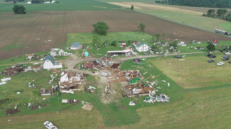
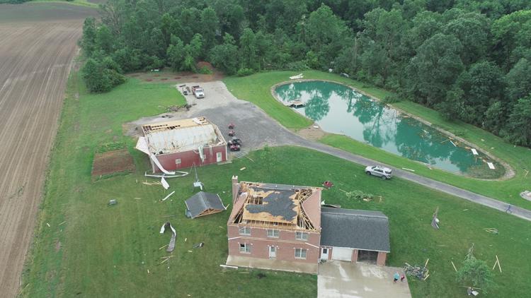
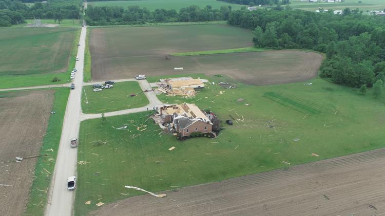
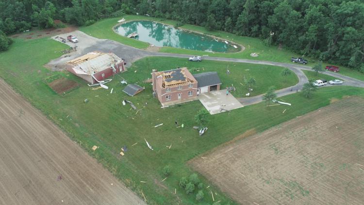
5:44 p.m. - Aaron Hoevel shared video with 13News of a tornado on the ground in Jay County. The video was taken around 4:05 p.m. in the area of 200 N 500 E.
4:55 p.m. - Jay County reports storm damage in the northeastern part of the county near Bryant, Indiana. The damage is mainly along State Road 67 from Bryant, east to the Ohio state line.
4:44 p.m. - Kelly Greene gave a live update on the severe weather risk.
4:20 p.m. - Severe storms with large hail, damaging winds and heavy rain have been firing in north central Indiana. Isolated tornadoes have developed too. See the latest forecast from Kelly Greene.
4:05 p.m. - A tornado was spotted near Trinity in Jay County. It's moving into Ohio.
4 p.m. - A tornado warning is now in effect for Jay County until 4:30 p.m.
3:51 p.m. - The Severe Thunderstorm Warning for the Winchester and Union City areas will continue until 4 p.m.
3:40 p.m. - The Severe Thunderstorm Warning for the Muncie and Winchester areas continues until 4 p.m.
3:32 p.m. - A Severe Thunderstorm Warning is in effect for Delaware, Henry and Randolph counties until 4 p.m.
3:30 p.m. - A Severe Thunderstorm Warning has been issued for Blackford, Grant, Huntington, Wabash and Wells counties until 4:15 p.m.
3:16 p.m. - A severe storm is moving into Grant County and could have some rotation.
2:59 p.m. - A severe Thunderstorm Warning for Wabash, Grant, Huntington and Miami counties is in effect until 3:30 p.m.
2:57 p.m. - A Flash Flood Watch was issued for parts of central Indiana through 10 a.m. Saturday.
2:49 p.m. - 13News Meteorologist Sean Ash says a storm near Peru is showing some rotation.
2:30 p.m. - A strong thunderstorm is moving into Miami County.
2:23 p.m. - Strong thunderstorms are moving out of White county and Cass county and moving into Carroll and Miami counties.