


INDIANA, USA — UPDATE: We are actively tracking severe cells across the state now.
Storms are firing and pushing across Indiana. Each one will have the ability to rotate, creating a tornado risk for the entire state the rest of the day (Tuesday May 7, 2024). Watch for storms until about midnight. Afterwards, the majority of them should move into Kentucky and Ohio.
We have a breakdown of which counties have the highest tornado, hail and wind threats individually.
Tap HERE to track the storms with our interactive radar.
Update on storm heading toward Indianapolis.
There will be multiple rounds of storms. Many times, the storm cells will be scattered, which means they will have the breathing room to rotate even more. Later this evening, storms will start to line up with wind in southern Indiana.
When to expect these storms
A thunderstorm or downpour is possible at any time the rest of Tuesday up until midnight. However there are some main thunderstorm time windows where the severe threat may be the greatest.


For most of northern and western Indiana, the strongest storms will be from 4 p.m. to 10 p.m. Afterwards, a lingering storm is possible, but most of them should be pushing east.
For most of central Indiana, watch around 6 p.m. to midnight for the strongest storms. However, a cell or two may hit slightly earlier than that.
For most of southern and southeastern Indiana, expect storms mainly after 6 p.m., with the greatest time window between 8 p.m. through 2 am.
Once a storm hits you, don't let your weather awareness down. Multiple storms may hit your locations through the evening. This is a very volatile environment where storms can freely pop-up until the cold front hits near midnight.
What is my risk for a tornado?
All of Indiana has rotation, which means all of Indiana has the threat for a tornado. The highest threats will be in near and north of Indianapolis. If we had to pinpoint an area of highest concern, it would be the north-central part of the state, including Lafayette, Kokomo, Peru, Tipton, Fort Wayne, Muncie, Lebanon and Noblesville.

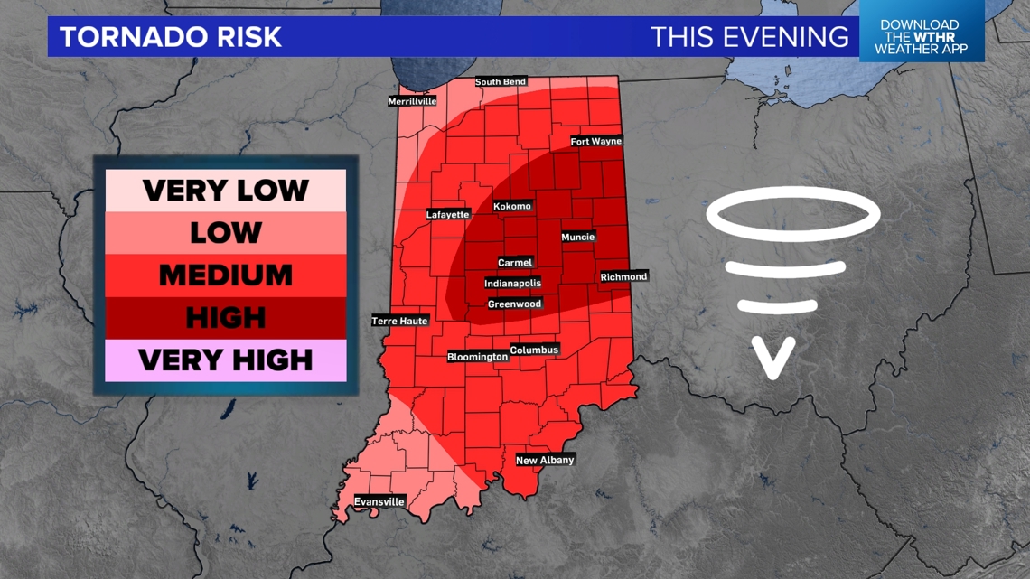
The hard thing about these maps is that it is our best guess, but the atmosphere is constantly evolving.
If you are not in the highest level, you still need to be on the lookout.
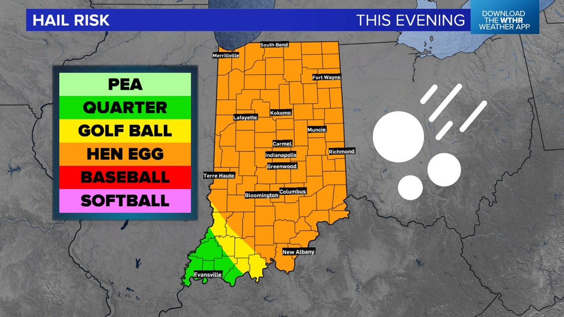
What is my risk for hail?
The supercells with the greatest rotation will have the largest hail. Many storms may produce quarter to hen egg-sized hail (2"). Rotation helps keep the hail cores drier so they can get larger and not too waterlogged.

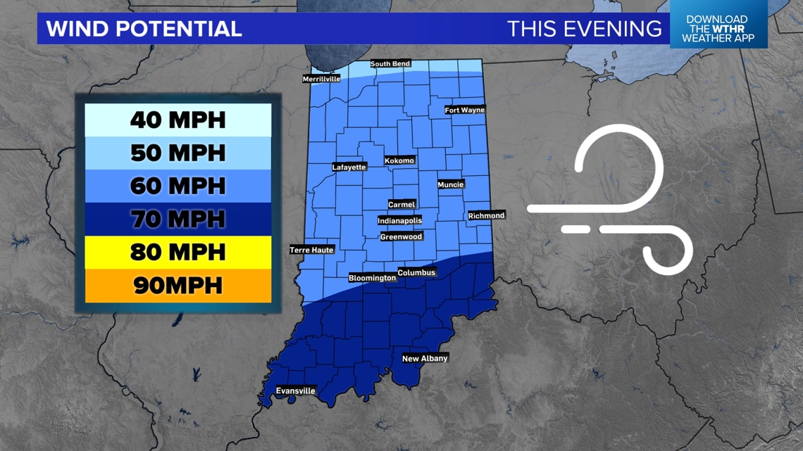
What is my risk for wind?
There will be localized areas of some wind; however, widespread wind is our lowest threat today. There may be small pockets of intense winds in individual cells and downbursts with larger storms.

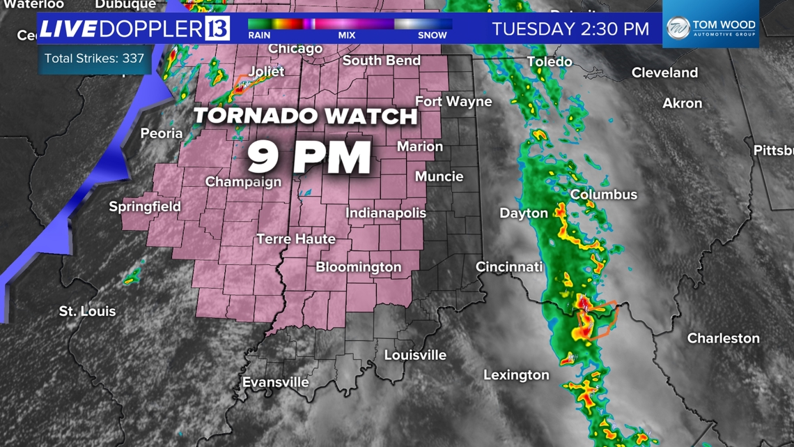
Tornado watch tonight
The first tornado watch is for western and central Indiana until 9 p.m. There is a high chance eastern Indiana also gets a tornado watch later in the evening.

Stay tuned to the WTHR weather team, and stay weather aware the rest of Tuesday.
For more updates on the weather forecast, check our our main weather landing page HERE.
