
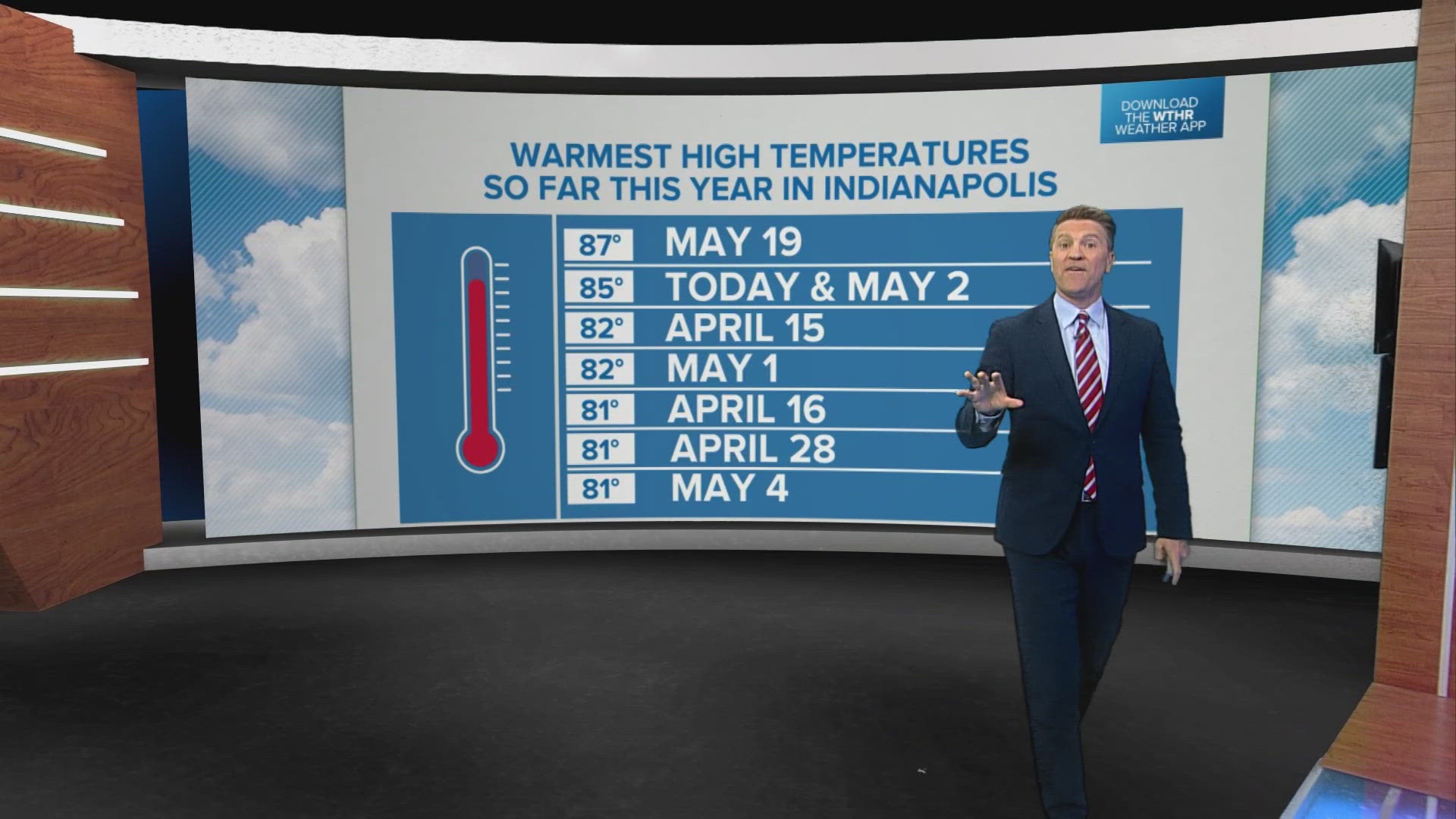
INDIANA, USA — Another hot and humid day is in progress in central Indiana, with daytime highs reaching the upper 80s and not far from the daily record high of 90° in Indy. With or without hitting 90°, temperatures will be nearly 15° above average and more like mid-summer than mid/late May.
We have plenty of sunshine with scattered cumulus clouds. We're not expecting much rain/storm coverage but will be watching northwestern Indiana, which will be closer to the remnant circulation of a decaying storm complex that could provide extra lift for some storm development. Any storms should remain in north-northwest of Indy, but storms that do develop could be locally severe in that zone.
Tuesday will be a near carbon copy with hazy sun and hot highs near 90°. We'll again be watching a likely severe weather outbreak in the Plains, and the remnants could approaching late Tuesday night.
There's a greater probability of severe storms on Wednesday. We'll certainly have a greater coverage of storms that day with daytime heating, abundant low-level moisture and an approaching slow-moving frontal boundary.
The location of that front is more uncertain and dictates how much rain/storm coverage going into race weekend. It's too early for specifics on timing and location each day.
Please check back for updates.

