INDIANAPOLIS — An unsettled weather pattern for central Indiana begins today as a slow moving area of low pressure tracks into the area and stalls out through Saturday.
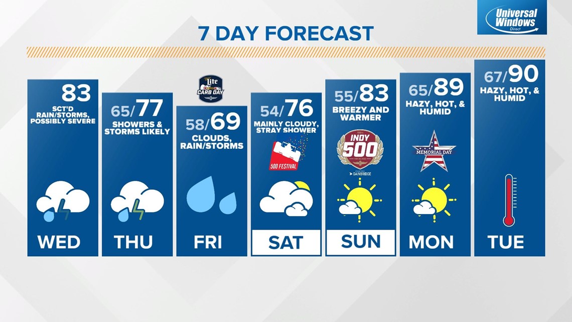
First, the widespread showers this morning become less numerous into the afternoon as the boundary triggering the rain lifts north. This will allow temperatures to recover into the low 80s and the atmosphere to recover, bringing a chance of isolated strong storms this afternoon.

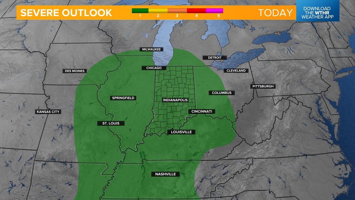
The Storm Prediction Center has the state under a level 1 of 5, meaning only isolated strong to severe storms are possible. The primary threat for today will be brief bursts of damaging wind. Large hail in a few storms can't be ruled out. This threat continues into the early evening and diminishes after sunset.

Southerly winds will usher in more moisture to the atmosphere today and overnight and that will keep stray showers around overnight with humid lows in the mid 60s.

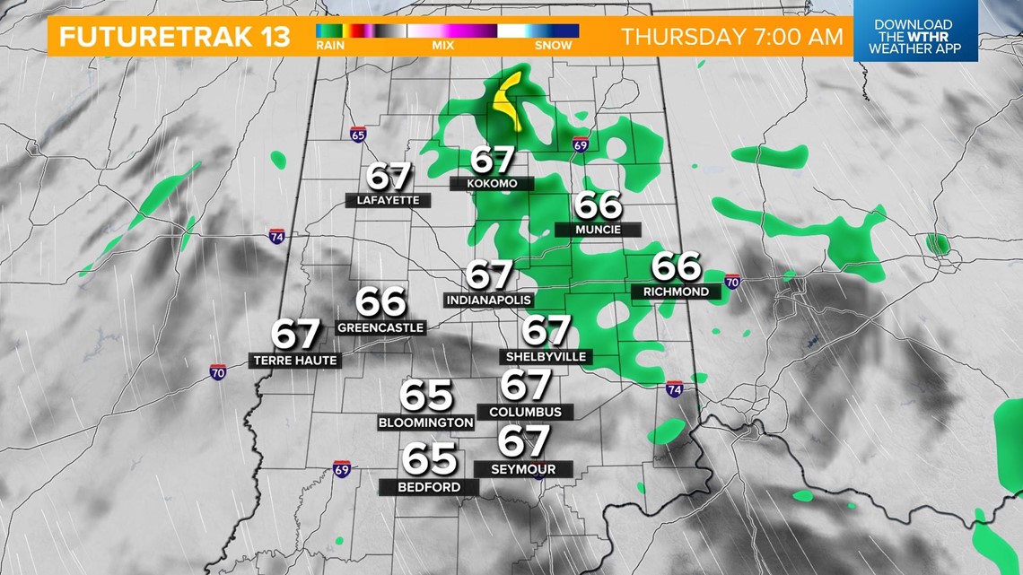
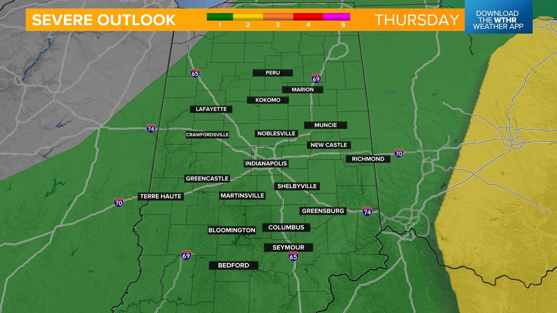
We'll tap into that Gulf of Mexico moisture associated with that southerly wind again on Thursday. This will enhance our chances of more widespread rain through the afternoon with embedded thunderstorms. While widespread severe weather is not expected, a few isolated strong to severe storms will again be possible Thursday afternoon.

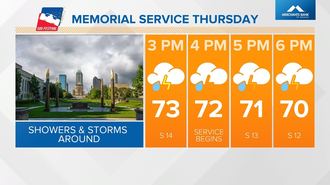
Plan ahead if you have plans to attend the 500 Festival Memorial Service as this event moves indoors due to weather. It'll still be a rather warm and humid day despite the clouds and rain with temperatures topping out in the mid to upper 70s.

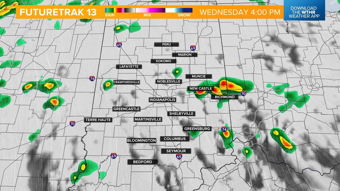
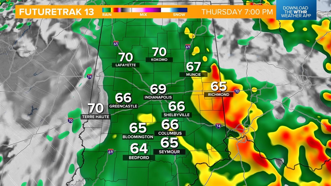
Bands of heavy rain continue into Thursday afternoon and evening with localized areas of flooding possible as parts of the state could see up to 1" of rainfall.

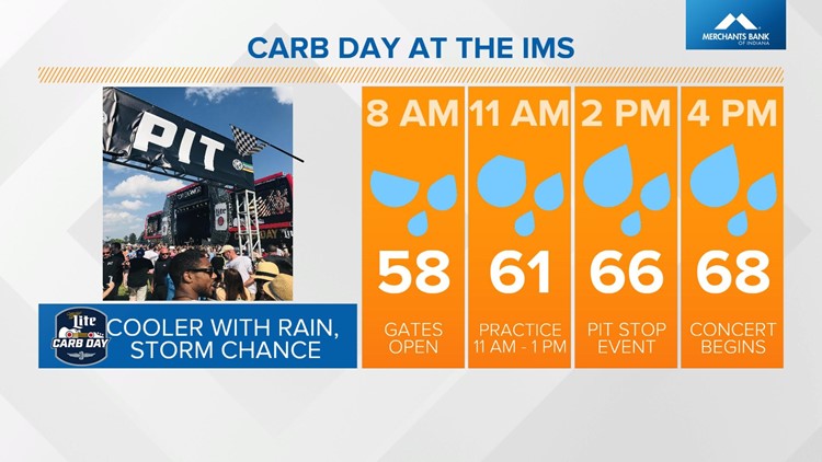
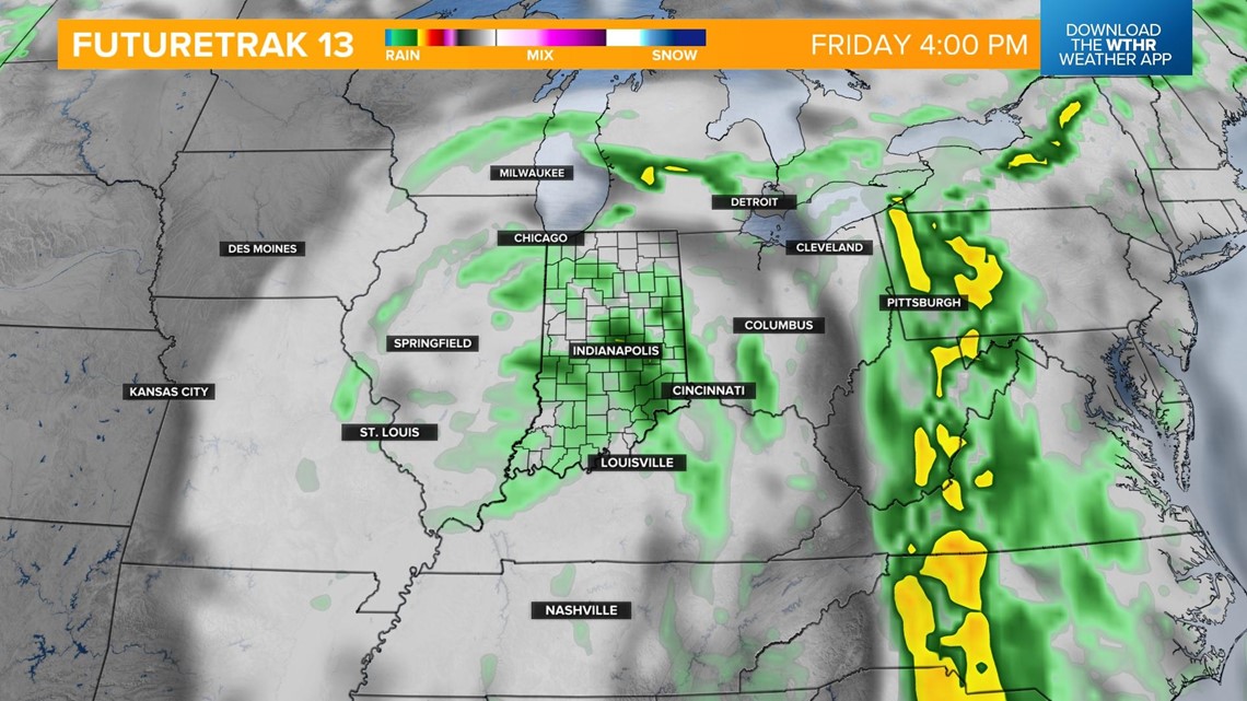
The "warm sector" of this weather system begins to exit on Friday but we'll still be left with ample cloud coverage and lingering rain chances. We could even see a few thunderstorms develop Friday afternoon, but with a low threat of them becoming severe. Temperatures will struggle to reach the upper 60s for Carb Day.


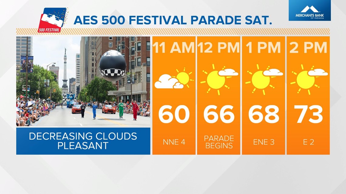
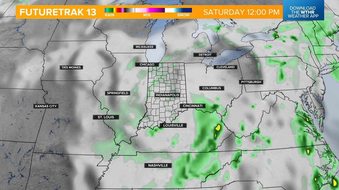
As this slow-moving system continues to track east Saturday, clouds will linger with the potential of a stray shower or two to start the day before clearing later in the day. We'll call it mainly dry for the AES 500 Festival Parade with temperatures warming through the 60s and 70s. Look for highs Saturday afternoon in the mid 70s.


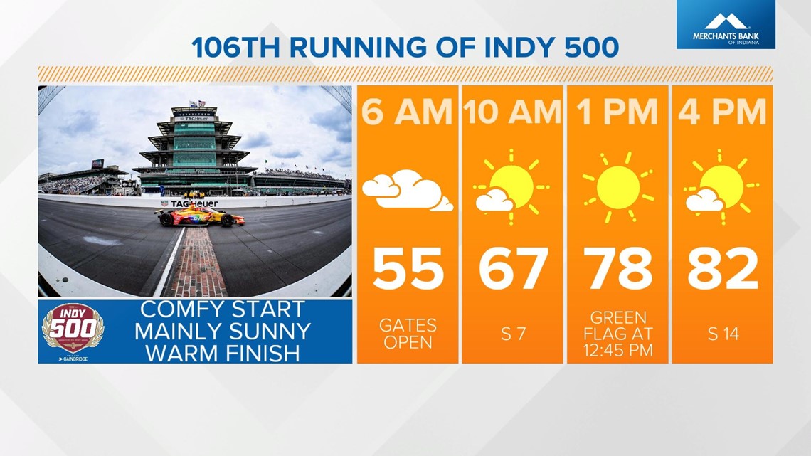
Race Day Sunday will be the turning point with our temperatures surging back into the 80s and a mild start to the day in the mid 50s. We're looking at a dry day as well with a mix of sun and clouds.

Prepare for a hot and humid Memorial Day with highs back in the upper 80s near 90. Next week overall looks much warmer as we unofficially kick off the summer season.

What other people are reading:
- Uvalde school shooting: All 21 killed were in same classroom, Texas DPS says
- See the new $100,000+ pool donated to an Indy grandma following her backyard disaster
- Iraqi citizen who lived in Indianapolis charged in plot to murder former President George W. Bush
- Check your bank account if you went to Meijer this past weekend
- 'Records are meant to be broken' | Hélio racing for 5th Indy 500 win
- Expert shares tips for saving on gas ahead of holiday weekend travel
- Families begin identifying 19 kids, 2 adults killed in Texas elementary school shooting
- Alzheimer's journey on 'This Is Us' hits close to home for Fishers woman