

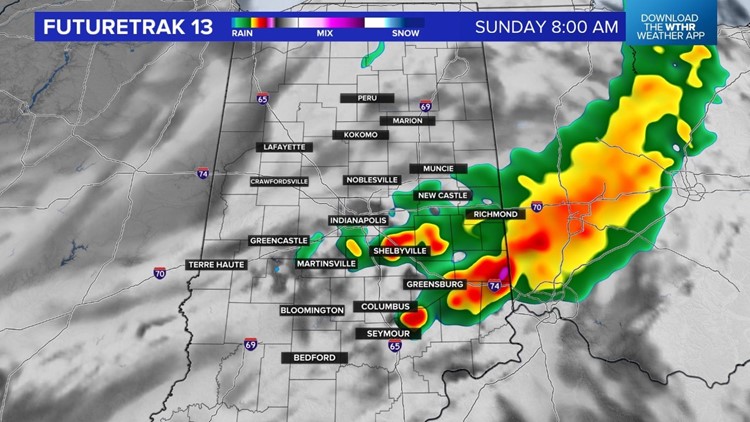
INDIANAPOLIS — A complex of rain and storms is moving across central Illinois late Saturday night. We will track that complex overnight into early Sunday. We are forecasting it to weaken but it will bring a much-needed rain chance overnight and early Sunday to central Indiana.

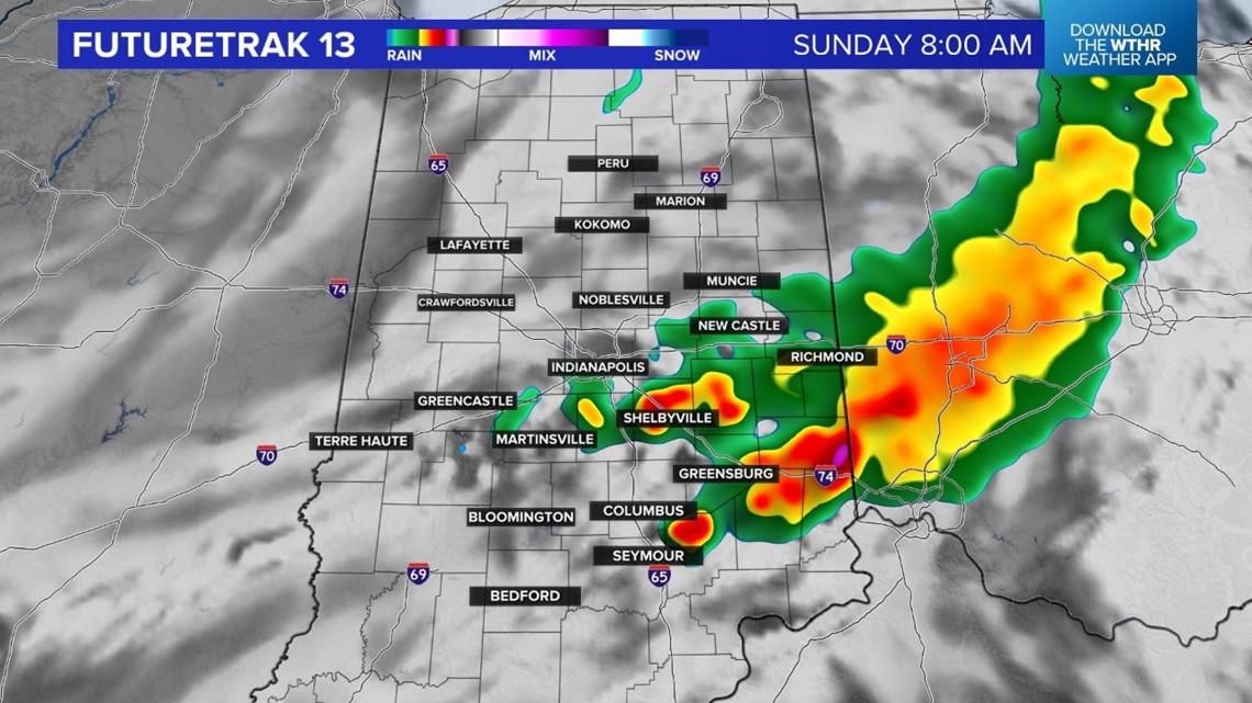

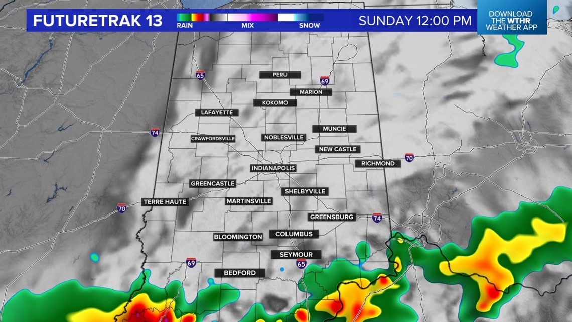

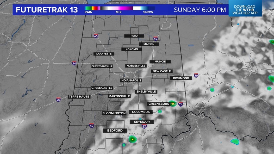
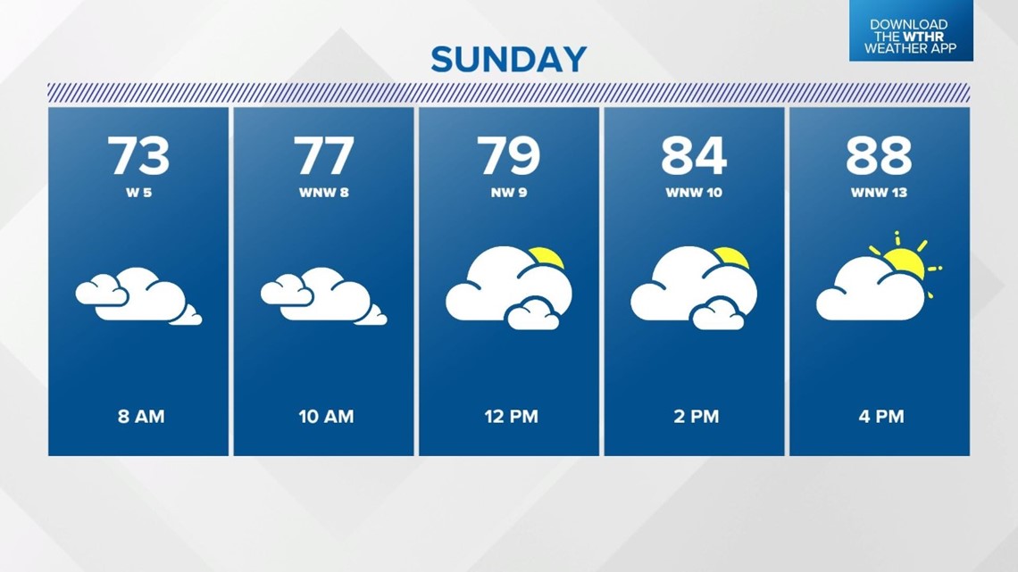
The storm chance shifts south on Sunday. If you have outdoor plans, be sure to check Live Doppler 13 Radar first. It will be a sticky Sunday, with highs of 85 to 90 degrees, but heat index values of 95+ degrees.

This weather system is a cold front and behind the front, there will be less humid air.
Sunshine is back for Monday and Tuesday will highs near 80 degrees.
Central Indiana will heat back up for the end half of next week. Forecast highs are in the upper 80s and lower 90s Wednesday through the start of the holiday weekend.
