
INDIANAPOLIS — A Winter Storm Warning will take effect at 3 p.m. Thursday and run through 7 p.m. Friday.
The main change to the forecast compared to earlier in the week is a quicker arrival time of the Arctic front and quicker departure time to the storm itself. This means instead of having errands and/or traveling done by 7 p.m., you should be where you need to go by 4-5 p.m. in the Indy metro area and sooner for areas in west-central Indiana.
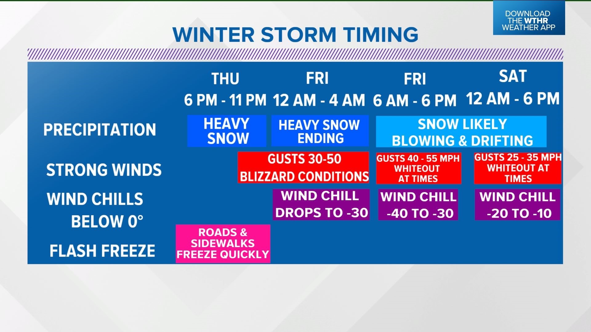
Areas of mist, sleet or rain showers develop after midnight and linger around early Thursday morning before becoming all liquid precipitation by noon. Temperatures will eventually shoot to near/above 40° for a few hours in the afternoon before the well-advertised Arctic front arrives.
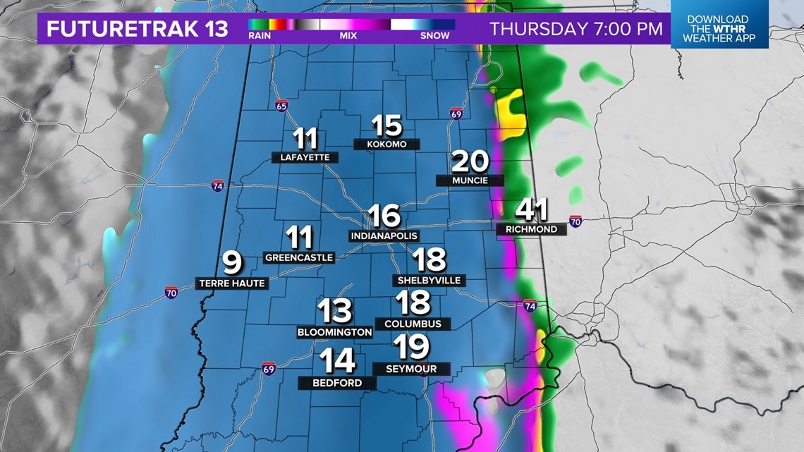
That front will be near the Illinois/Indiana border around 3 p.m. Thursday. As we've said all week, once the front passes your area, the weather conditions will change rapidly and road conditions will deteriorate in a matter a few hours as temperatures plummet 30°-40° in short order.

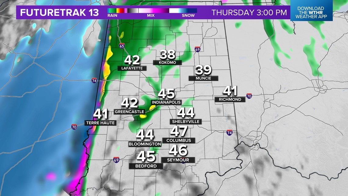

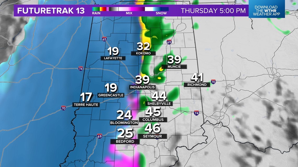

We're expecting strong front to cross the metro area around 5 p.m. Thursday.
From west-to-east behind the front, a flash freeze occurs that instantaneously makes wet roads/sidewalks icy as the leftover moisture from rain becomes a glaze.
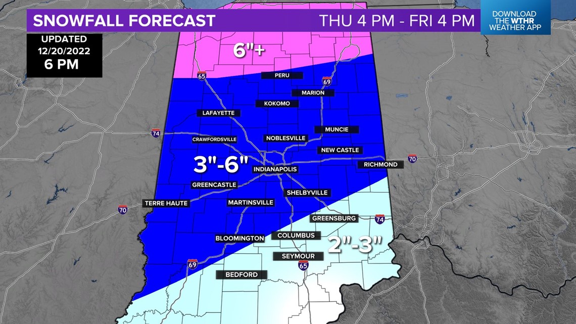
At the same time, there will be a rapid transition of rain-to-snow following the passage of the front. Snow falls heavily at times until just after midnight and accounts for most of our initial snow accumulation.
The bulk of the 3 to 6 inch snow forecast occurs before 1 am Friday and makes an already monumental task for road crews even more daunting.
This is why we're urging against travel if possible with the glaze of ice being covered by fresh snow.
Making matters even worse is temperatures dropping below zero by early Friday morning. That's just an impossible scenario for safe travel and a timely clean-up of snow/ice on roads/sidewalks.

Another reason to avoid traveling will be the whiteout conditions will experience from strong wind interacting with falling snow or snow already on the ground. Blowing and drifting snow will be around into Christmas Eve day and aggravates an already dangerous situation.
We're also urging against spending much - if any - time outside Thursday night into Christmas Eve morning as wind chills drop to dangerously low levels of -30 or colder. This becomes the longest stretch of -30 to -20 wind chills since January 2014. It only takes 10 minutes or less in wind chills that cold for frost bite to occur.

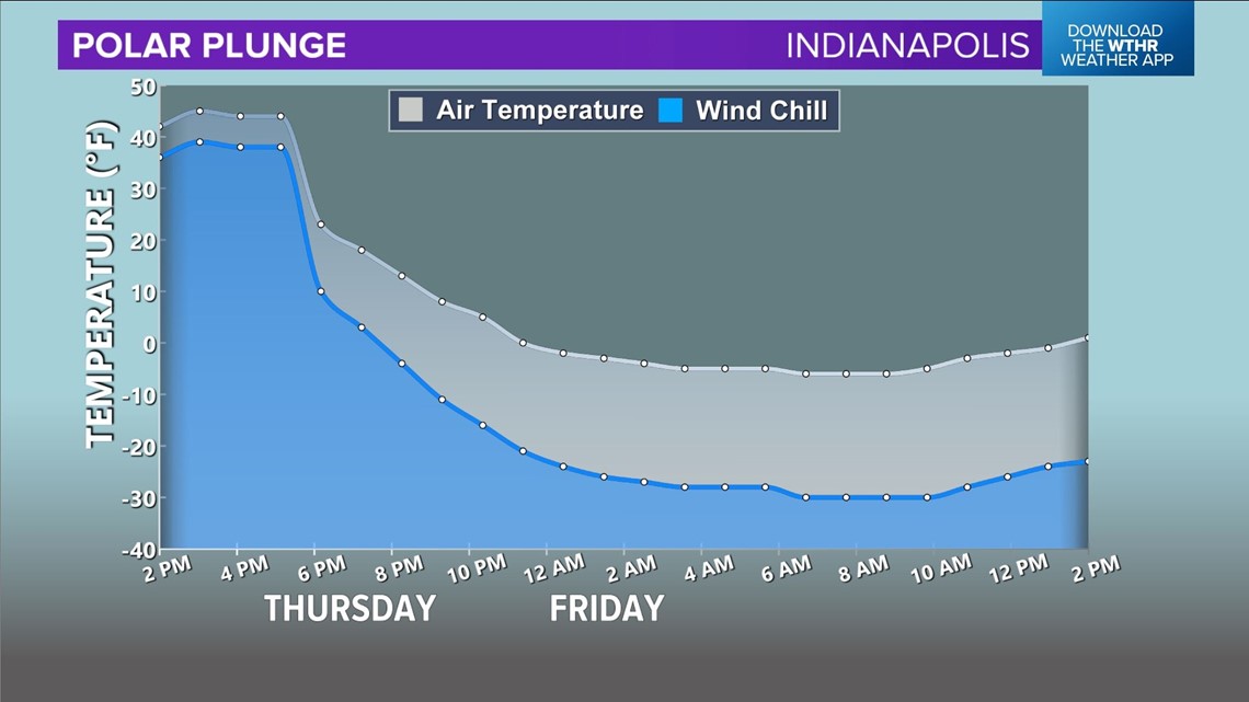
There will also be many hours below to near zero temperatures. That long duration of cold can/will burst pipes.
Steady light, but impactful, snow continues into Christmas Eve. Though light, it's falling on very cold roads and keeps them slick for the holiday weekend.
Stay safe, friends. The Live Doppler 13 Weather Team will be on top of this storm and post updates/changes as needed.

