
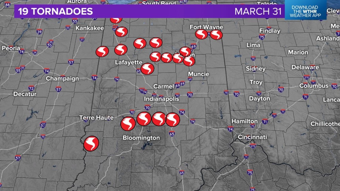
INDIANAPOLIS — The National Weather Service has teams surveying damage from a deadly and destructive severe weather outbreak and those teams say at least 19 tornadoes, including four EF-3 tornadoes, touched down Friday night across Indiana.
How you can help
WTHR Cares for those impacted by tornados in Indiana and across the Midwest. If you would like to help with a donation to the Red Cross, you can click here, call 800-RED CROSS or text the word REDCROSS to 90999 to make a $10 donation. Donations enable the American Red Cross Indiana Region to prepare for, respond to and help people recover from these disasters.

Sullivan County: EF-3 tornado
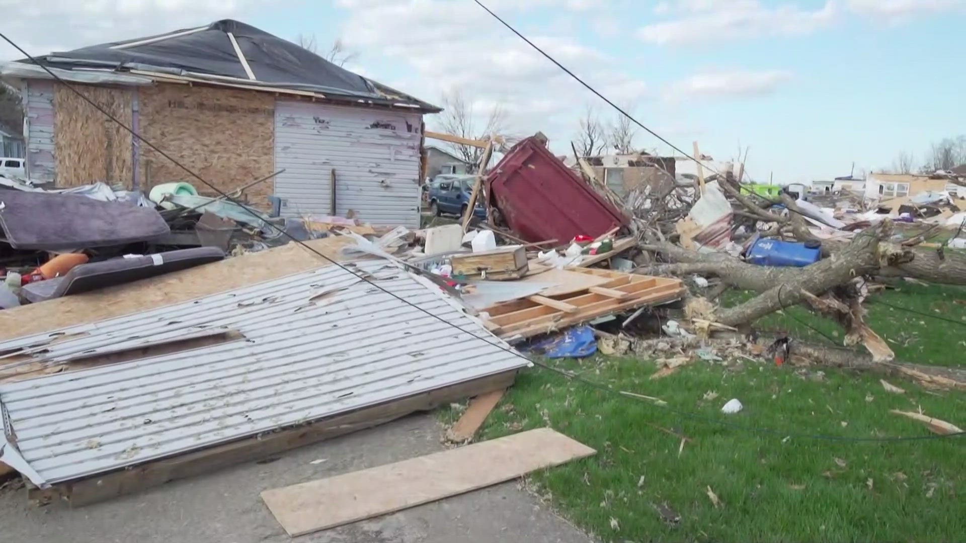
The largest tornado was in Sullivan County, where officials say three people were killed, eight were injured and at least 200 homes were destroyed.
According to the preliminary findings by the NWS, survey teams estimate Sullivan County was hit by an EF-3 tornado with peak winds of up to 155 mph.
The tornado is believed to have touched down at 10:21 p.m. and it traveled a little over 13 miles, crossing the Wabash River and entering Sullivan County where it threw a modular home at least 200 yards to "destruction," the NWS said.
It continued into the city of Sullivan, damaging dozens more homes, including a modular home that was thrown at least 150 yards killing one occupant and injuring another.
Many trees were sheared 20 to 30 feet off the ground.
Johnson County: EF-3 and EF-0 tornadoes
The second-largest tornado tore through Whiteland. The NWS initially thought Whiteland was hit by an EF-2 tornado with winds of up to 135 mph, but in an update Monday, the NWS preliminarily upgraded that tornado to an EF-3 with winds of up to 140 mph.
The tornado is believed to have touched down at 11:33 p.m. and it traveled about 3.5 miles.


As it moved through the Park Forest neighborhood, it intensified from an EF-0 to an EF-2 and kept moving northeast toward US 31.
It continued to strengthen, producing mid-range EF-2 damage near Forum Drive and then high-end EF-2 damage as it crossed the railroad tracks and hit
a neighborhood near Paris Lane and East Pearl Street.
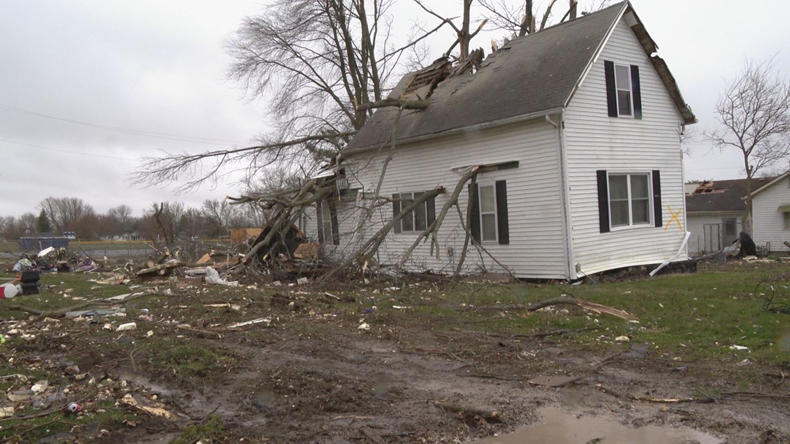
Numerous homes in its path had damaged roofs, several had most of their exterior walls collapse, one only had one wall left and another was completely destroyed with only a concrete slab left.
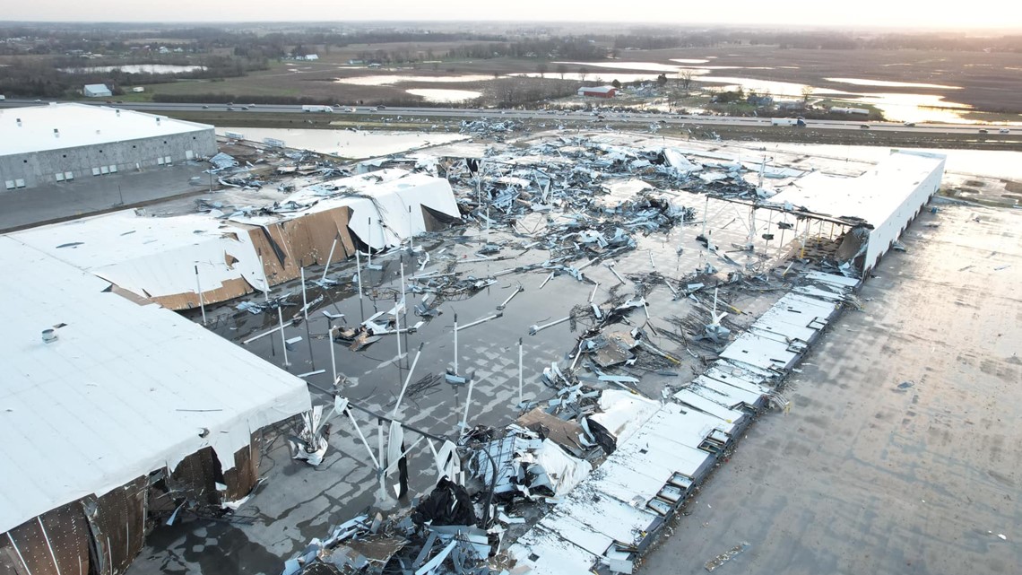
A warehouse further northeast had preliminary low-end EF-3 damage. Portions of the warehouse were completely gone and blown onto I-65.
The NWS said the tornado quickly lifted just east of I-65.

Minutes before the Whiteland tornado, at 11:27 p.m., an EF-0 with winds of up to 85 mph touched down in Bargersville.
The tornado traveled just short of 2 miles, damaging trees and downing multiple power lines that were left laying across SR 135. It lifted just before racing over SR 144.
On Saturday afternoon, Governor Eric Holcomb declared a disaster emergency in both Johnson and Sullivan counties.
In Johnson County, Whiteland was hit particularly hard. Overnight Friday, Sheriff Duane Burgess told residents to stay away, citing live power lines in roads and yards and debris scattered across the area.
Owen/Monroe counties: EF-3 tornado
An EF-3 tornado with peak winds of 138 mph touched down in Owen and Morgan counties near McCormick's Creek, killing two people camping at a state park and injuring two others.
The tornado began at 11:01 p.m. in McCormick's Creek State Park
It had wind speeds of up to 138 mph and traveled 4 miles, snapping hardwood trees, seriously damaging or destroying homes and wrecking roofs.
Grant County: EF-3 and EF-2 tornadoes
The NWS reports an intense tornado developed southeast of Gas City and tracked rapidly northeast. It traveled 6.35 miles, crossing I-69 before dissipating just east of County Road 900 East and just south of County Road 100 South.
The EF-3 tornado started at 11:42 p.m. and had wind speeds of up to 140 mph.

An EF-2 tornado with winds up to 120 mph traveled through Swayzee, laying a path of destruction 3.1 miles long.
It started south of County Road 300 South in Swayzee at 11:33 p.m. and tracked rapidly east through downtown Swayzee where it damaged numerous homes, businesses and the high school.


Morgan County: EF-2 tornado
The National Weather Service says an EF-2 tornado with peak winds of 130 mph hit Morgan County near Martinsville at 11:21 p.m.
It traveled 8.6 miles, causing numerous homes to have "considerable" roof damage and lifting an empty grain bin and displacing it.
It also caused sporadic tree damage and threw a pontoon boat across a lake then over a house before it came to rest about a quarter mile from its original resting point.
Clinton County: EF-2 tornado
In Clinton County, an EF-2 tornado touched down near Colfax at 10:45 p.m. It had wind speeds of 120 mph and traveled 6.79 miles.
It began southeast of Colfax and impacted a large homestead with a barn and toppled a large radio tower. Then it moved through portions of rural southwestern Clinton County causing damage to several farmsteads. A few barns between US 52 and I-65 were completely destroyed, the NWS said. The tornado only caused minor damage for a short period of time before doing additional significant damage southwest of Frankfort.
"The tornado only caused minor damage for a short period of time before doing additional significant damage southwest of Frankfort," the NWS said in its preliminary findings.
Benton/White counties: EF-2 tornado
An EF-2 tornado with winds up to 115 mph touched down at around 8:30 p.m. in Benton County near Oxford. It traveled a little more than 15 miles, downing trees and powerlines and damaging homes before ending in Badger Grove in White County.
Benton County: EF-2 tornado
This tornado started at around 8:35 p.m. near Fowler in Benton County. It had wind speeds of up to 120 mph and traveled 8.5 miles.
The tornado damaged a wind farm, downed a windmill tower, damaged a home and also downed trees and power poles along its path before ending near Remington.
Allen County: EF-2 and EF-0 tornado
Two tornados were identified in Allen County, an EF-2 tornado near New Haven with estimated peak winds of 120 mph that traveled 7.86 miles, and an EF-0 tornado near Harlan with estimated peak winds of 75 mph that traveled 1.14 miles.
Benton/Jasper counties: EF-1 tornado
An EF-1 tornado with winds up to 105 mph traveled 10.3 miles from the Remington area in Benton County into Jasper County, the NWS said.
It touched down at 8:41 p.m.
The damage mostly consisted of snapped power poles, downed trees and damage to small farm outbuildings.
Howard County: An EF-1 and two EF-0 tornadoes
Howard County had three tornadoes, the NWS said.
The first was an EF-0 with wind speeds up to 80 mph that touched down at 11:11 p.m. in a field with a few trees near Russiaville. It traveled just short of a mile, damaging a home, trees and a barn before lifting off the ground in a nearby field.
Minutes later, at 11:15 p.m., a second EF-0 tornado with peak winds of 80 mph touched down near Russiaville and traveled 0.14 miles.
The NWS said it damaged an outbuilding, trees, several small sheds, a home and it also threw a playground.
A third, stronger tornado hit at 11:20 p.m. This one was an EF-1 that touched down near Greentown and traveled just short of 6.5 miles.
It had peak winds of 110 mph and injured one person.
The tornado began in a rural field and completely destroyed a small barn and a mobile home, causing one person to be seriously injured.
This tornado continued to do tree, barn and home damage to farmsteads to the northeast.
Cass County: EF-1 tornado
Survey teams say there was likely an EF-1 tornado in the Royal Center area, with estimated peak winds of 100 mph. It touched down at 10:13 p.m. and traveled 1.73 mph.
Lake County: EF-1 tornado
The NWS confirmed there was an EF-1 tornado that traveled from Merrillville to Hobart, Indiana. However, the survey of this tornado has not been completed in full and, the NWS said, information on the tornado will be made available later.
White County: EF-0 tornado
There was an EF-0 tornado with speeds of 85 mph that traveled 1.29 miles. It started near Smithson at 9:55 p.m.
Other locations to be surveyed:
The NWS said in the coming days it intends to finish/conduct additional damage surveys in the following locations (note that the NWS said this is not necessarily an exhaustive list):
- Portage, IN
- Valparaiso, IN