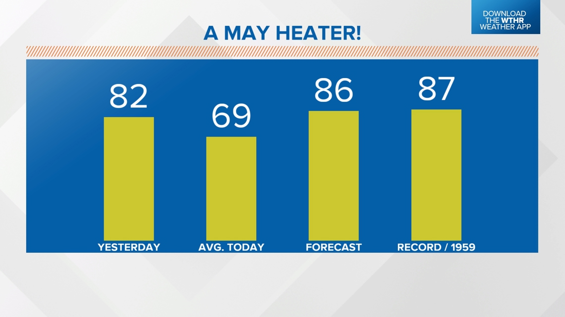
INDIANAPOLIS — If you've ever wondered what mid-July like air feels like in early May, then you can step outside this afternoon. Temperatures soared into the mid/upper 80s with rather humid air.
We remain on record high temperature watch in Indianapolis where we're forecasting 86°. That would be just shy of the daily record (87° in 1959) for May 2nd and would be one of only 27 days on record with a high of 86°+ before May 3rd in Indy, with the last occurring on April 30th, 2007 (86°). In case you're wondering, the earliest 90°+ day on record in Indy is April 24th, 1925.
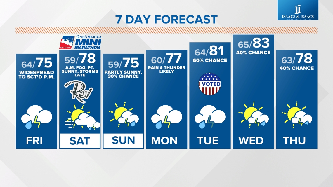
With or without records, there's definitely a summer feel to this airmass with temperatures nearly 20° above average. Plenty of warmth and mugginess to the air, but little to lift it to create rain/thunderstorms. We'll continue to keep in a slight chance with the heating of the day possibly being enough in some areas for isolated thunderstorms.

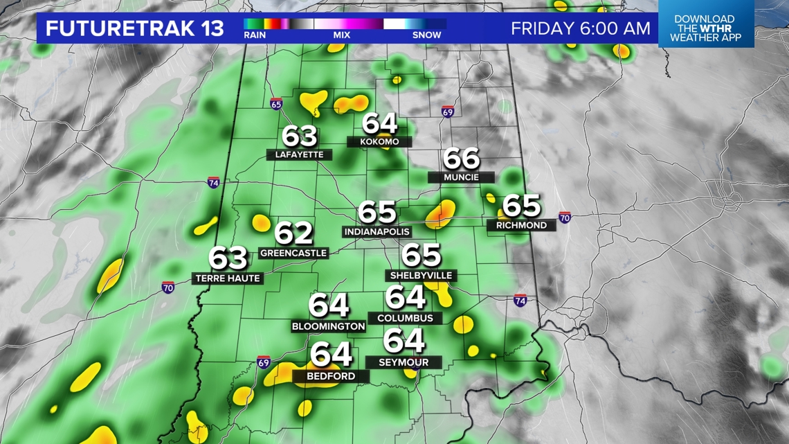
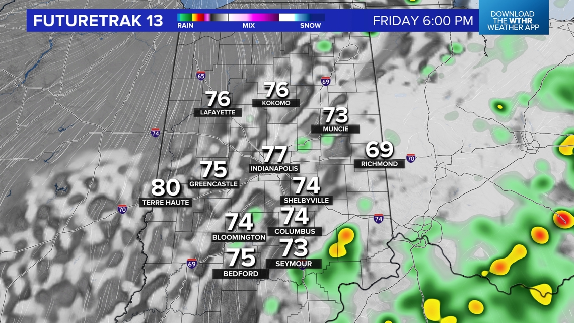
Much higher odds are in The Region and around Chicagoland, closer to an approaching low and near the warm front. All of that action to our west arrives overnight into Friday morning. Plan on a damp commute tomorrow morning with widespread rain and embedded thunder.
Though rain coverage scatters-out Friday afternoon, the highly humid will still be capable of localized downpours and heavy thunderstorms as a slow-moving system crosses through the state.


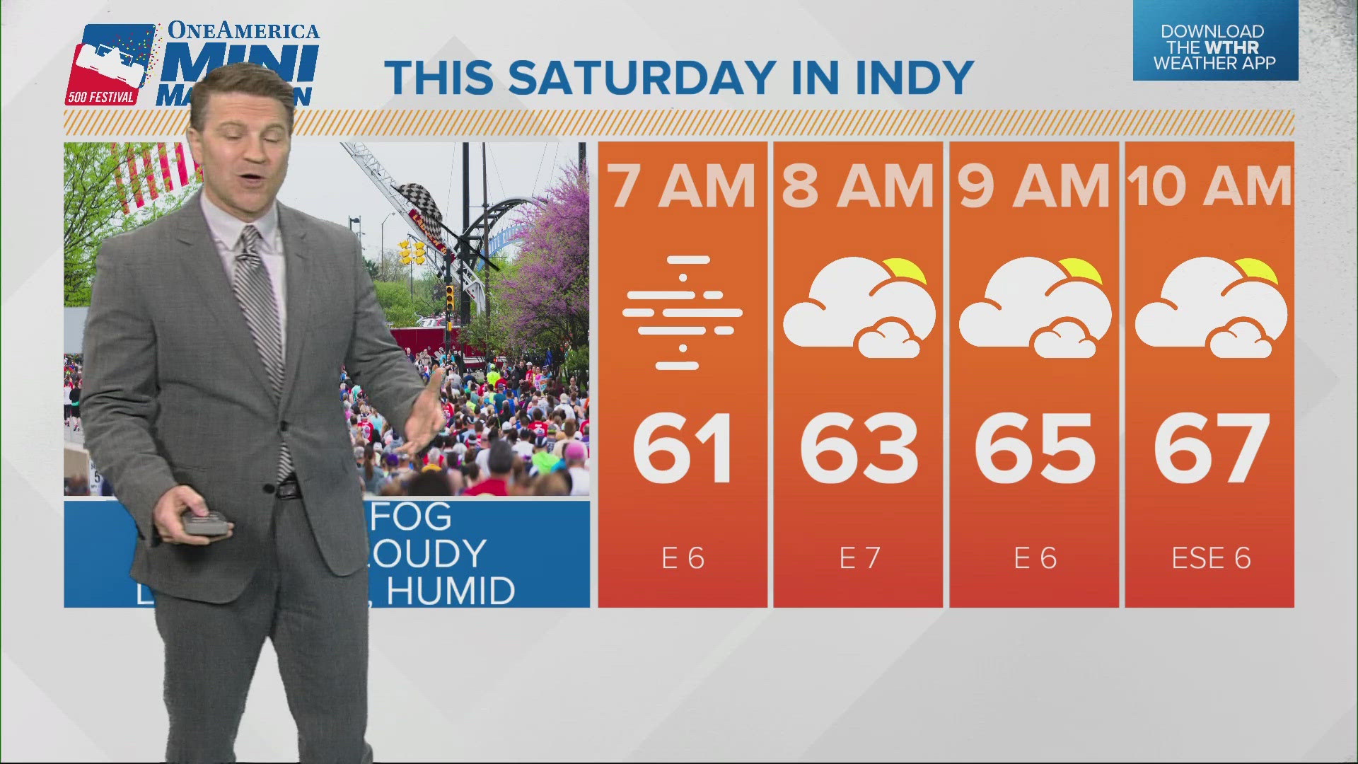
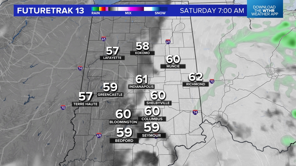
That low will be east of central Indiana by Saturday morning, but close enough for residual moisture to create areas of low cloudiness and dense fog. The slowness of the system also keeps dewpoints hovering around/just above 60° for the 500 Festival Indy Mini-Marathon. Though temperatures won't climb much between 8 a.m. - 10 a.m., the Muggy Meter will be slightly humid and more so than what most have trained in.


The remainder of Saturday will be summer-like with humid highs in the 80s and watching/awaiting an approaching broken line of thunderstorms nearing the Illinois/Indiana border around 8-9 p.m. Check back for updates.