

INDIANAPOLIS — For the first time since early October, Indianapolis has hit 80°+ in back-to-back days. In fact, areas south of I-70 aren't too far from 90° this afternoon. The unseasonably hot air is contrasted for pleasantly mild air in north-central Indiana, which is well north of a stalling boundary near the Ohio River.
Near/south of that boundary, isolated thunderstorms are possible over the next several hours and some of these could produce locally severe wind/hail. Any storms that do develop will likely be slow-moving due to the lack of upper level steering currents.
But the majority of the Channel 13 viewing area won't have much and can enjoy a pleasant evening.
Storms become scattered later tonight into Tuesday. Any storm that develops tomorrow could become severe. We'll update in the morning, but we'll need to monitor a warm front lifting through the area closely as it could enhance low-level wind shear during peak heating.


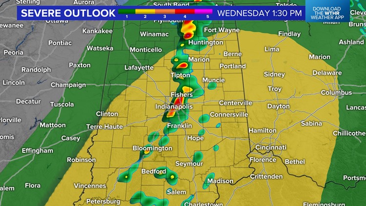
Another chance of severe storms exists on Wednesday as we'll be back in the warm sector with an approaching storm system. Stay Weather Aware the next couple of days before cooler, more stable returns later in the week.
The cool change leads to a much different weekend of clouds and temperatures near 60° Saturday to 50s on Sunday.


