

INDIANAPOLIS — We knew that something would have to give in the atmosphere. We typically don't go from record warmth, and even 60s at this hour in a late February evening to 30s and snow showers without paying a storm price.
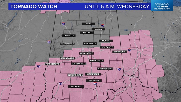
That finally occurs in some areas between now and 5 a.m. Wednesday. A Tornado Watch has been issued for the southern half of Indiana, including Indianapolis, until 6 a.m. Wednesday with the expectation of storms increasing over the southern half of the state as a strong cold front approaches.
The front, and its lift, has been the missing piece of the storm puzzle and plays role of "cap buster" overnight. That "cap" has a been a lid of warmer air aloft that's prevented storm development nearly all day.


Analysis shows parameters in place to fuel storms to quickly become severe after developing. It appears there will be multiple clusters of storms within the watch box and possibly some supercells, too. All modes of severe weather are possible, including damaging hail and the possibility of a significant tornado occurring, too.
We urge you to have multiple ways to receive warnings tonight and keep your phone turned on to receive those. We'll update on-air and online as needed and will be here monitoring radar.
The severe threat ends areawide with the passage of the cold front between 3-4 a.m.
