
INDIANAPOLIS — The 13 Weather Team is tracking the potential for severe storms overnight.
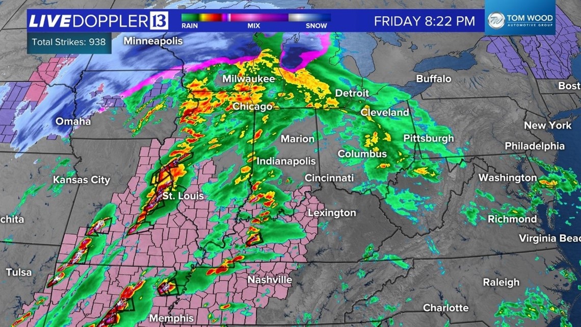
Here is how radar looked around 8:30pm Friday. There was line of severe storms moving from eastern Missouri into western Illinois. This is the line that will get here in a couple of hours.

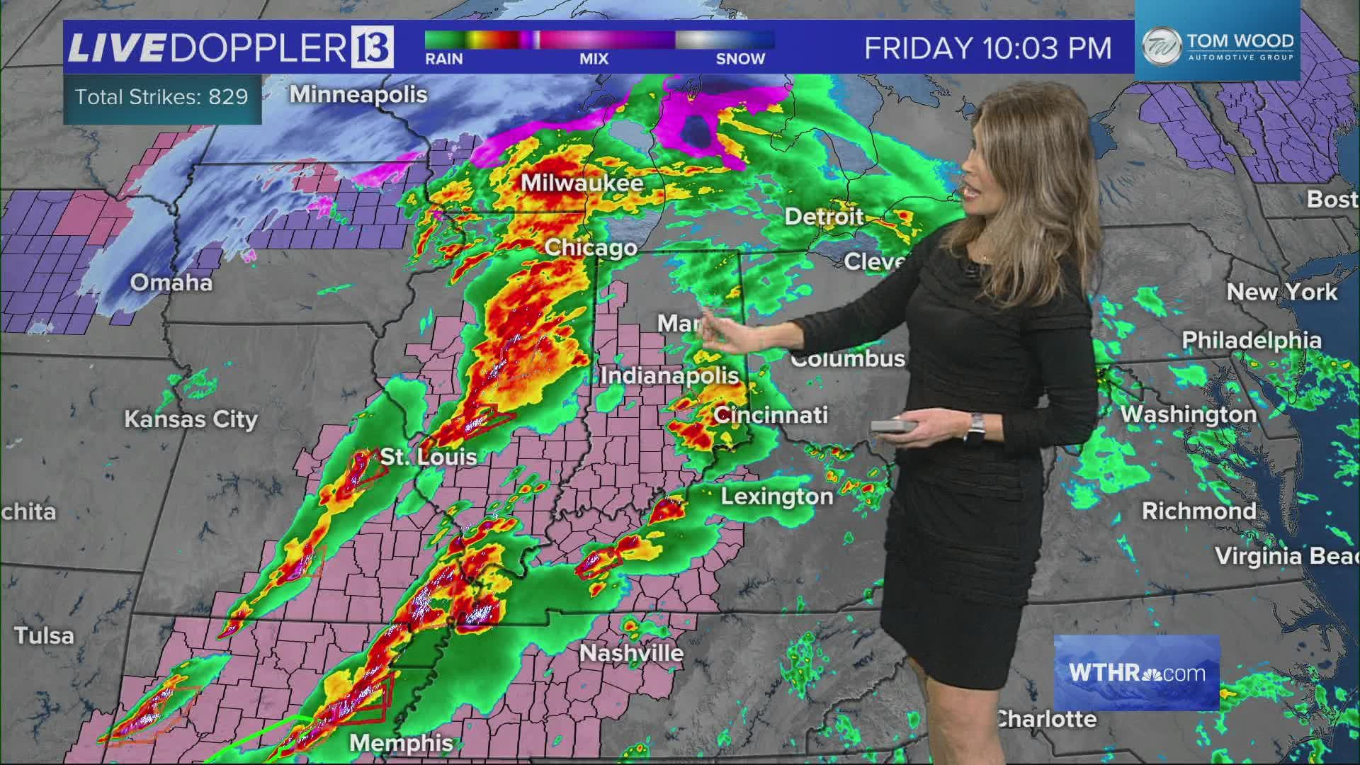
A tornado watch has been issued until 3 a.m. for most of west central Indiana, including Marion County.
A system like this has the potential to be even more dangerous because it is dark and people are sleeping. We are encouraging you to have a few ways to get warnings and don't have your cell phone on silent or do not disturb.
STAY WEATHER AWARE: View interactive radar
We will help you stay weather aware with extra coverage on air and online this evening and overnight until the threat is gone.

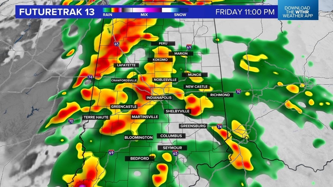

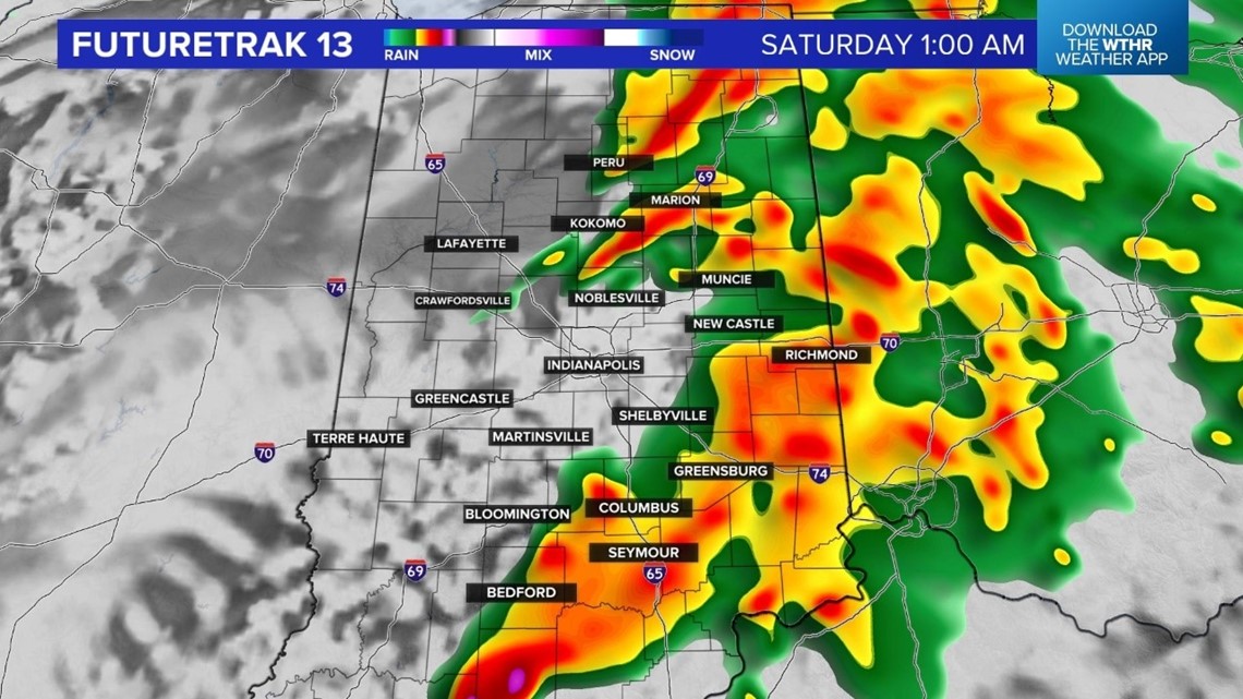


The timeline for the threat for severe storms is from about 10pm Friday through about 5am Saturday. Damaging wind gusts and tornadoes are the biggest threats. Temperatures will stay in the 60s through early Saturday morning and then drop into the 30s by Saturday afternoon.
Download the Live Doppler 13 weather app: App Store | Google Play
The weekend will end with sunshine and highs in the middle and upper 40s on Sunday. Looking ahead to next week we are tracking a mild weather pattern with highs near 50 on Monday and in the middle 50s on Tuesday. 60 degree warmth is back for Wednesday and Thursday, along with a few showers especially on Thursday.