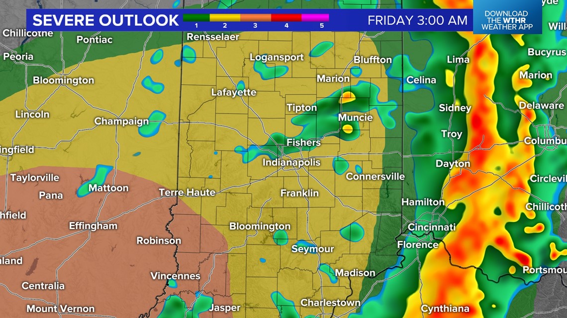
INDIANAPOLIS — We continue to advertise the need of being Weather Aware tonight, at least between the hours of 9 p.m. and 2 a.m. That's when the leading of a complex of thunderstorms will move across central Indiana.
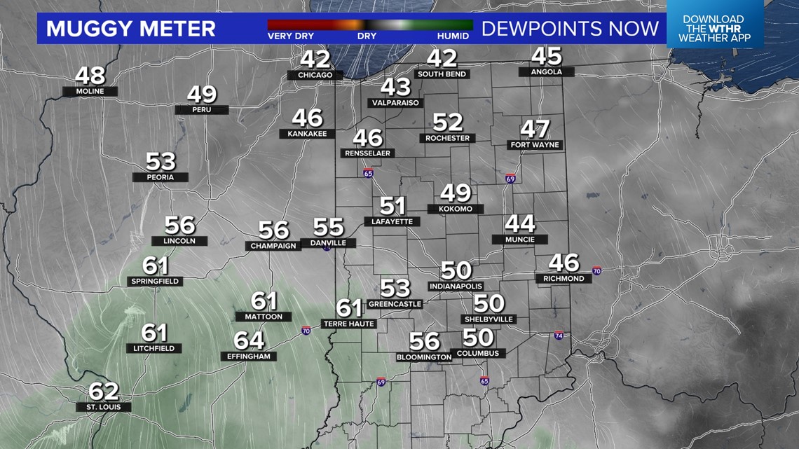
Currently low-level moisture is lacking locally for severe weather. However, a narrow of wedge of slightly higher dewpoints (60°+) is expected to nose into parts of central Indiana later tonight to help aid in "juicier" air and to allow this storm complex to survive even after daytime heating.

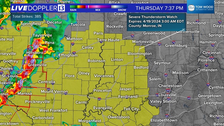
A Severe Thunderstorm Watch was recently issued for southwestern Indiana where the "juicier" air exists currently. The Watch goes until 3 a.m. but the severe threat will likely be over for that part of Indiana well before that time.


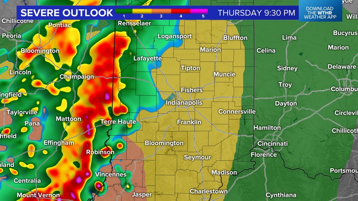
While we do envision widespread gusty storms and a period of heavy rain rates during the aforementioned "Weather Aware" time, we do not envision widespread severe weather. However, there may be some areas of 60+ mph wind gusts, embedded rotation, and possibly a few tornadoes on the leading edge of the storm complex. That's already occurring around the St. Louis metro area.

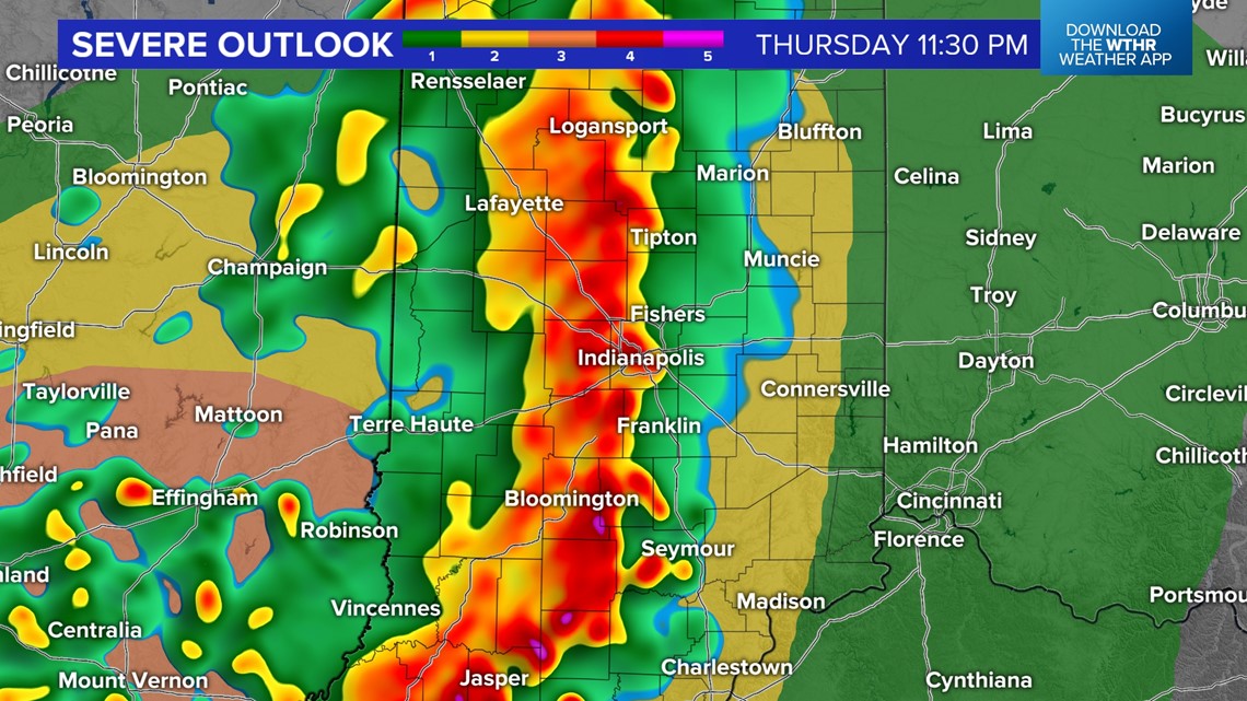

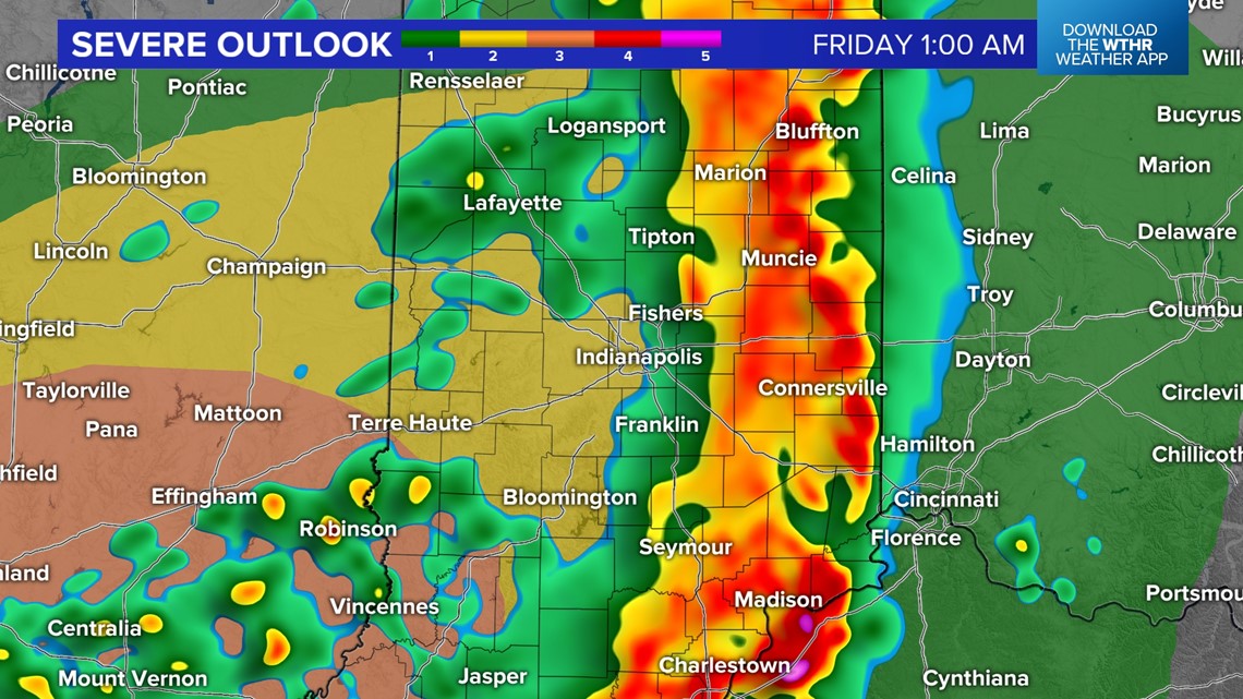
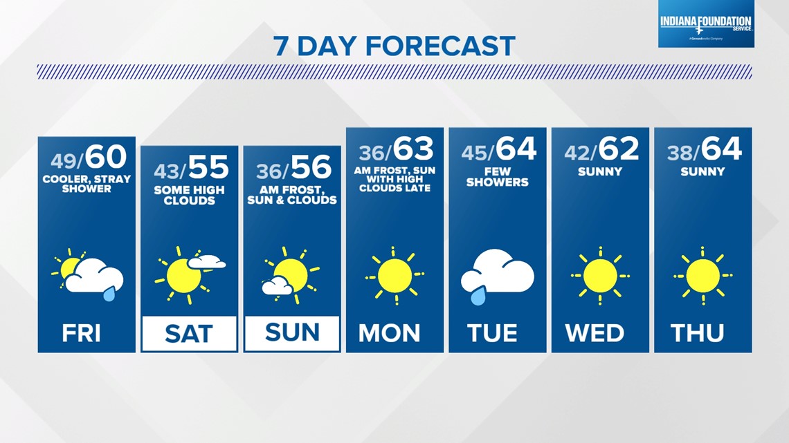
The complex nears the Illinois-Indiana border around 9 p.m., the Indy metro area around 10 p.m. to 12 a.m., and the Ohio state line around 1-2 a.m. The threat of severe weather ends from west-to-east during that time as cooler, stable air quickly returns and sets the stage for a multiday streak of quieter weather.
Watches and/or Warnings may be issued over the next six hours. Please have multiple ways to receive them and we'll continue update on the progression of the line.