
INDIANAPOLIS — We have made it through two rounds of storms with the third on the way for later Thursday. A few of the stronger storms did cause damage in Jay county in eastern Indiana.
Skies will be clear Wednesday night and early Thursday. Forecast highs are in the range of 75 to 80 degrees on Thursday.
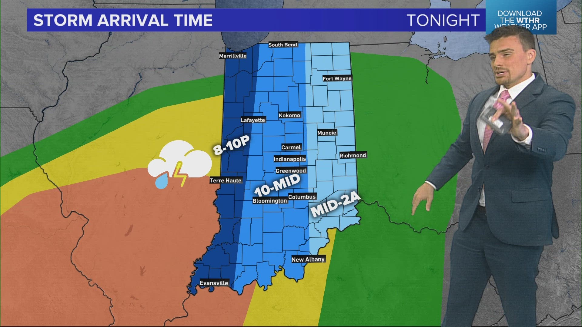
Most of the day will be dry, with that third round of rain and storms arriving around 5 p.m. This round of storms will impact central Indiana from about 5 p.m. to midnight. There is the threat of severe weather.
Here is the outline of that severe threat and it is a bit elevated across the southwestern part of the state.


Here is the timeline with FutureTrak13.


Cooler air arrives for Friday and will stick around into early next week. Cool means highs in the 50s and 60s.