
INDIANAPOLIS — We've got an active set up with multiple rounds of rain and storms today and tomorrow.
When are severe storms expected?
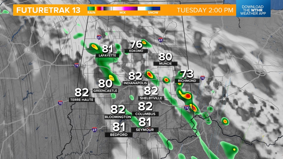
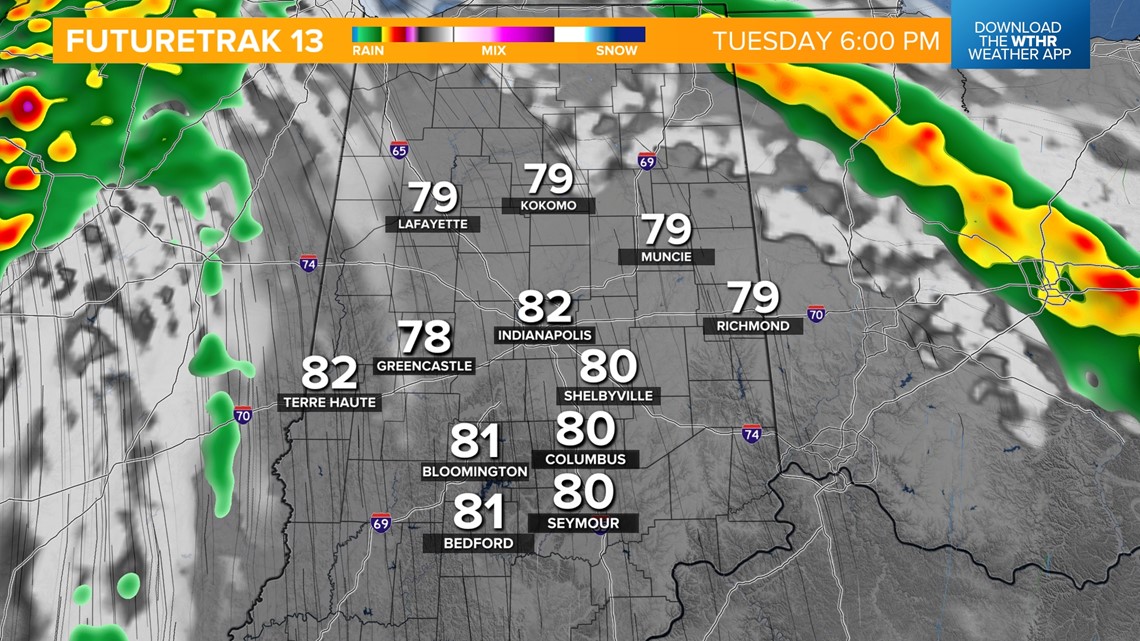
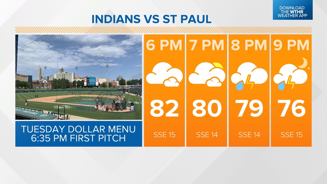
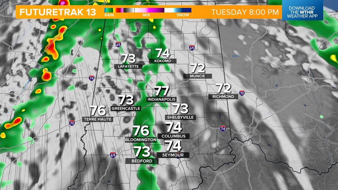
WAVE 1: 12 p.m. - 4 p.m.: Non-severe. A frontal boundary is lifting north through the state and will trigger a round of scattered showers and storms this afternoon. We'll then see a lull with lots of dry hours during the evening rush hour through sunset allowing temperatures to recover to the low 80s. Tonight's Indians game starts in the clear for the 6:05 p.m. first pitch with rain chances increasing toward the end of the game.


When are severe storms possible?
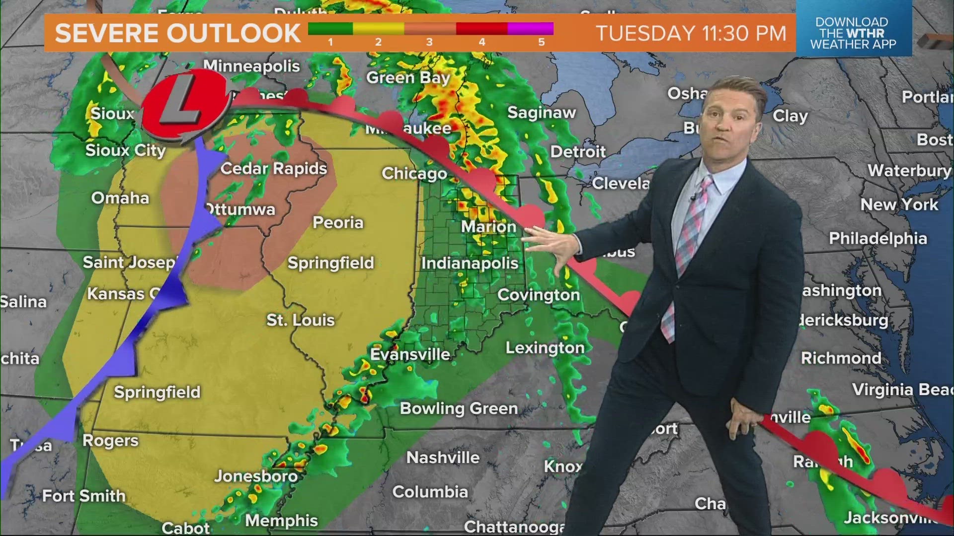
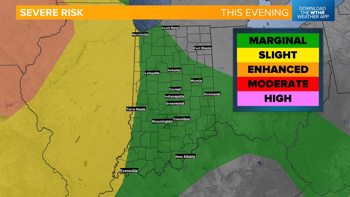
WAVE 2: 8 p.m. today - 4 a.m. Wednesday: Low-end severe threat. The Storm Prediction Center has placed most of Indiana under a level 1 of 5 for isolated strong storms. Damaging wind gusts would be the primary threat. Severe threat ends and rain pauses for Wednesday morning's rush hour.


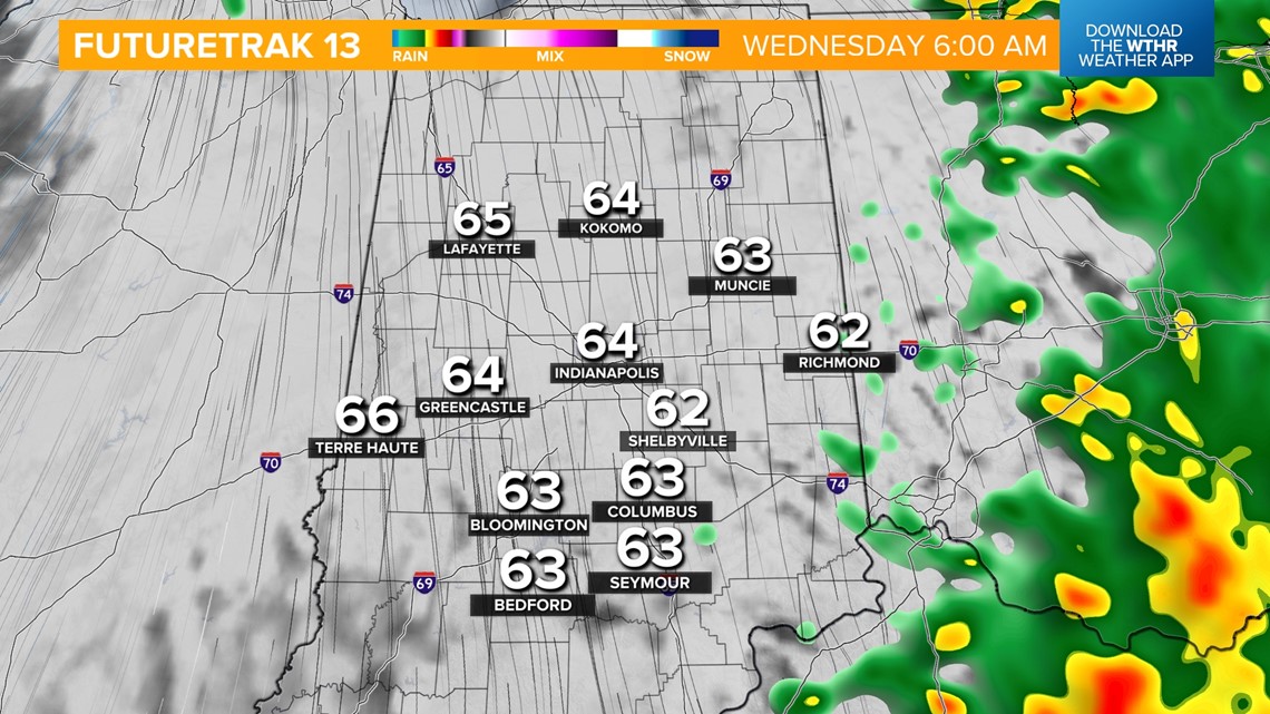
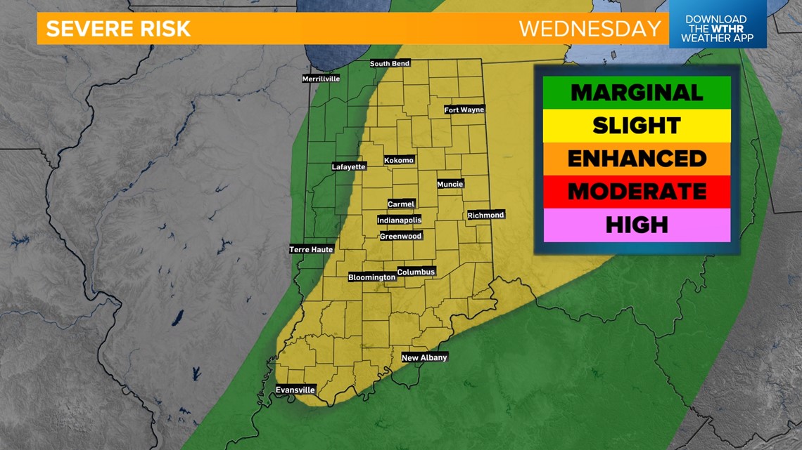
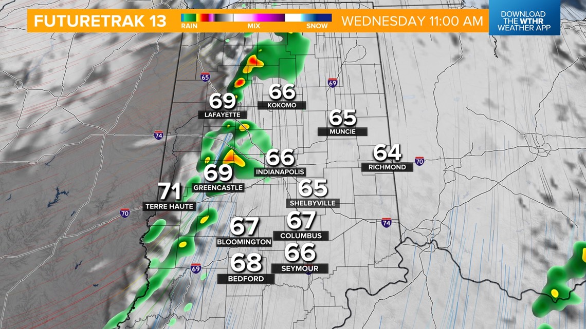
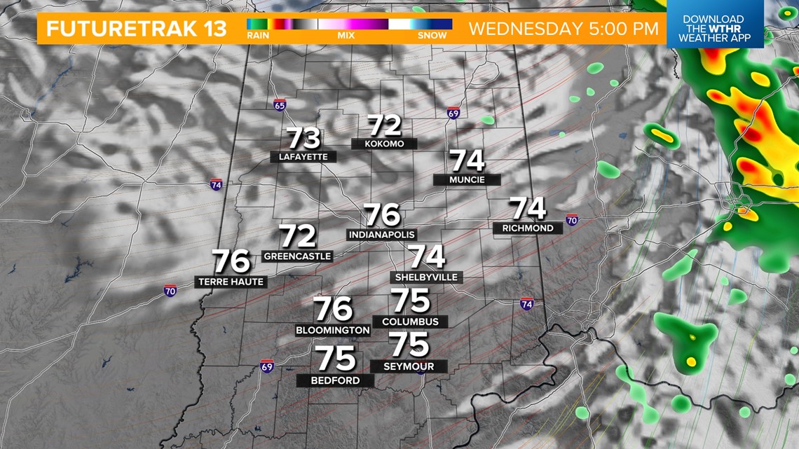
WAVE 3: 11 a.m. - 4 p.m. Wednesday: Scattered storms will develop Wednesday afternoon as a cold front sweeps across the state. A few strong to severe storms are possible as the Storm Prediction Center upgraded the area to a level 2 of 5 for the risk of large hail as the primary threat and damaging wind gusts and rotating storms as lower-end threats.


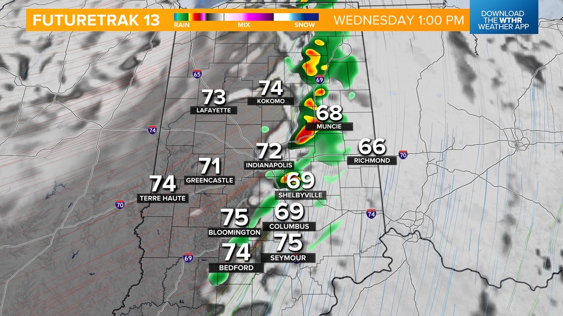
Temperatures will recover to the mid-70s Wednesday afternoon just after the front exits to the east.

How much does it cool off behind the cold front?
We get a break from the rain on Thursday and it'll still be relatively mild for this time of year with highs near 70.
The cooling trend will be more noticeable with a secondary cold front set to move through late Thursday into Friday morning. This will bring scattered rain showers through the first part of the day Friday as well. Look for highs near 60 Friday and only in the mid-to-upper 50s for the weekend. Temperatures are trending slightly below normal through the first part of next week.

