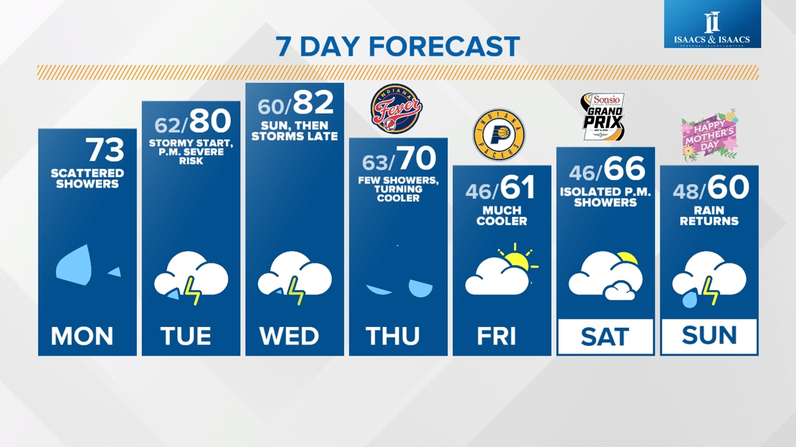
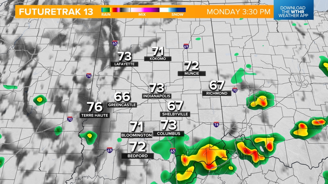
INDIANAPOLIS — Scattered rain has been impacting mainly the southern half of the state so far today as a boundary stalls out in that area. While it won't be an all-day washout, stray showers will be possible through the afternoon across central Indiana and especially south of the I-70 corridor. Rain-cooled air, cloudy skies and a northeast breeze today will hinder temperatures to the low 70s for highs.


When should we be alert for severe storms?
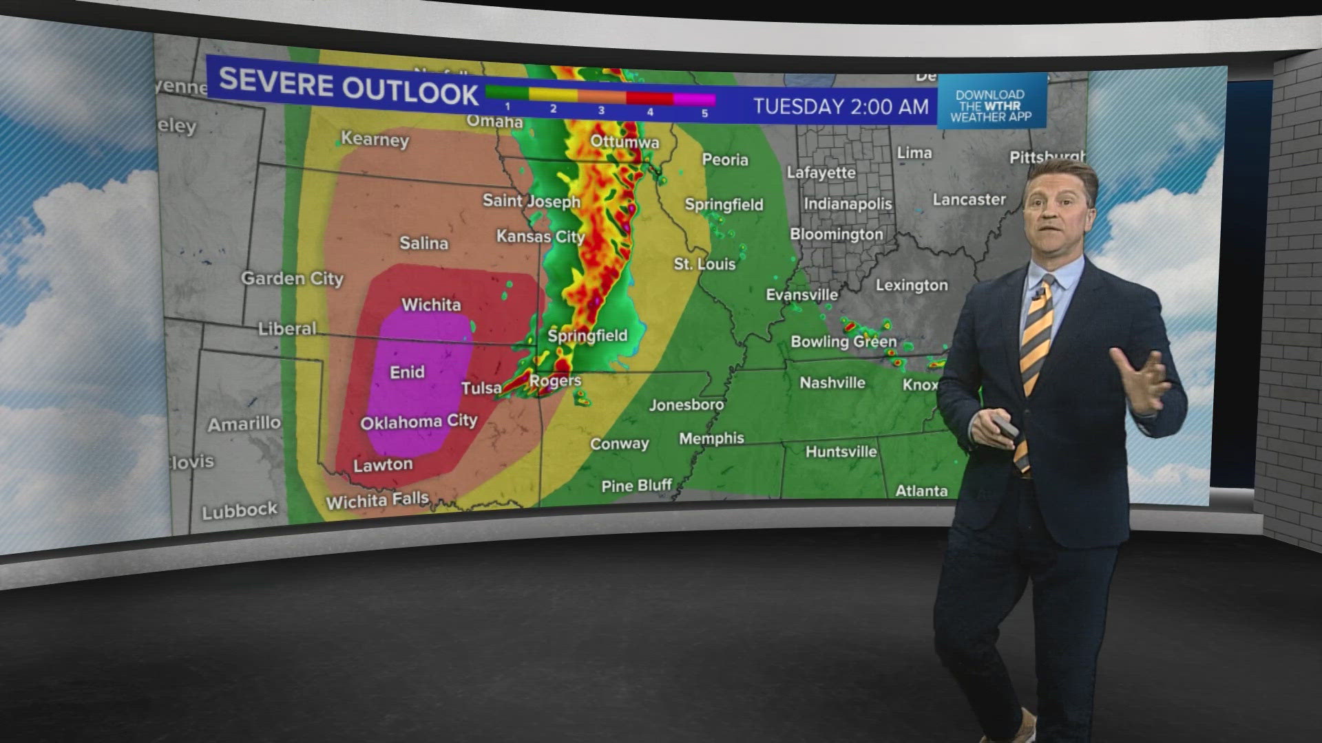
A few rounds of strong to severe storms will impact Indiana starting Tuesday and continuing through Wednesday evening. The boundary stalled in southern Indiana today will lift northward, switching up our winds from the south and ushering in a much warmer, moist air mass capable of elevating severe potential. Highs remain above average in the low 80s both Tuesday and Wednesday.
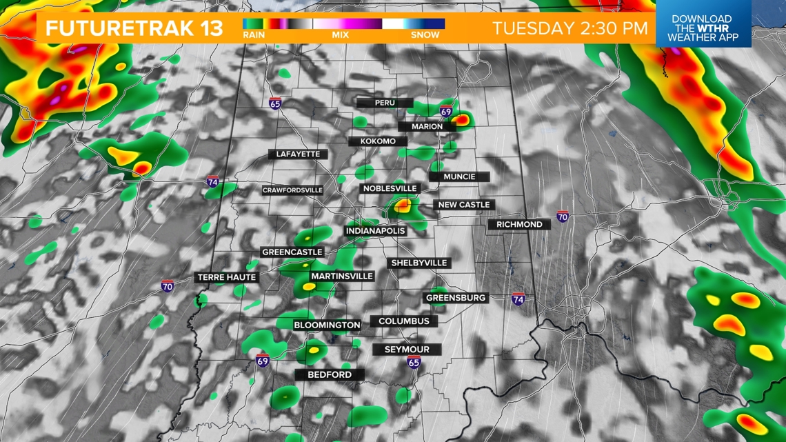
ROUND 1: Morning hours Tuesday approximately 6 a.m.-noon. This arrives as a line of storms will impact the state from west to east. This will be a low-end severe threat, with the primary threat being damaging wind gusts.

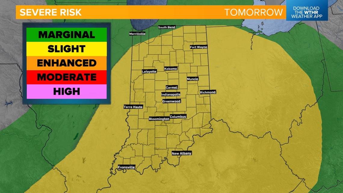


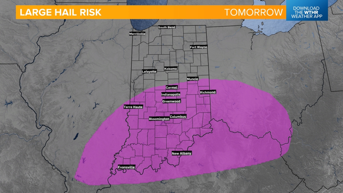
ROUND 2: The better chance of severe storms will be in the afternoon, mainly after 2 p.m. and continuing through 11 p.m. All modes of severe weather are possible, but the primary threat will be damaging wind gusts mainly north and large hail across the southern half of the state.


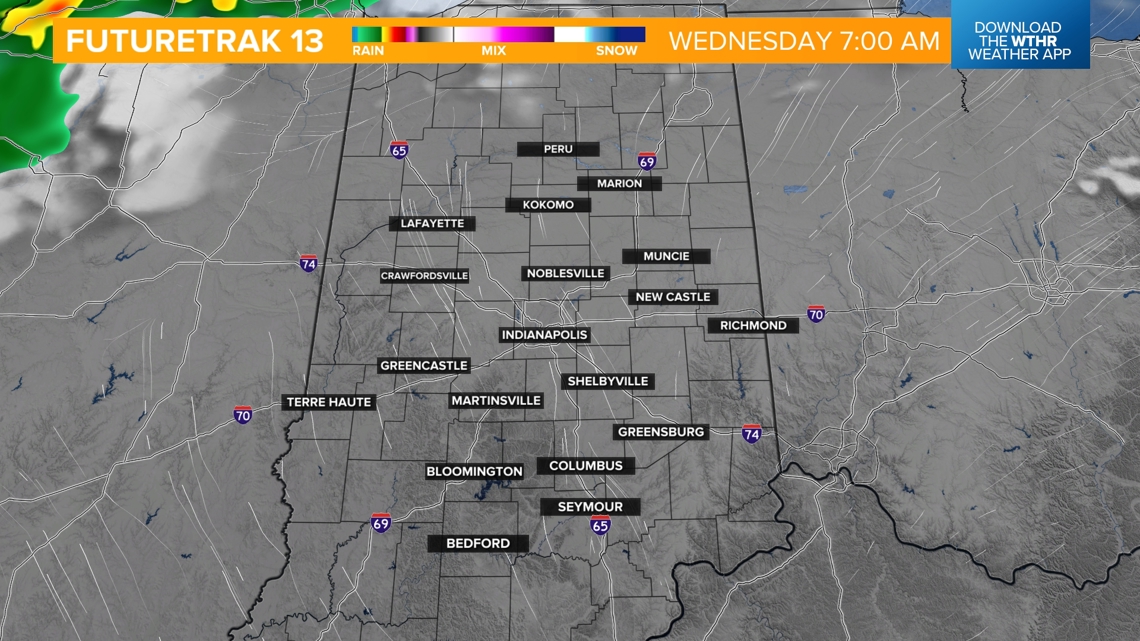
We'll get a break from stormy weather overnight and through the morning hours Wednesday.

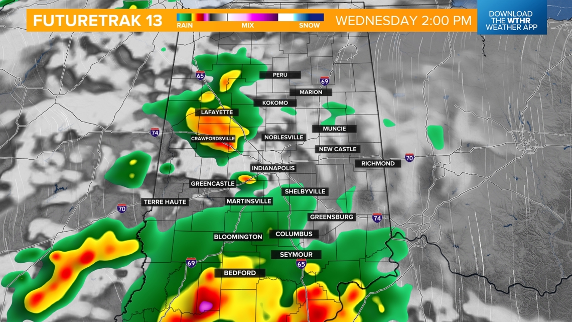
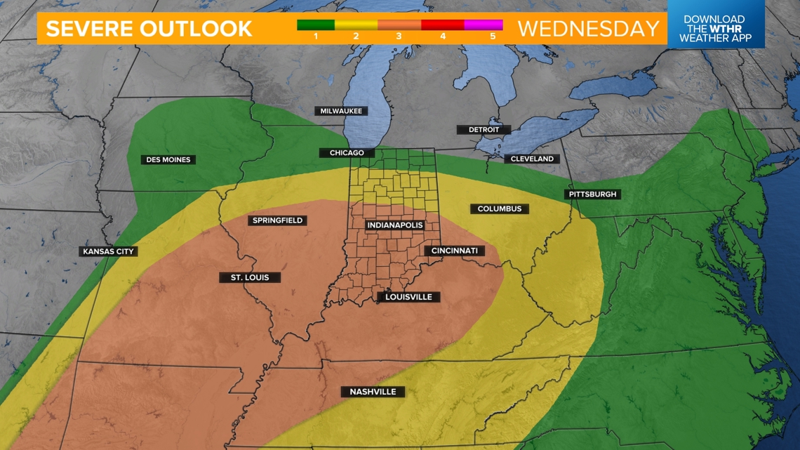
WEDNESDAY ROUND 3: Another round of severe weather is possible Wednesday afternoon, mainly after 2 p.m. continuing into the late evening. All modes of severe weather are possible Wednesday, but the primary threat will be damaging wind gusts.


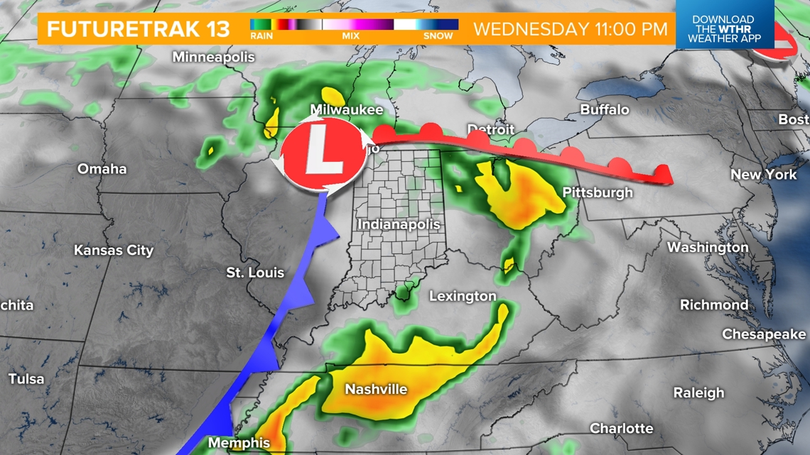
Behind the cold front early Thursday, temperatures will begin to drop. We'll likely spend most of the day in the 60s with a few stray showers that wrap around the backside of the area of low pressure.
Friday looks to be a mainly dry day with only a stray shower or storm possible, but much cooler with highs only in the mid-60s.
The cooler air looks to stick around through next weekend with highs only in the 60s.