
INDIANA, USA — We do not need it, but more rain is moving into Indiana for Tuesday. A stray, light shower is possible in the morning, but more widespread, heavier rain will arrive later in the afternoon and evening.
Tap HERE to track the rain moving into Indiana.
Some good news! No severe weather is expected. If a pocket of rain gets stronger, we may get a few rumbles of thunder, but that should be it.
Some bad news: This front will bring a quick cooldown again to the Midwest. Another frost may even be possible Thursday morning.
How are we doing on rain for the state?
Central and southern Indiana have especially been soaked this April. For the year so far, much of the state is running a couple inches above normal. For April specifically, Indianapolis is on track to have at least the 10th wettest April in the past 100 years.
Indianapolis April so far: 6.50"
Indianapolis April record: 8.97" (2013)
Indianapolis average: 4.43"
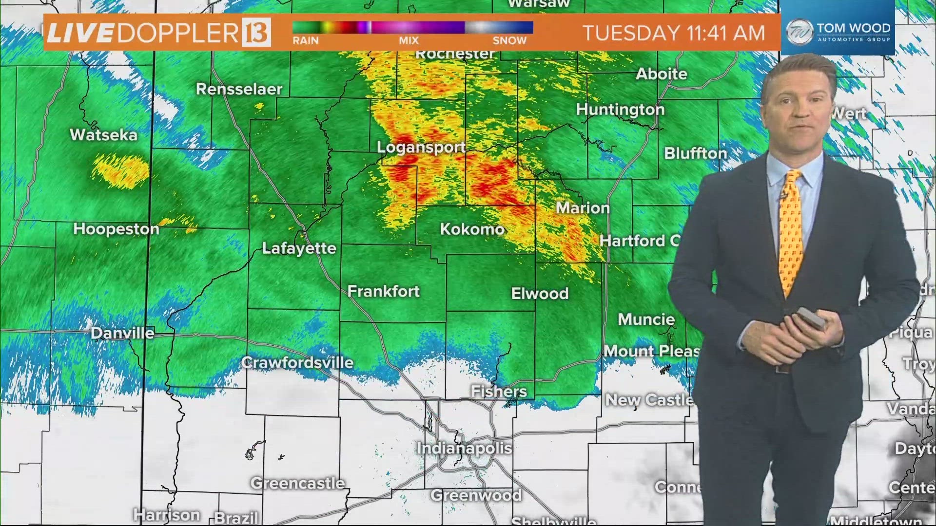
Tracking rain for Tuesday
As a front pushes south, more rain will develop. There is not a lot of moisture in the atmosphere right now as drier air has lingered across the Corn Belt since the weekend.


How much rain can we expect for Indiana?
This will not be a washout, but a healthy quarter-inch to a half-inch of rain is possible. The highest rainfall totals will likely be in western and northern Indiana. The rain will not be too heavy. Generally when the main bands of rain are over your county, you could see 0.1" per hour. That is a light to moderate, steady rain. No flooding is expected.


When will the rain arrive?
Everyone will get something different for timing; however, most of central Indiana will get higher rain chances later in the afternoon and evening.
MORNING
Most of Indiana will be dry in the morning. In fact, for those especially south of Indianapolis, you may have some sunshine. Expect partly cloudy skies to become mostly cloudy skies, which will then become overcast skies and rainy skies later in the day.
In the morning, the best chance of rain will be in northwestern Indiana, but not all the way to Lake Michigan. There may be some showers for the morning commute around Lafayette. This rain would be very light and spotty.


MIDDAY / EARLY AFTERNOON
Near and just after lunchtime, steady bands of rain will start to push into northern Indiana. Over time, the front will then gradually move this rain band south into the Indianapolis area.
The best chance of rain in the afternoon will still be near and north of Indianapolis. This rain should still be light.


EVENING
The best chance for rain will be after 3 p.m. Showers will push south and cover most of central Indiana. Expect this rain to last until 6-9 p.m. around Indianapolis.
For those north and west of the capital, we may even see a little sunshine to end the day, still mixed in with some spotty showers. Those spotty showers will linger on and off into the night.
We should be mainly dry by sunrise Wednesday morning.


How much cooler will it get after the front?
This is not a major cold front. Compared to all the other fronts we have had this month, this one is fairly weak. Expect highs to drop to the 50s on Wednesday. That's how cool it was this weekend. Some patchy frost will be possible Thursday morning.
By Thursday, a south wind will roar back, helping us to return to 70s and 80s across Indiana for the weekend.