

INDIANAPOLIS — Today starts windy and warm with temperatures approaching the low 80s in the afternoon as clouds increase. A potent cold front brings the risk of strong to severe storms in the late afternoon and evening, especially across northwestern parts of the state where the Storm Prediction Center has issued a level 2 of 5 risk zone.
Damaging wind gusts will be the primary threat with a few rotating storms possible as storms develop ahead of the main cold front.

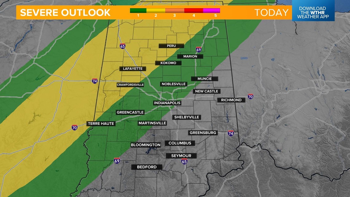
Scattered storms develop across northwestern parts of the state in that elevated risk zone from 2-4 p.m. This includes places like Attica to Lafayette to Logansport.

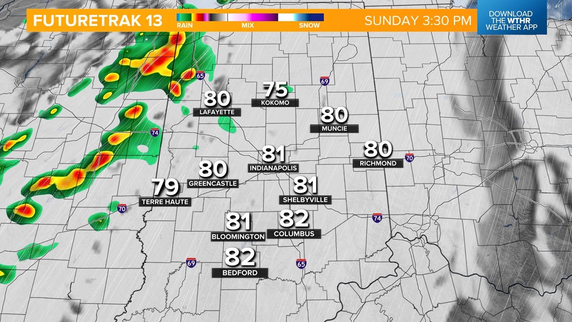

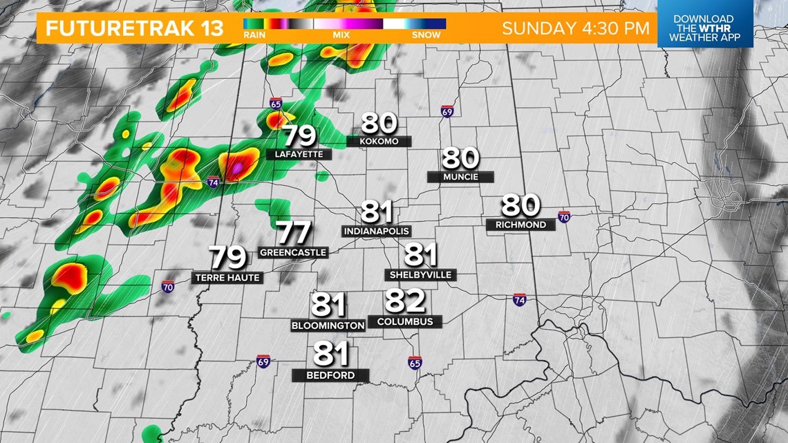

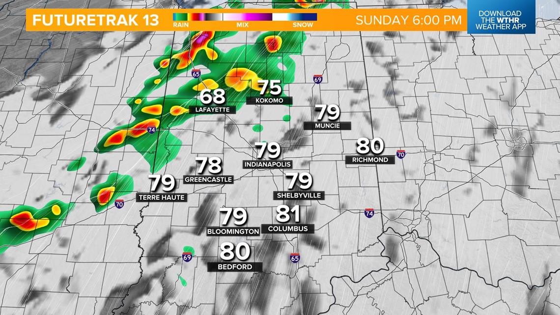
A line of storms will then develop after sunset and move across the state from west to east. There will still be a risk of damaging wind gusts as this line moves through, especially on the western side of the state.

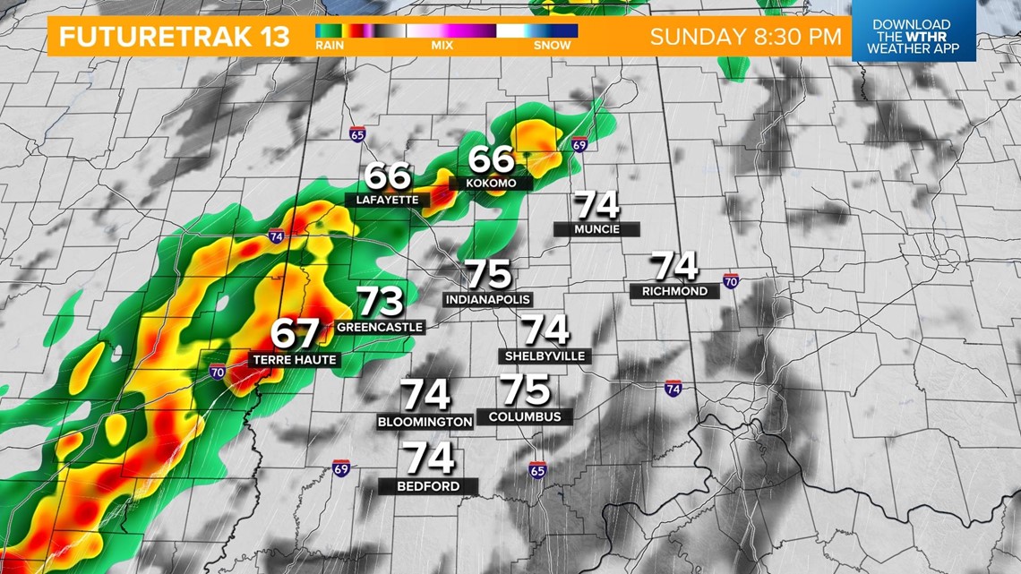
This line will move into the Indy metro after 10 p.m. and begin to weaken as it tracks into eastern parts of the state.


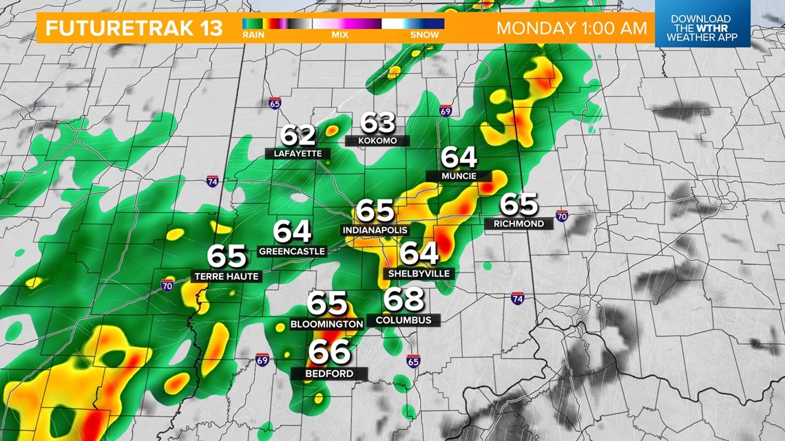
The severe threat ends with scattered rain showers continuing overnight.


Rain lingers through early Monday as cooler temperatures take over.

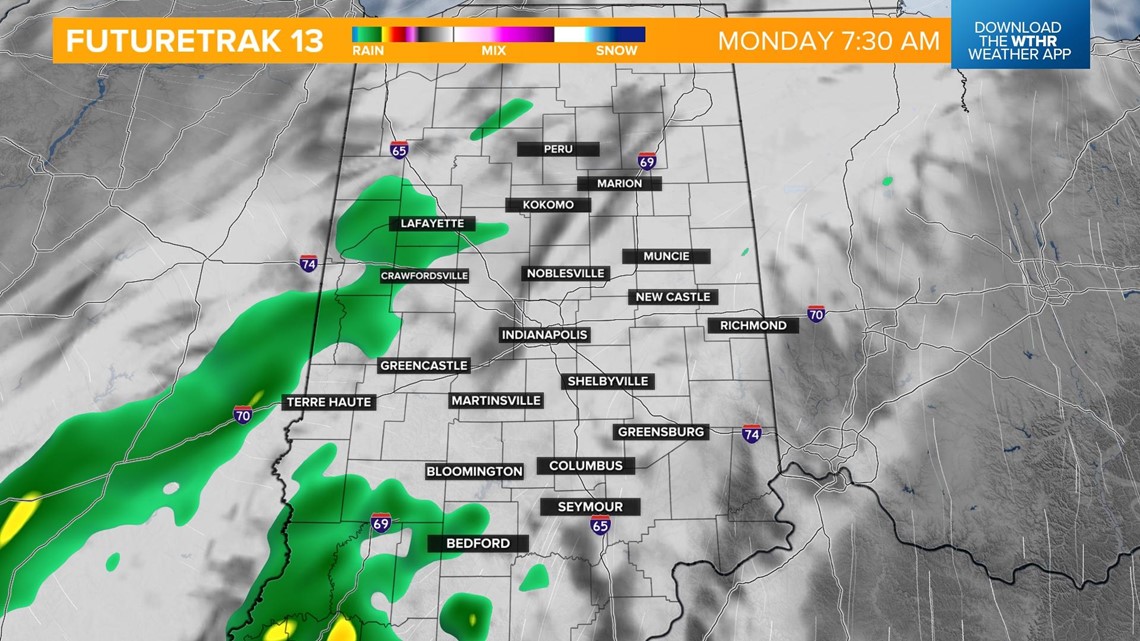
We'll drop into the mid 50s in the mid morning and recover slightly into the low 60s in the afternoon as the sky clears.
