

INDIANAPOLIS — Hold on to your hats... it is going to be a very windy and wet day. A potent cold front will track through the state today bringing strong wind gusts and rain.
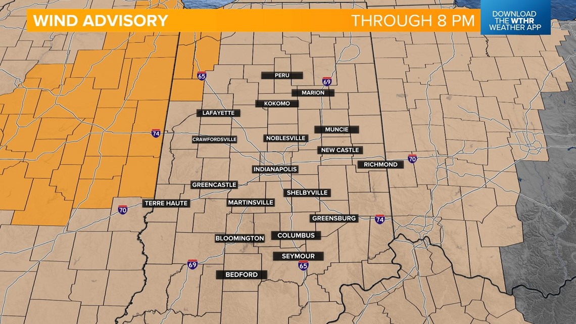
A Wind Advisory will be in effect through 8 p.m. with wind gusts in excess of 50 mph possible at times. Make sure all outdoor items are secure and prepare for the potential of isolated power outages.

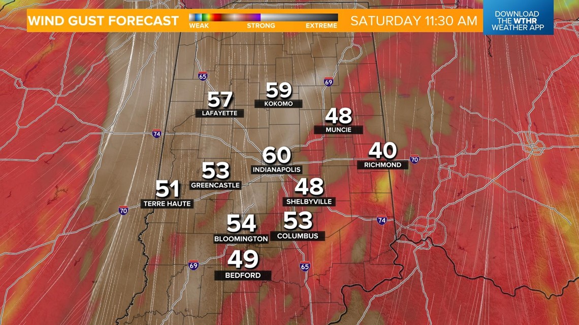
Rain has already moved in and will be heavy at times. A few lightning strikes can't be ruled out. Winds will begin gusting over 40-50 mph.


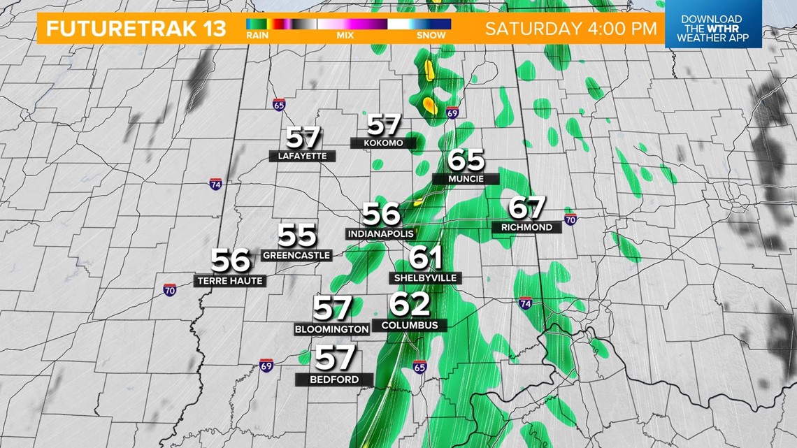
Steady rainfall continues through the afternoon throughout central Indiana.


A line of heavy rain will move through the Indianapolis metro area in the late afternoon as the cold front moves passes. Winds will still be gusting over 50 mph. Temperatures will hold steady in the upper 50s and low 60s until the front passes.


Rain will exit the state after sunset and skies will clear this evening. Winds will also ease a bit at this point.

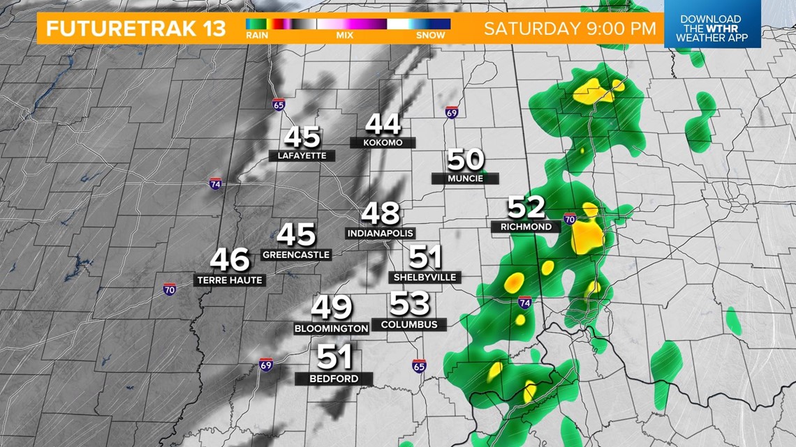

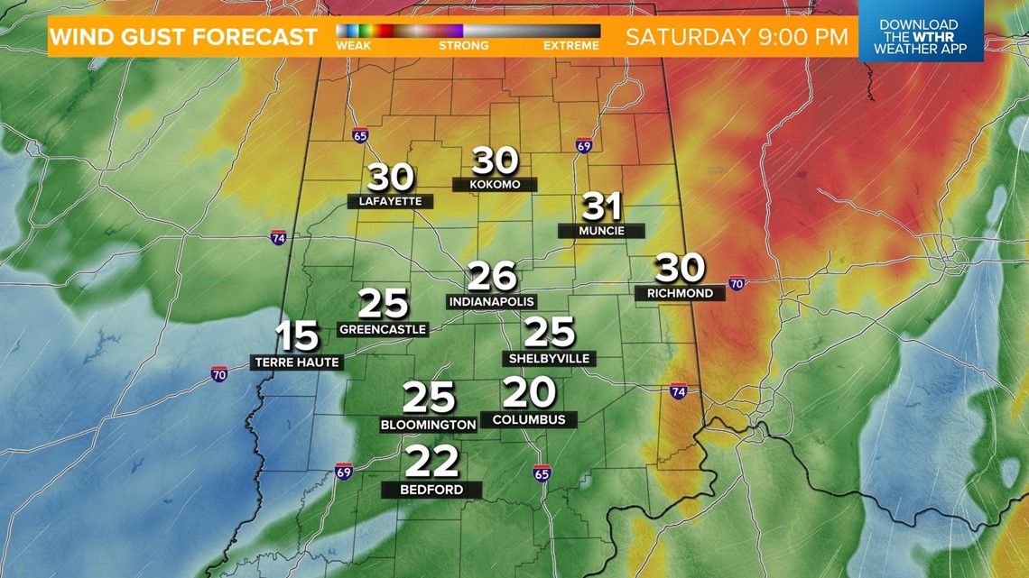
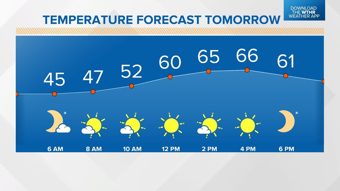
Temperatures fall back into the mid-40s. Winds stay breezy with 25 mph wind gusts possible. Much better weather arrives for the second half of the weekend. Sunshine returns and temperatures recover to the mid-60s on Sunday.

Another cold front will move through on Monday but this time it will be a less potent, dry frontal boundary. Temperatures will be hindered a bit, with highs in the mid-60s Monday and low-60s Tuesday.
