
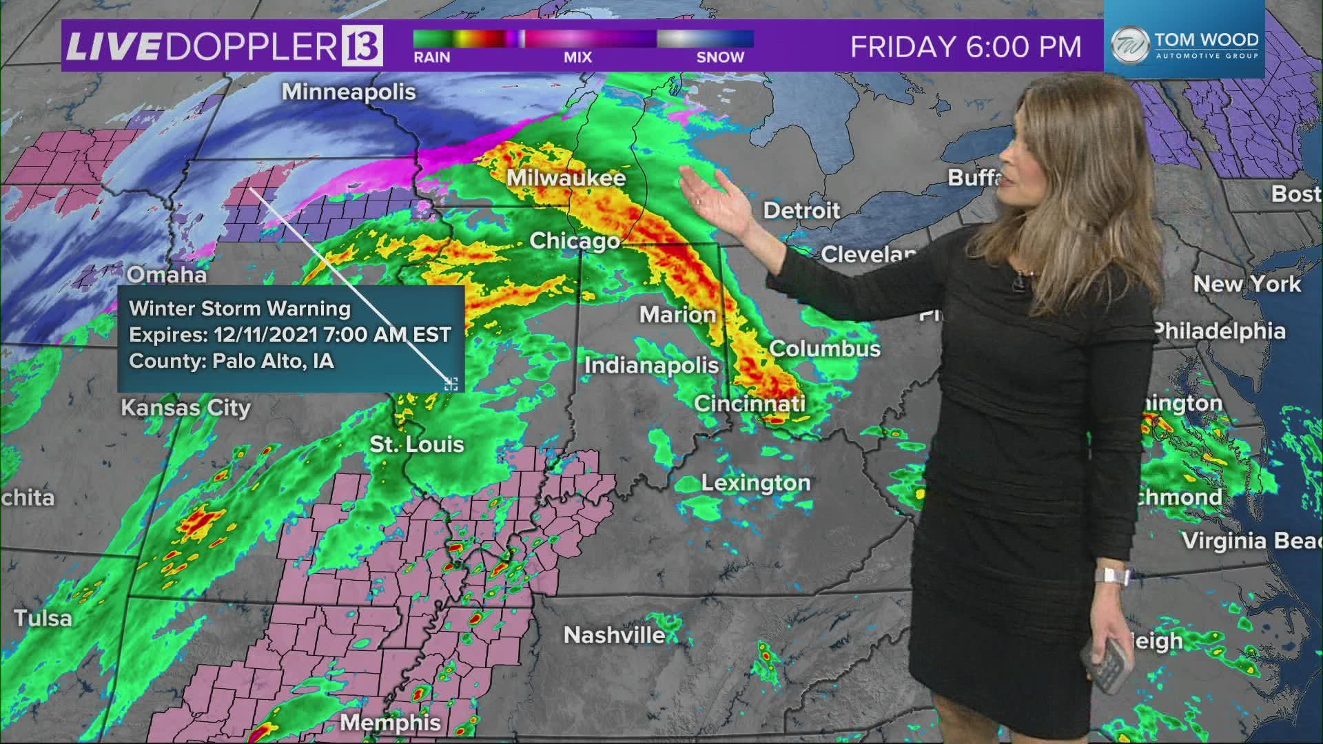
INDIANAPOLIS — A potent and rare December storm will take place today, with strong to severe thunderstorms possible late this evening into Saturday morning. Warm, moist air is moving into central Indiana this afternoon. Temperatures have been on the rise all morning, climbing into the mid 50s for all of central Indiana by late afternoon. Temperatures will continue to rise this evening, into the low to mid 60s by midnight.

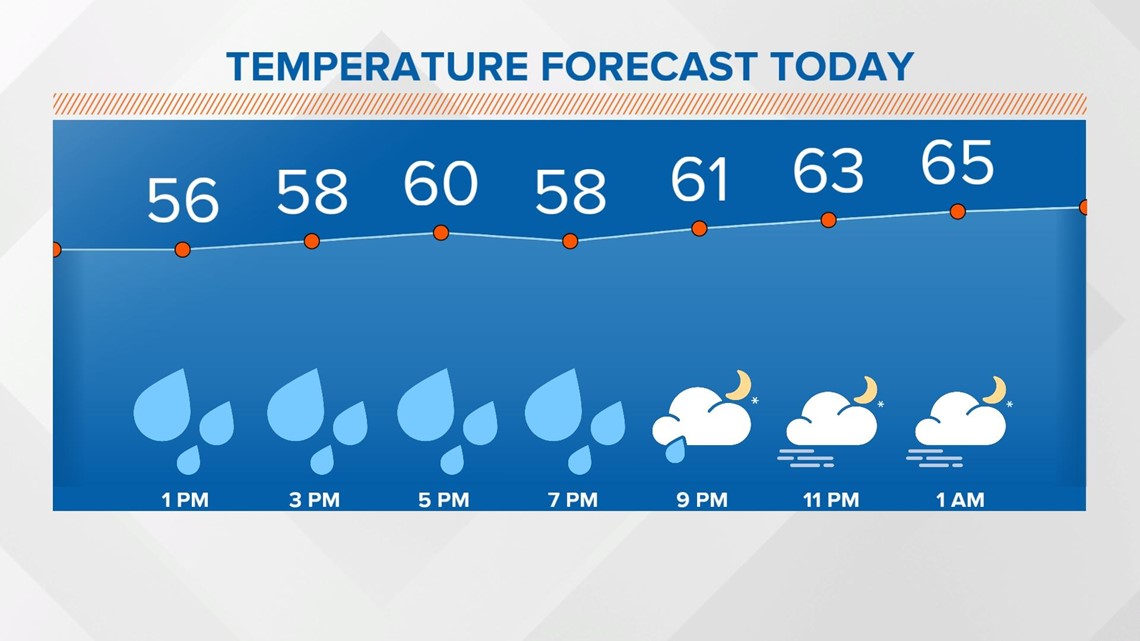
Showers will move in by late afternoon until about mid-evening.


There will likely be a lull in the shower coverage ahead of the cold front.

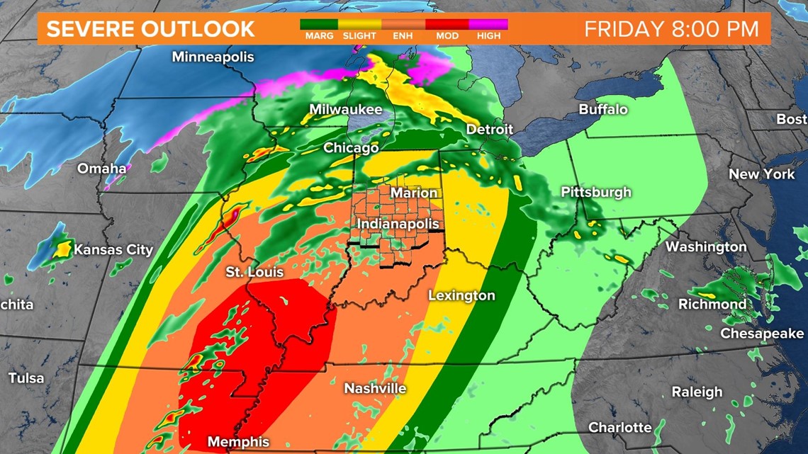
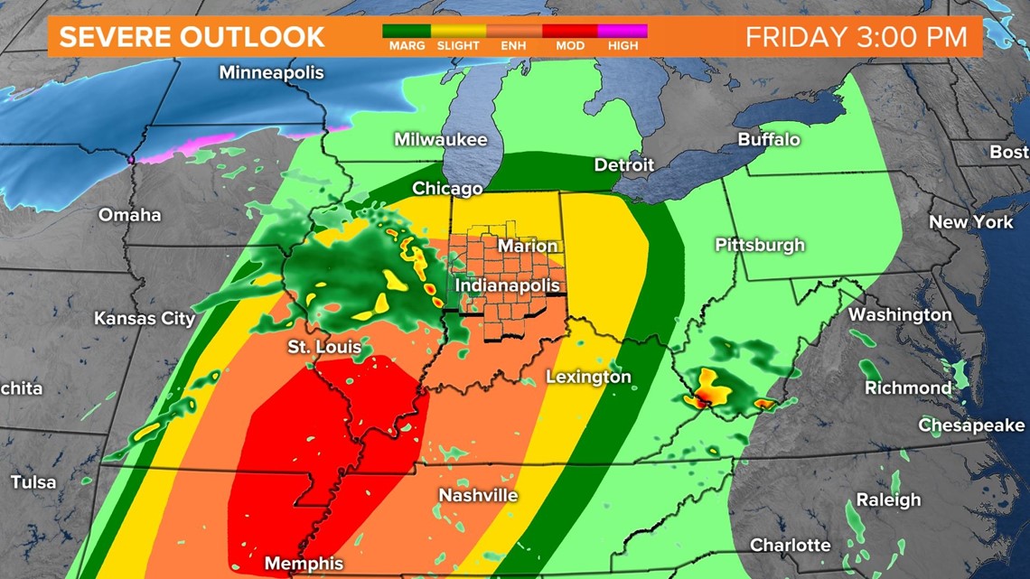
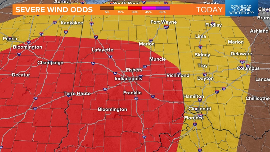
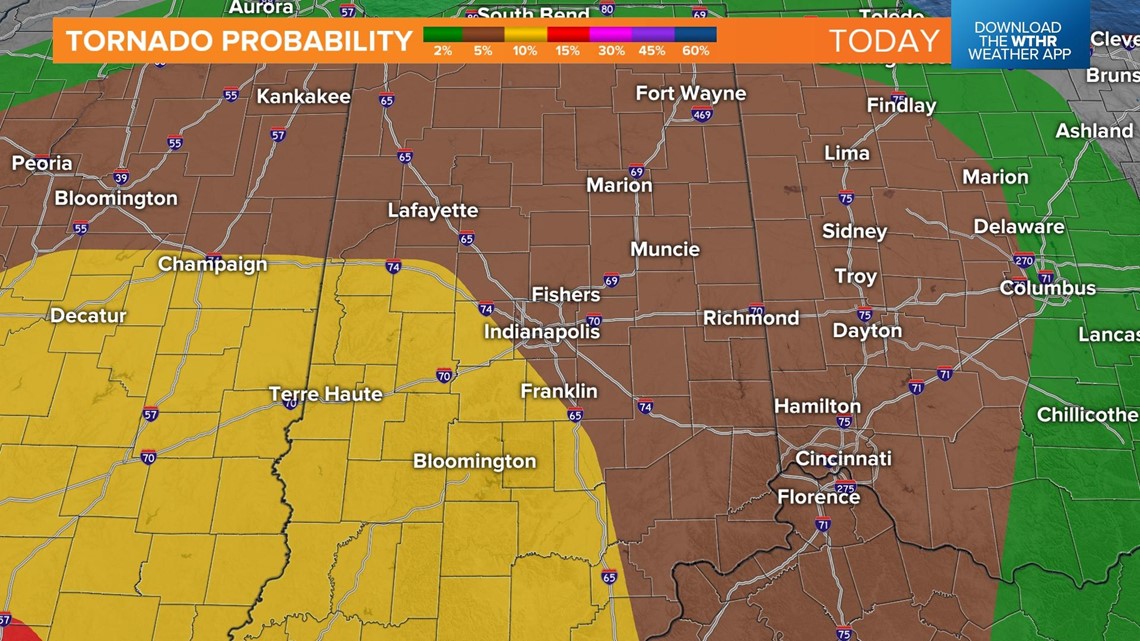
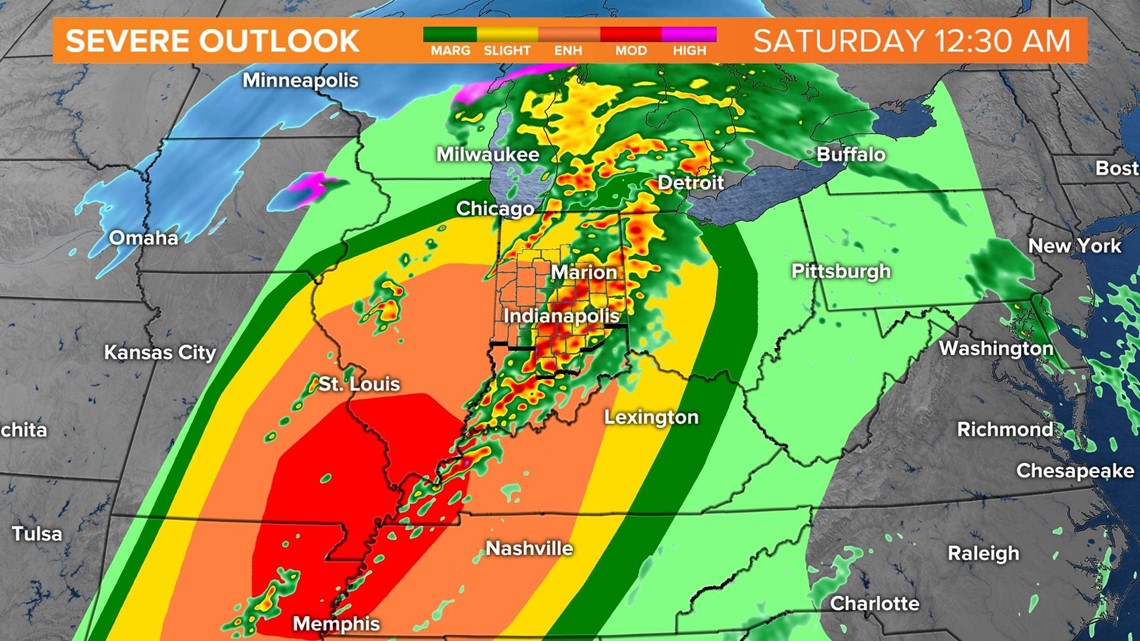
The strong cold front will push in late tonight, triggering strong to severe thunderstorms. All of central Indiana is outlined for a risk of severe weather, with southwest central Indiana in the higher risk.
STAY WEATHER AWARE: View interactive radar

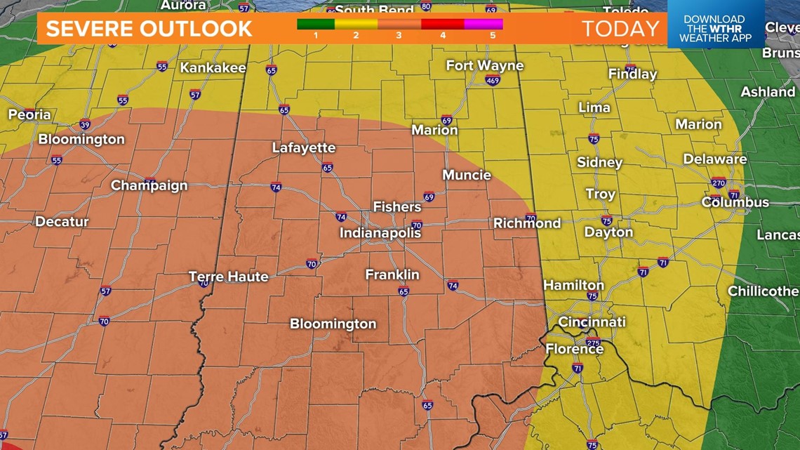
Damaging winds will be the main threat with tornadoes possible, too.


Stay weather aware
The time frame will be from 8 p.m. Friday to 5 a.m. Saturday These will be fast-moving storms that will likely prompt warnings. Make sure you have the Live Doppler 13 Radar app on your phone and make sure your phone is set up to get warnings.
Download the app: App Store | Google Play
You also want to make sure your ringer is turned up and you have the emergency alerts switched on. Don't silence or set your phone to do not disturb mode. With such a rare event in December and late at night, it’s best to stay weather aware.


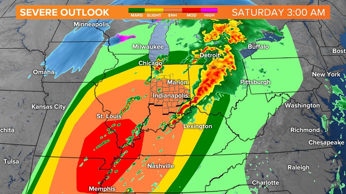
Storms will taper off and lose intensity by sunrise Saturday.