

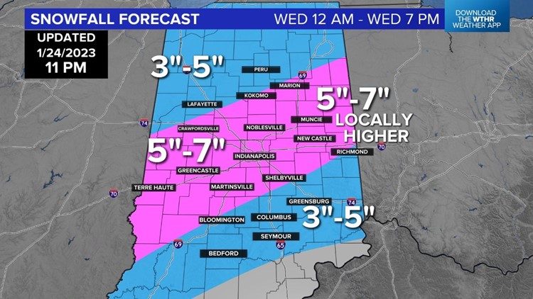
INDIANAPOLIS — Most of central Indiana is under a winter storm warning for Wednesday.
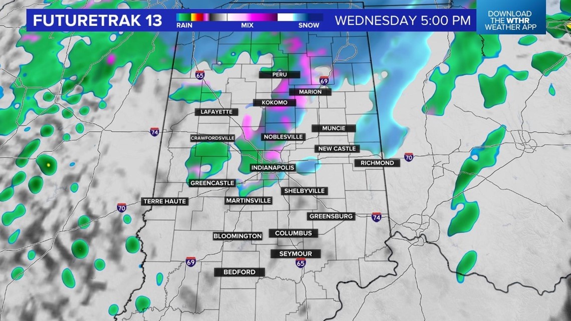
All of our latest data indicates the potential for 5-7 inches of snow for a good part of our area. The totals will be lower where we have more mixing of the snow with rain. This is a still developing storm system and there will be some additional updates as the storms moves in.
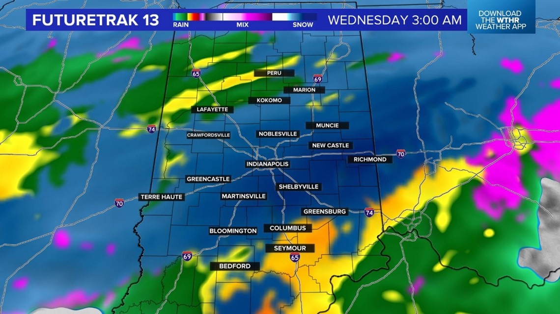
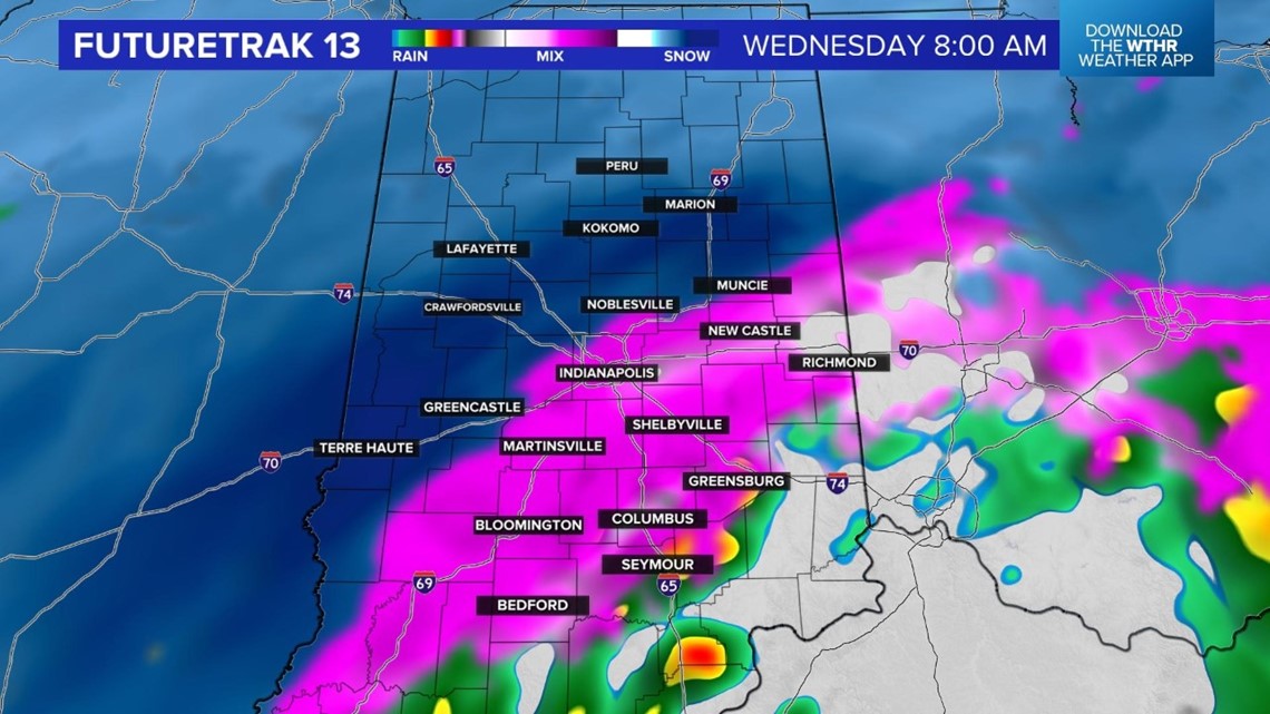
The first wave of heavy snow hits just before the Wednesday morning drive. We are timing it from about 1 a.m. to 5 a.m. Prepare now for delays and cancellations.


We do have a couple of things working in our favor as far as road conditions are concerned. Road and surface temperatures are up today after highs in the 40s. This will help melt some of the snow as it hits the surface. We are also forecasting temperatures to stay at or just above freezing on Wednesday. This will also aid in melting.
We do, unfortunately, expect the snow to be heavy enough to stick and cause problems for the Wednesday morning drive.
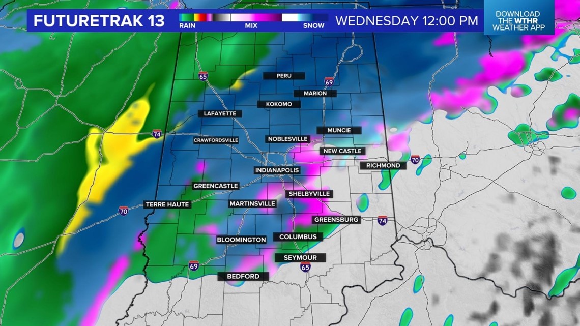
Another wave of snow is possible from about 9 a.m. to noon Wednesday will lead to more snow-covered roads. Allow extra travel time on Wednesday and download the Live Doppler 13 Weather app for Live Doppler 13 Radar, delays and closings and any updates to the forecast.
