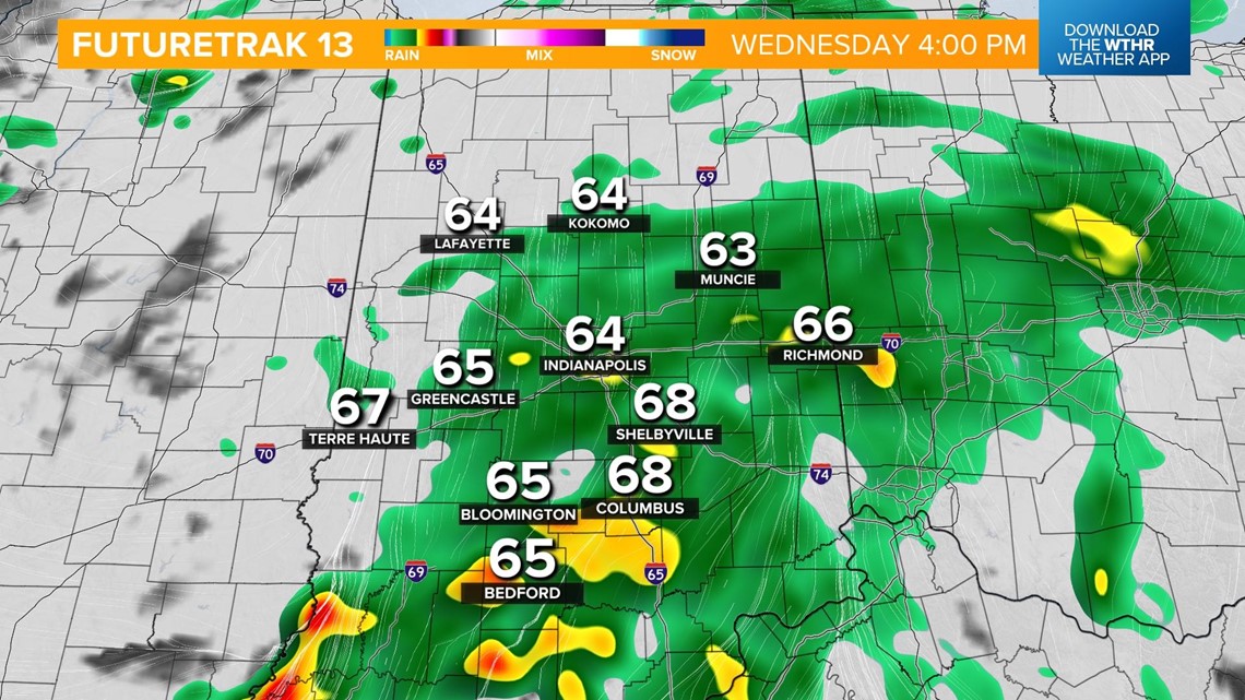
INDIANAPOLIS — After a brief lull from the morning rain, a second round of rain and a few thunderstorms are set to move into the Indianapolis metro area around the lunch hour.

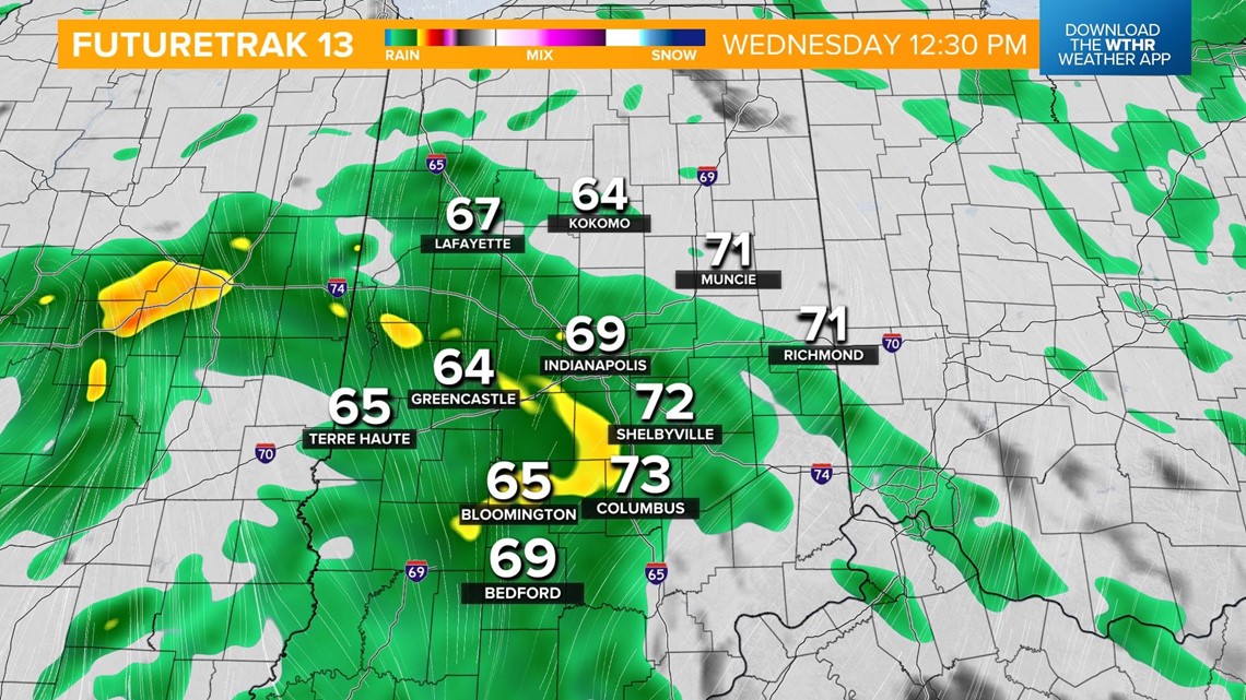
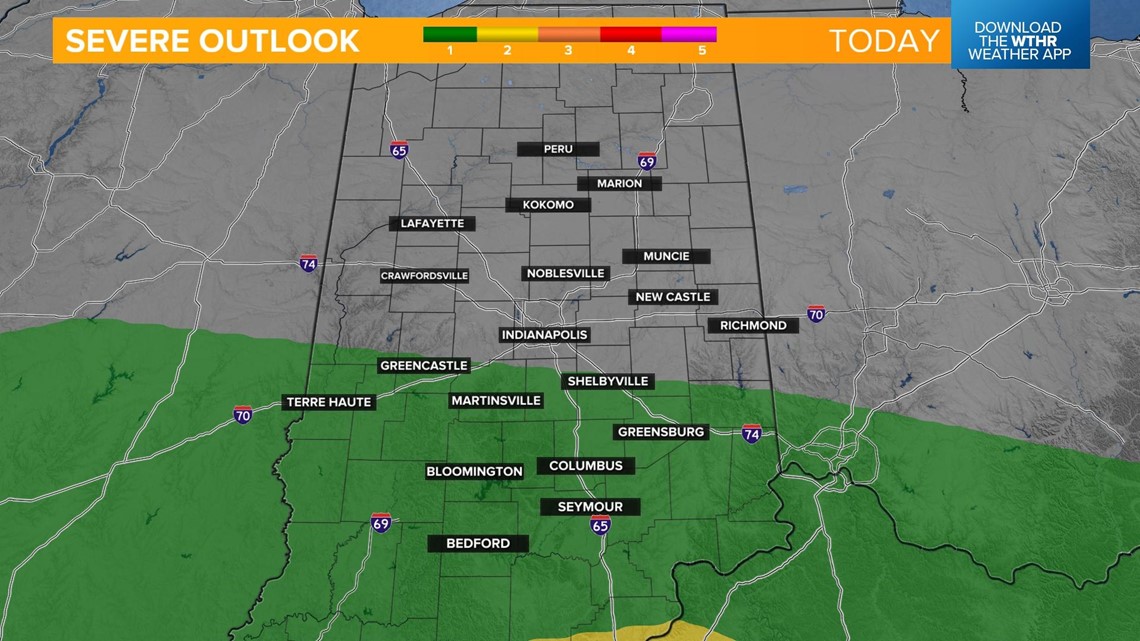
The atmosphere will be slightly more unstable across the southern tier of the state and that will trigger more storm chances in the afternoon. Some storms could be strong to severe with damaging wind gusts possible, but keep in mind lightning is a threat in any thunderstorm.


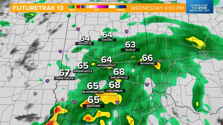
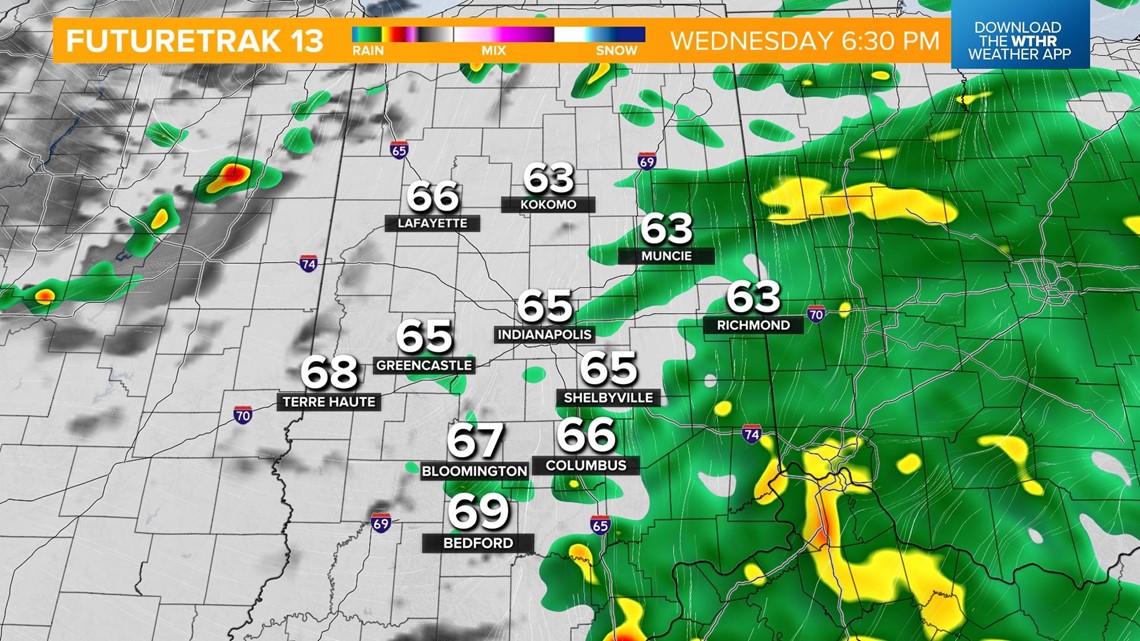
Rain and a few storms will continue through the evening rush and begin to taper off from west to east after 6 p.m.

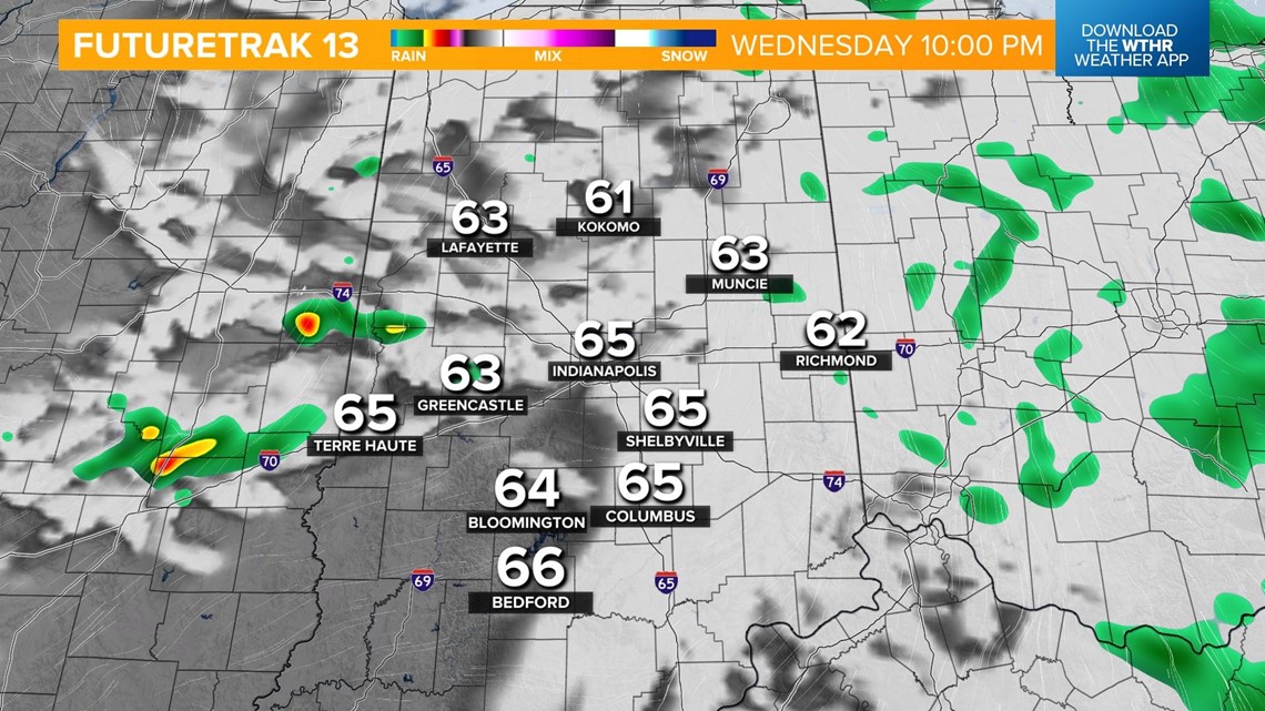
With the exception of a stray shower or storm in the evening, skies will begin to clear.

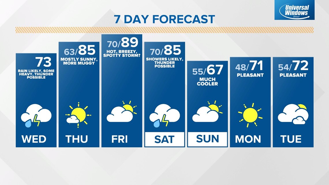
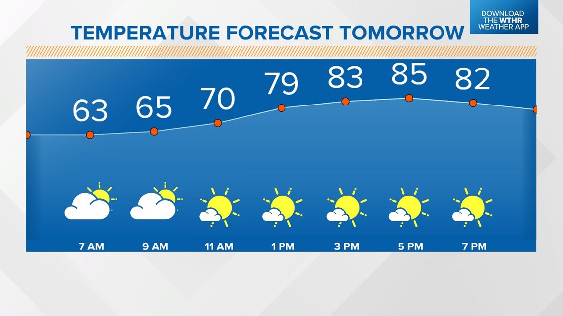
We've got lots of dry time on Thursday with only an isolated storm chance in the afternoon as heat and humidity increase. High temperatures return to the mid 80s.

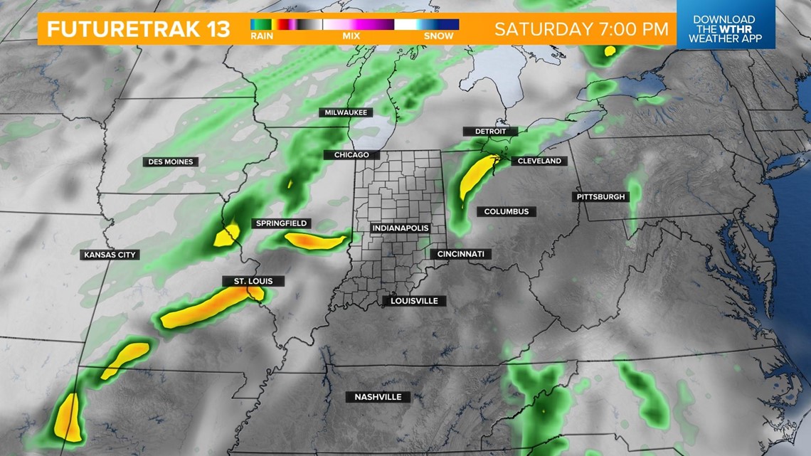
Friday will be the hottest day of the week with highs in the upper 80s. A stray late-day shower or storm will again be possible with the heat of the day. Our next storm system arrives Saturday bringing showers and storms. Temperatures will still be in the 80s before the cold front arrives Saturday evening.

This will bring a major drop in temperatures once this system passes with highs back in the mid 60s on Sunday.