

INDIANAPOLIS — There were several reports of trees down on Wednesday due to severe winds near 60mph. Those reports came from near Greenfield to Pendleton with one storm.
Another storm caused some damage from Lebanon to Michigantown to Burlington.
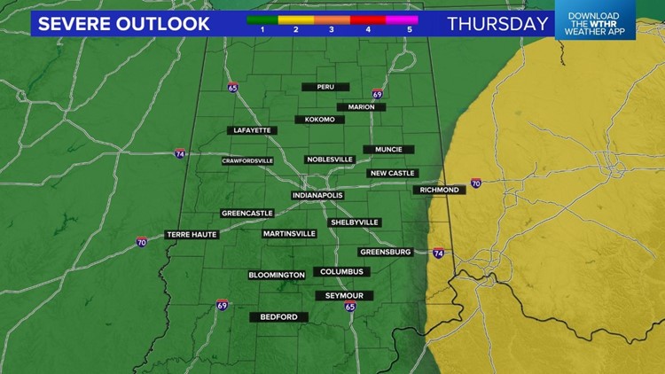
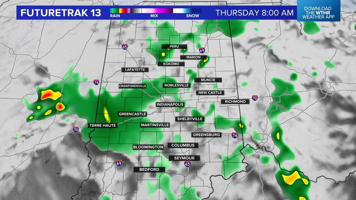
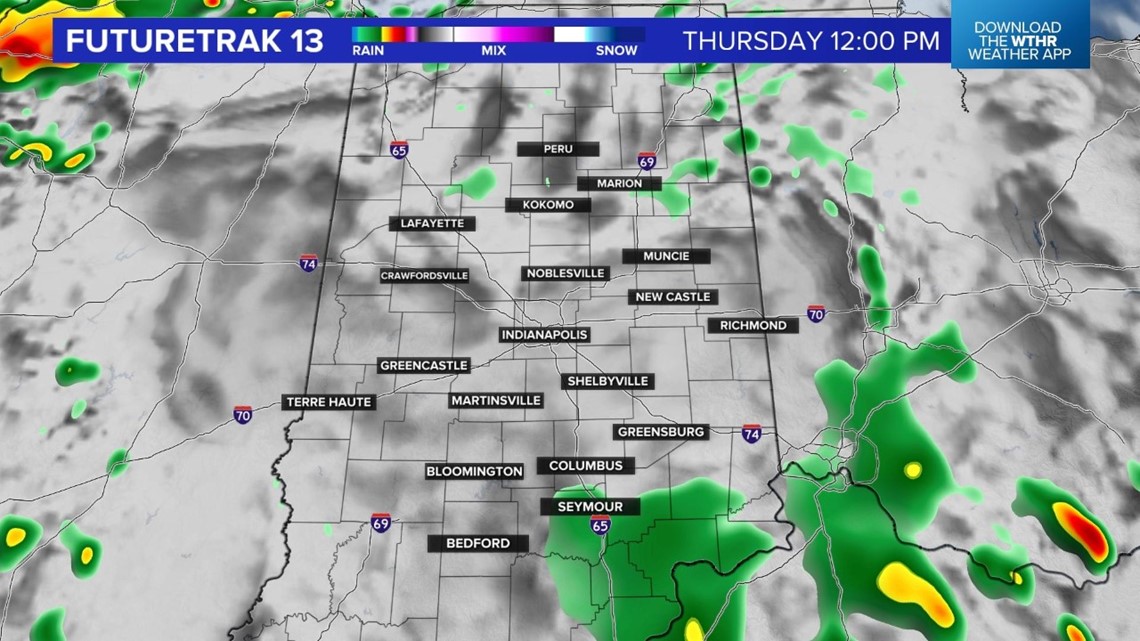
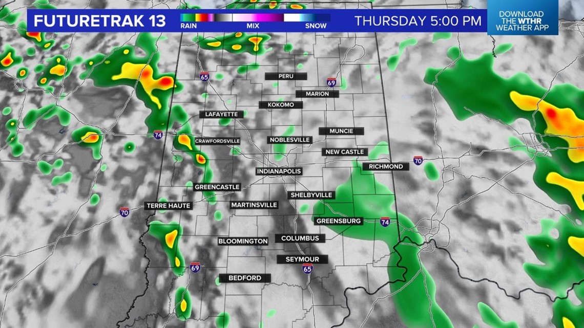
More storms develop Thursday afternoon and evening. We are again under the threat for severe storms on Thursday. Rotating storms and damaging wind gusts are the primary threats.

Forecast highs are in the upper 70s.

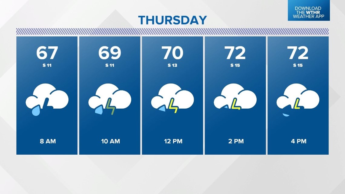
A few dry hours are possible in between the scattered storms. Check Live Doppler 13 Radar before your outdoor plans.


RELATED: 'Race Day' tornadoes: 18 year later

The center of this slow moving weather system will be over us on Friday. This means there will still be a few showers and storms possible. Right now it doesn't look like a washout for Carb Day but you will need the jacket and the rain gear.
Highs will only be in the range of 65 to 70 degrees.
What other people are reading:
