
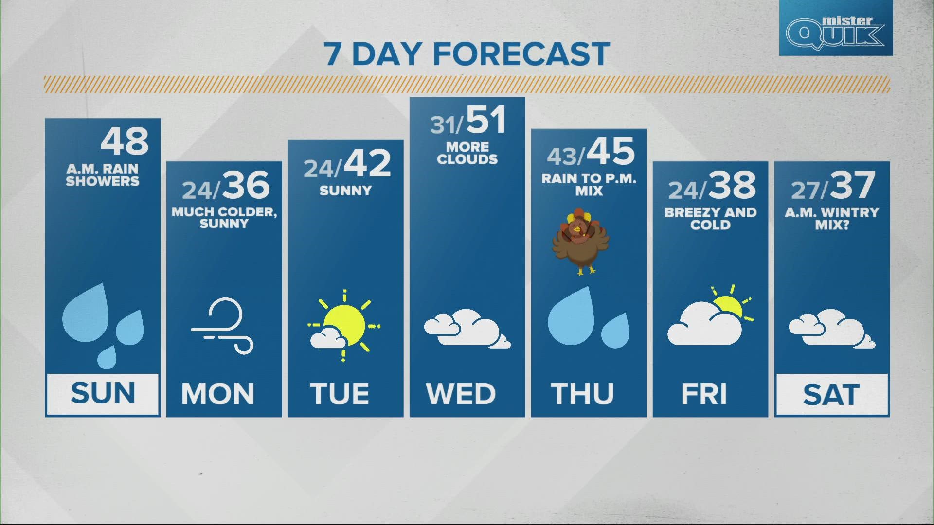
INDIANAPOLIS — Rain showers will be likely through the early afternoon and could become heavy at times. Rain will exit the Indianapolis metro area around 2 p.m. and clear the state shortly after as the cold front tracks east.


Temperatures will rebound into the upper 40s in the afternoon before much cooler and drier air pushes in behind the front. This will clear the sky, but set up central Indiana for a major drop in temperatures overnight. We'll wake up to the mid 20s with wind chills in the teens Monday.


Highs only reach the mid 30s as Monday will be the coldest day of the busy travel and holiday week. We will have lots of sunshine for Monday and Tuesday. Temperatures rebound into the low 40s Tuesday and into the low 50s by Wednesday.


Clouds will increase but we should stay dry on Wednesday.


Rain chances return for Thanksgiving Day starting in the morning.


Temperatures hold steady in the low to mid 40s during the day. After that, temperatures drop Thanksgiving night on the backside of a cold front and bring a brief rain/snow mix.

