Welcome to astronomical autumn (meteorological fall began September 1st for record-keeping purposes) with the equinox occurring this morning at 9:30 AM. That's when the sun's direct rays began to cross the equator where it is now spring in the southern hemisphere.
Due to the earth's tilt, our daylight in the northern hemisphere will continue to shorten each day and we'll lose nearly 3 hours of daylight between now and December 21st... the winter solstice.
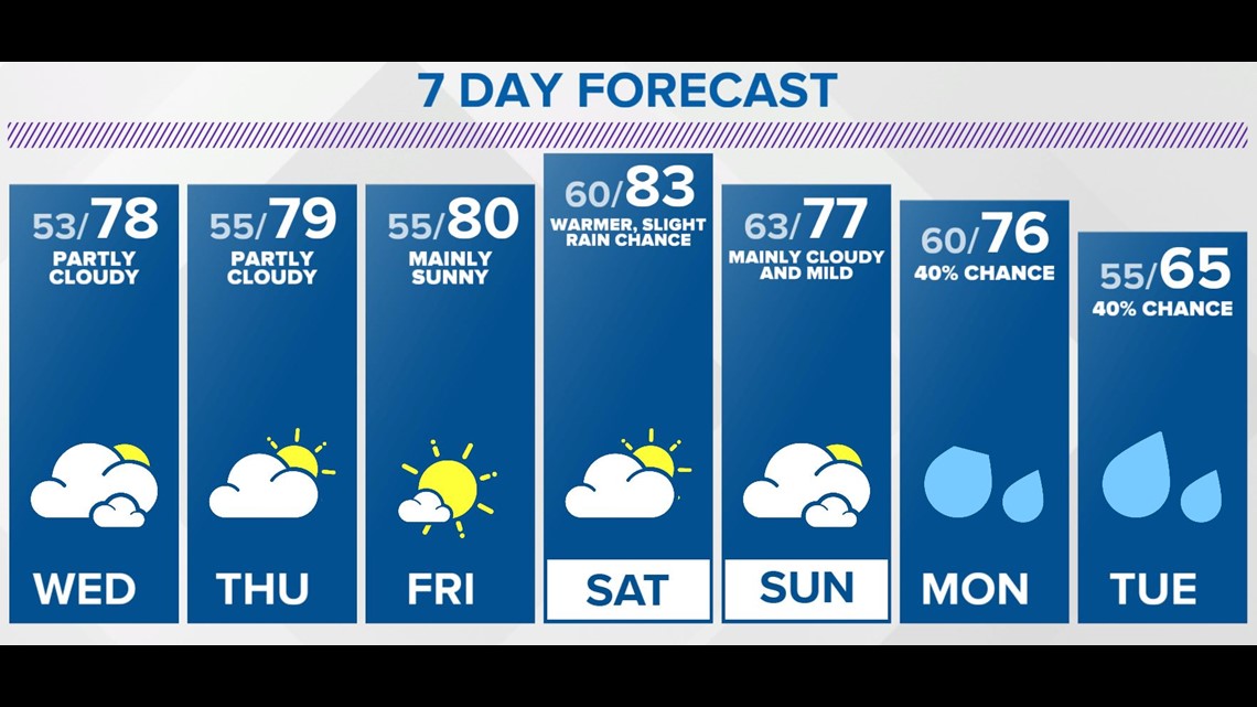
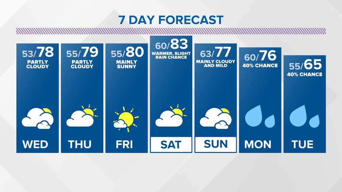
With the exception of an abundance of haze/remnant wildfire smoke it's a pleasant day in central Indiana. The crisp morning gives way to mild highs in the upper 70s this afternoon.
The Muggy Meter climbs a little bit over the next 24 hours as the wind becomes southwesterly. But even then, dewpoints in the 50s is definitely tolerable in the short-term. Mid-range guidance suggests remnant tropical moisture pushes dewpoints to 60°+ Friday into the weekend, but unfortunately this moisture doesn't bring great rain prospects to the area.

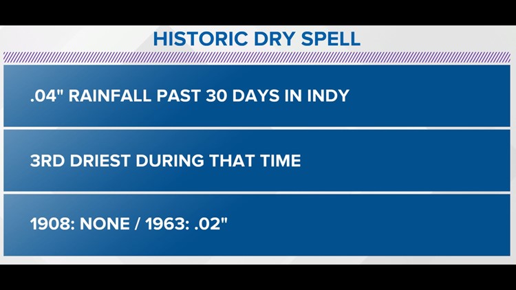
It's been an historic dry spell for Indianapolis and central Indiana over the past 30 days... with many locations in a 3"+ rainfall deficit during that time. It's one of the driest periods for Indy during the last month and the National Weather Service in Indianapolis tweeted it's been 35 days without at least a tenth of inch... the longest since the infamous summer of 2012.
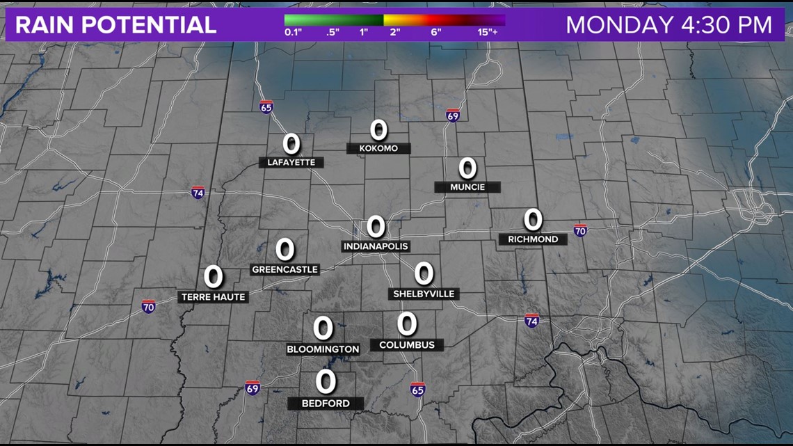
But unfortunately, much of the widespread rain from what's left of Tropical Storm Beta stays well south of the Ohio River and we have low confidence that a cold front brings substantial rainfall on Sunday. It doesn't mean we'll stay completely dry, but we're in a holding pattern to bust-up what is a historic dry spell since the 19th of August.


Long range signals on honing-in-on a pattern change middle to latter half of next week that deliver much colder air to open-up October. Stay tuned for the potential of widespread frost if this verifies.