

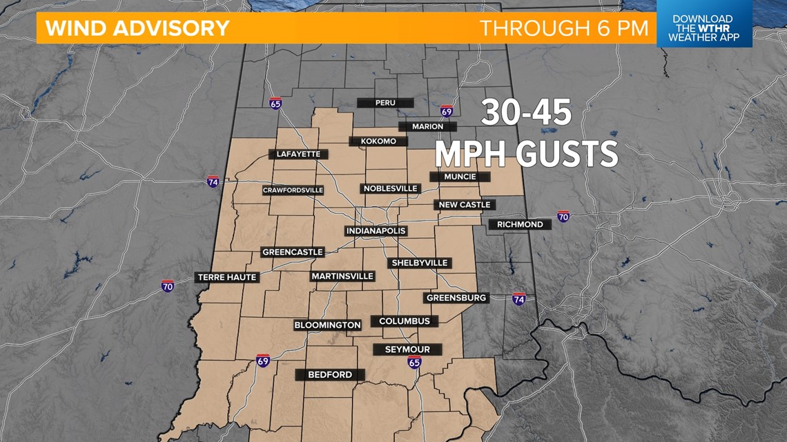
INDIANAPOLIS — A Wind Advisory will continue through 6 p.m. as a strong area of low pressure approaches and eventually moves through central Indiana. Winds will gust up to 45+ mph today, leading to the potential of downed tree limbs, isolated power outages and difficult travel.

We'll then see a slight lull in rain over the next few hours as temperatures recover into the low-to-mid-60s. The cold front then moves through after 1 p.m., sparking pop-up thunderstorms. The Storm Prediction Center has placed most of the state under a level one of five for the threat of an isolated strong to severe storm this afternoon. A small part of eastern Indiana was upgraded to a level two of five for a slightly increased chance of seeing a severe storm. This will exit the state around 5 p.m. to the east.


Behind this system, skies will begin to clear this evening and overnight as a cooler, drier air mass takes over. Wednesday will be the coolest day next week with morning lows in the mid-30s and areas of frost possible in outlying areas. Highs will only be in the upper 40s/near 50.


Temperatures start to trend upward starting Thursday with highs in the mid-50s, then climb into the mid-60s for Friday. We'll then see temperatures trending above average through the first part of next week with highs in the 60s.


We're watching a few storm systems that will bring a chance of scattered rain, especially during the first part of the day, on Saturday. Easter Sunday looks mainly dry to start the day with another round of rain possible in the late afternoon and evening.


