INDIANAPOLIS — A Severe Thunderstorm Watch is in effect until 3 a.m. Tuesday for a large portion of central Indiana.
Counties in the watch include Bartholomew, Boone, Brown, Decatur, Delaware, Fayette, Fountain, Hamilton, Hancock, Hendricks, Henry, Johnson, Lawrence, Madison, Marion, Monroe, Montgomery, Morgan, Owen, Putnam, Randolph, Rush, Shelby and Wayne counties.
Weather Headlines:
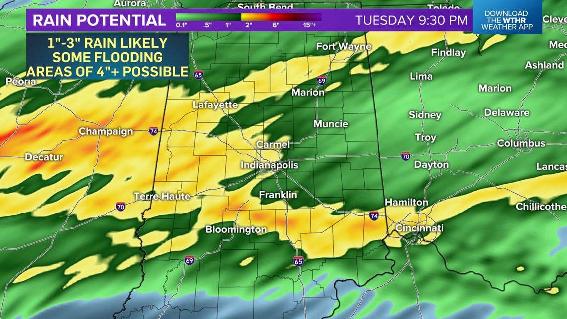
Swath of 1"-3" likely tonight in central Indiana with areas of 4"+ and flooding possible
Embedded severe gusts, hail, and rotation
Watches and warnings are possible tonight/predawn Tuesday
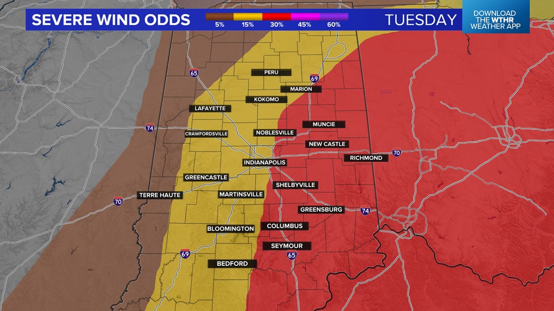
Severe risks have been elevated for Tuesday (during 12 - 7 pm)
Buckle up for what will be a stormy ride at times over the next 24 hours. It's starting this afternoon south of Interstate 70 already with storms developing along a warm front. These may produce quarter-sized hail, 60 mph gusts, and could also rotate along that boundary.
What a difference the front is making in central Indiana with cooler 40s/50s north contrasted by near 80° to the south.
Initial cells this evening will have a greater chance to rotate and/or produce significant hail before eventually congealing into a widespread heavy rain/thunderstorm complex. By that time, the front may be draped over central Indiana which becomes the "tracks" for "training" storms. That ups the ante for flooding within heavy rain rates. Bottom line, expect a loud night in central Indiana with the possibility of watches and/or warnings.


The complex will linger into early Tuesday morning. How quickly it dissipates/departs to the east plays a major role in how volatile the atmosphere becomes later in the day. Right now, it's impossible to say how long the clouds linger.
But hi-res modeling is bullish on enough time for the atmosphere to recovery and for supercell storms to develop within the warm sector in central Indiana. Modeled wind profiles between noon and 7 p.m. Tuesday would support tornadic supercells that could also produce significant hail (baseball-sized or larger) and destructive wind (75+ mph gusts).


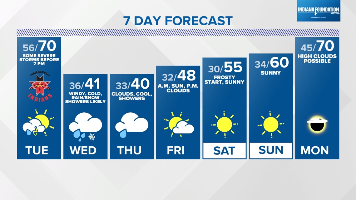
Please be Weather Aware the next 24 hours and follow us for updates. The threat of severe weather quickly ends with the passage of a cold front Tuesday evening. That front delivers much colder air Wednesday and Thursday along with wind-whipped rain/snow showers.