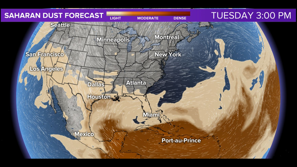
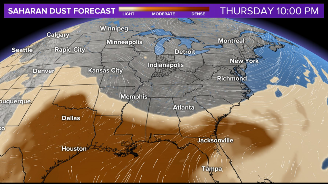
INDIANAPOLIS — Dust layer modeling continues to show the SAL (Saharan Air Layer) riding the upper level wind northward into the Ohio Valley from the Caribbean.
We reiterate that the SAL reaching the states, some 6,000 miles away from the Sahara Desert, occurs nearly every summer.


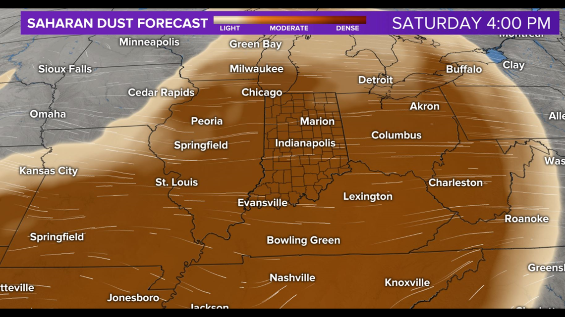
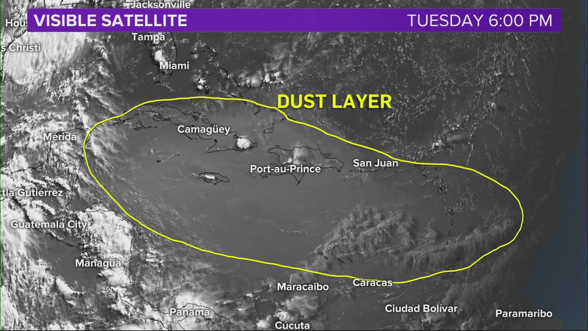
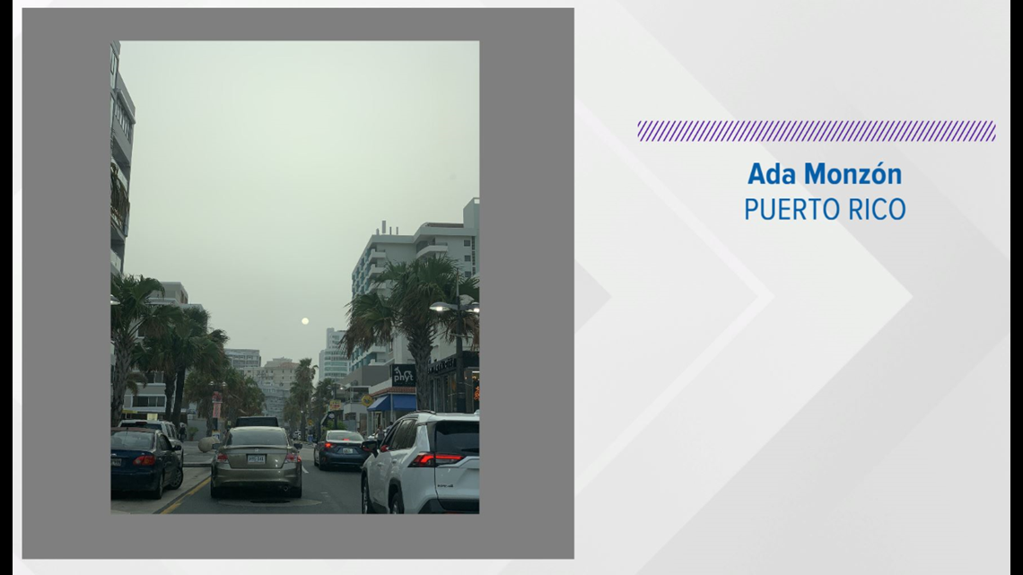
However, this particular wave is much more expansive and dense. The scene from Puerto Rico, courtesy of Chief Meteorologist Ada Monzón, shows how milky the sky looks within the dust layer.


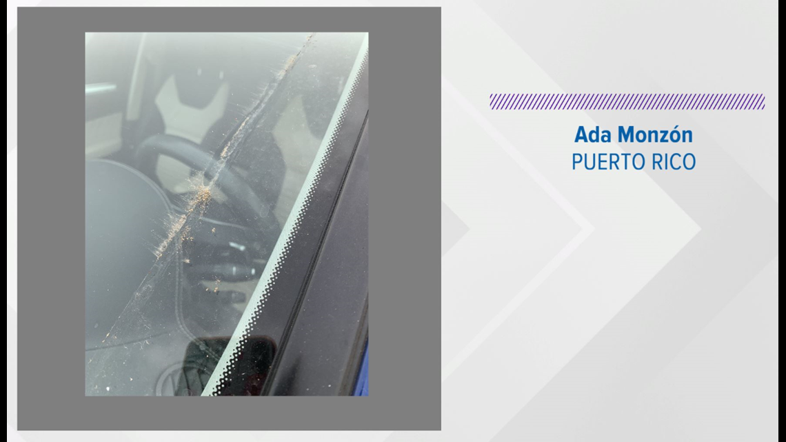


When it's this dense, and if it rains, it produces a "muddy" rain that's residue (iron) can be seen on cars, etc.
Coincidentally, that iron is beneficial to soil and in effect crops too.
On the other hand, it can also limit precipitation development by limiting heating/instability.
We'll continue to update you on the progress. But please know this isn't apocalyptic.