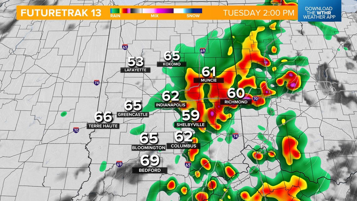
INDIANAPOLIS — Scattered showers and storms will continue this afternoon as a slow-moving cold front tracks across the state. Severe storms are not expected, but it is possible to see brief heavy rainfall, gusty winds, small hail and frequent lightning within these storms. Temperatures will hold steady in the 60s through the afternoon.

As the boundary stalls out across southern Indiana this evening, a line of storms will likely redevelop before pushing out overnight.


A lingering shower mainly south will be possible through early Wednesday before high pressure begins taking over helping to clear skies a bit by Wednesday afternoon. High temperatures will be cooler in the mid-to-upper 50s.


We'll stay dry Thursday with highs near 60.


Our next weather system is set to bring rain starting Friday morning and continuing through the day. Rain will be heavy at times Friday night into Saturday. Temperatures will hold steady in the 50s on Friday and through the overnight hours into early Saturday morning ahead of a potent cold front that will send temperatures plummeting back through the 40s Saturday afternoon.


Any remnant moisture around Saturday evening could briefly mix with snow flurries as temperatures continue to drop into the 30s. Sunshine returns for the second half of the weekend, but temperatures will be unseasonably cool with morning lows near 30 and highs in the mid-40s. We'll see a slight temperature recovery to start next week.