

INDIANA, USA — It's been a rough end to April for the central United States as the general jet stream pattern has parked west of the Mississippi River bringing repeated storms for a few days with several tornadoes. High pressure to the east is breaking down and will allow rain to push east, but not with the high severe threats.
Tap HERE to track the rain and storms with our interactive radar.
A few days ago, a large warm front swept across the country bringing warmer, more humid air to much of the nation east of the Rockies. Now we have a jet stream and low pressure system sitting over the central United States, using the heat and humidity over and over again to bring thunderstorm creation over multiple days.
Let's look at the weather setup...
A high pressure dome has sat over the southeastern and Tennessee River Valley for several days. That has brought drier weather for the most park. The storm out to the west is stuck in place because it has not been able to break through the higher pressure.


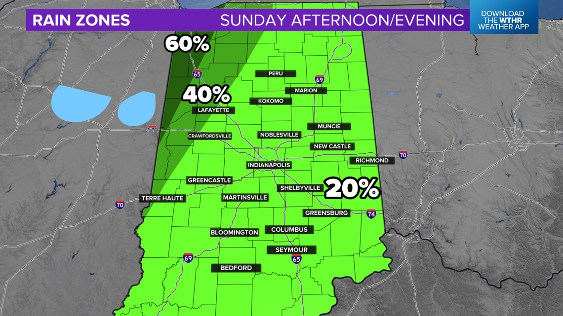
Indiana has been in an interesting spot, lying right along the edge of the high pressure zone. This has helped limit thunderstorms the past few days. However we have developed some scattered downpours along the edge, scooting northeast near or north of Indianapolis. That will likely continue for Sunday, April 28.
Until Monday, rain zones will remain to stay elevated west and north of Indianapolis. Everyone has a chance for a stray shower, but much of the state will likely stay dry.

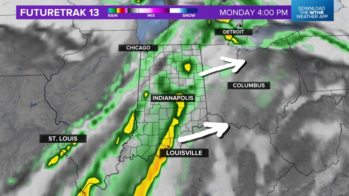
The high pressure ridge will break down and retreat southeast toward the Atlantic by Monday, allowing rain to finally press east. However by then the orientation of the jet stream and the stretching of the low pressure system will likely decrease severe weather chances by then.
How much rain will fall on Monday?
A half inch or so is possible, with some areas getting slightly more. Rain will gradually move in Monday. An alignment of winds from the surface to the upper-levels will reduce severe weather and mainly just bring scattered rain, mixed with downpours and thunder. Expect Monday to be mostly wet, especially in the afternoon.

— 13News Matt Standridge
