
INDIANA, USA — Big question... will it stick? Probably not. We are expecting more snow showers to mix in with the rain tonight across Indiana. Accumulations are not expected. But who has the best chance for snow?
Tap HERE to track the rain/snow showers with our live, interactive radar.
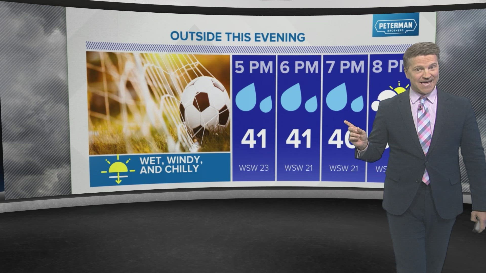
After thunderstorms the past few days, winter has come back with chilly, windy air across Indiana. An upper-level low pressure system has settled into the Great Lakes, spinning around lots of clouds and showers, some of them rain and some of them snow!
Many across Indiana have seen some graupel fall from the sky, which looks a lot like Dippin' Dots. These are snow crystals that have had water droplets freeze to the outside, looking like little, opaque snowballs. We typically get them with upper 30s and low 40s.
How cold will it get tonight?
After 30s and 40s Wednesday, temperatures at night will drop slightly more into the mid-30s, increasing the chance for snow showers to mix in across Indiana.


Who has the best chance for snow showers tonight?
We should go from rain/graupel to more snow showers mixing in tonight as colder air arrives.
The center of the cold-core low will start in northwest Indiana and push southeast toward Indianapolis. Then, it should swing east near I-70 toward Richmond.
Cold-core lows have colder air closer to the center of lowest pressure. That's why the map looks like a big swoosh mark. It's not all about the farther north you go, the colder the air gets for this particular system. Plus, there should be thicker clouds and more precipitation closer to the center of the low pressure.

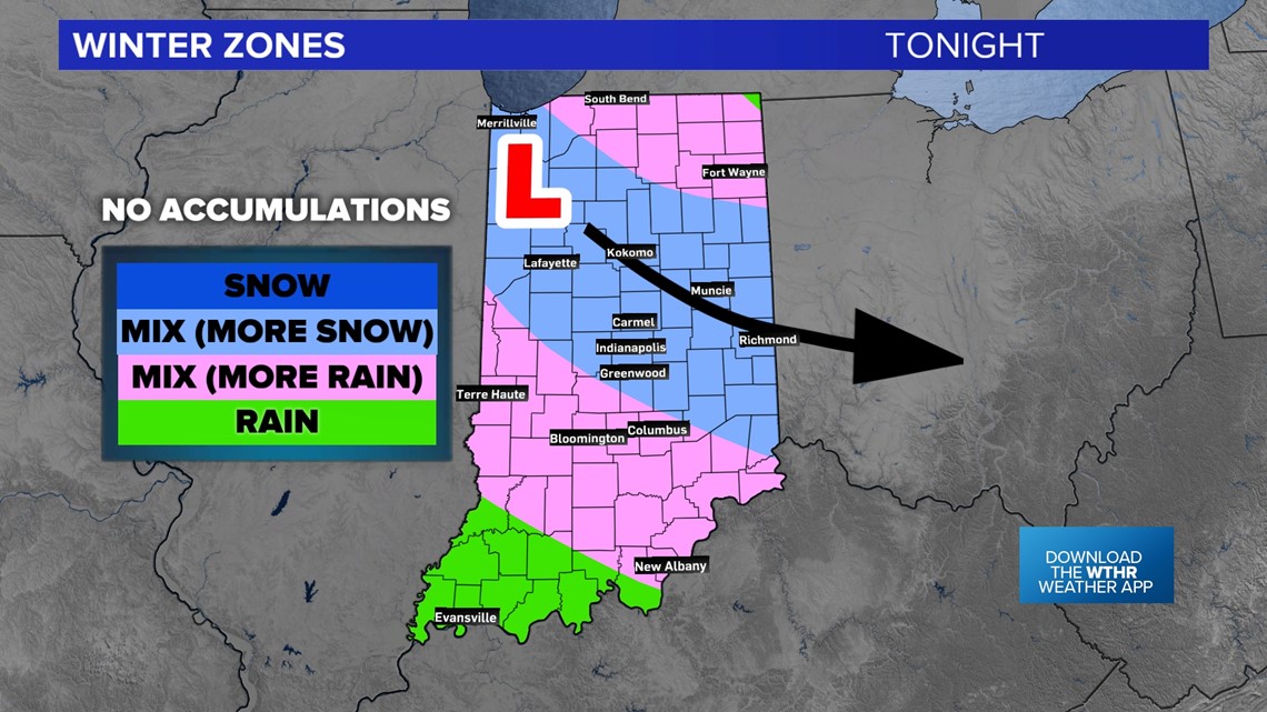
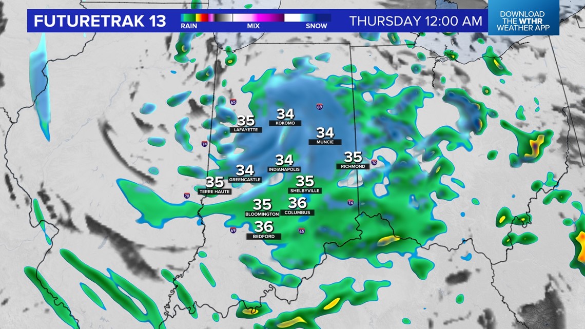
On radar, it will look like a swirling mass of rain and snow showers, almost like a tiny winter hurricane. Snow showers will be likely across much of central Indiana tonight.
Will the snow stick?
Most likely no. Ground temperatures have been warming up. It will be hard for the snowflakes to accumulate. There may be some grassy surfaces that get some temporary dustings, but most likely with the raindrop mixing in, snow will have a hard time sticking.
We don't expect the roads to be impacted. Plus, temperatures will never drop below freezing, so flash-freezing should not be an issue. Just some wet roads are possible Thursday morning with a flurry.

We should warm up into the weekend! By Monday, total solar eclipse day, we should be back in the 60s and 70s! Hopefully we can have clear skies.
What is graupel? 13News Meteorologist Sean Ash explains in the video below.