

INDIANAPOLIS — Clouds have been steadily increasing this afternoon and thickening up from west-to-east. At the time of posting, the thicker cloud deck had reached U.S. 31 and was creeping eastward.
But undercutting that layer of moisture aloft is a relatively drier layer near the surface. The latter is taking a chunk out of the radar, approaching the Indy metro area. It won't keep Indy totally dry, but clouds will have more bark than bite in Indy with just some passing showers.
Farther north-northwest (Lafayette to Kokomo), where there's greater lift to overcome the drier air, the showers may be steadier and heavier for a time before sunset.
Again, this doesn't mean there will not be raindrops at times around the metro area this evening. But there will still be ample dry time to enjoy temperatures hovering in the upper 60s to lower 70s.
A scattering of showers and some rumbles of thunder will be around from now into Saturday morning. These are developing along an approaching warm front that brings more humid air for the weekend. It also brings much warmer air too, with highs in the 80s.


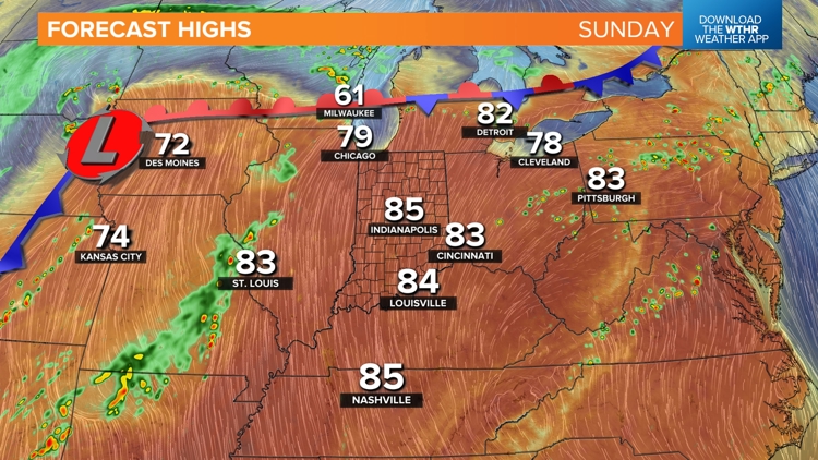
Near-record highs are possible Sunday in what's looking like the warmest air of the year so far. With a lifting mechanism lacking, expect many rain-free radar hours this weekend, with a boundary staying to our west. That front returns Monday, with more numerous showers and thunderstorms.


