
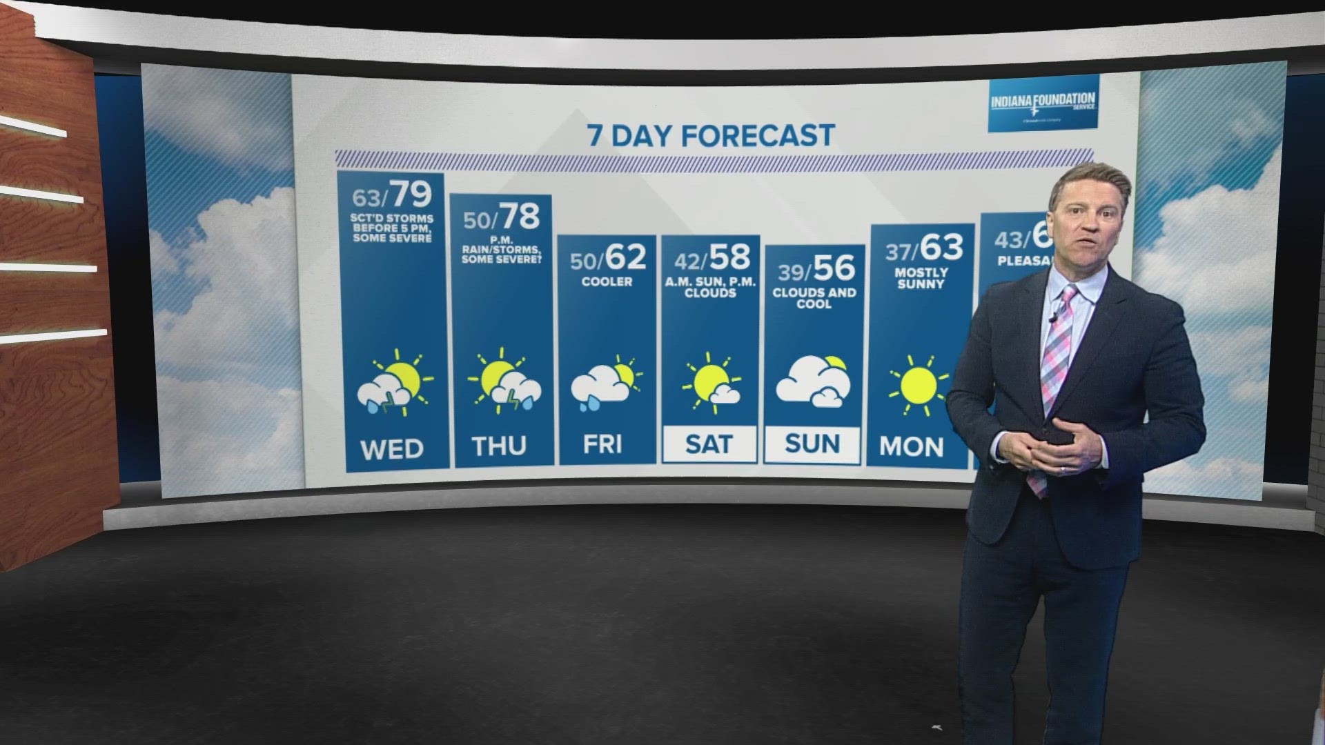
INDIANAPOLIS — It's another unseasonably warm April day in central Indiana with highs near/above 80° for the third straight day. At the time of posting, a warm front was noted nearly paralleling the I-65 corridor with a narrow line of returns on Live Doppler 13 Radar.
Between now and 5 p.m., it's possible that those returns intensify some to form a quick-moving band of showers and/or thunderstorms. But latest analysis of the atmosphere shows low-level instability is highly lacking, so it's conceivable by the time there's sufficient instability, the boundary could be located on the eastern-northeastern periphery of the WTHR viewing area and quickly exit into Ohio/Michiana.


Bottom line: There will be ample dry time this afternoon and evening as we'll be watching more intently what's happening upstream in Iowa/Northwestern Illinois/Northern Missouri. The remnants of those storms arrive around the IL/IN border after sunset, with much uncertainty on what type of "shape" they'll be in. But we'll need to remain Weather Aware with the potential they'll still be severe initially.


They'll cross the state between 10 p.m. and 4 a.m., and then, we'll be monitoring radar closely again tomorrow for additional thunderstorms. Latest guidance continues to put the noon to 5 p.m. window in play for severe storm potential, with a line of storms moving west-to-east with a cool front. Storms tomorrow could produce hail and/or rotate.


And a third day of severe storm potential comes on Thursday as central Indiana gets close to and/or gets back into the warm sector of the next low pressure system. We'll need to monitor location of an expected warm front closely that day as it could be the source of enhanced low-level wind shear for rotating storms and/or becomes the track of a heavy storm complex.
After Thursday night, cooler and more stable air returns and quiets our local weather for several days.

