INDIANAPOLIS — A warm front lifting through the state has brought some gusty winds and warmer temperatures.
THIS AFTERNOON: Mainly sunny, 35-40 mph wind gusts.

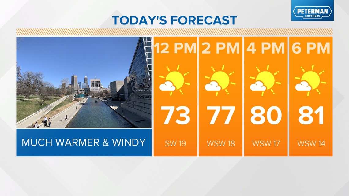
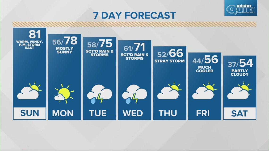
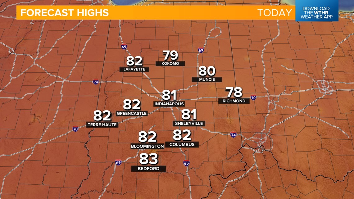
Highs in the low 80s — just a few degrees shy of the record high of 85 set back in 1883.


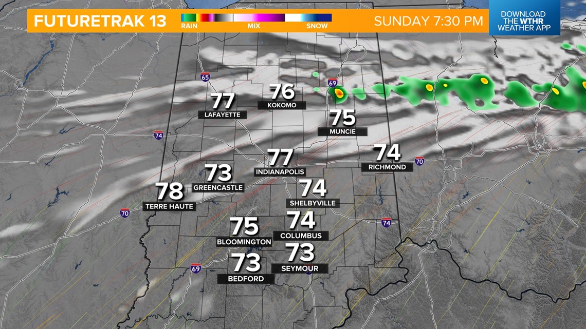
Is rain expected today?
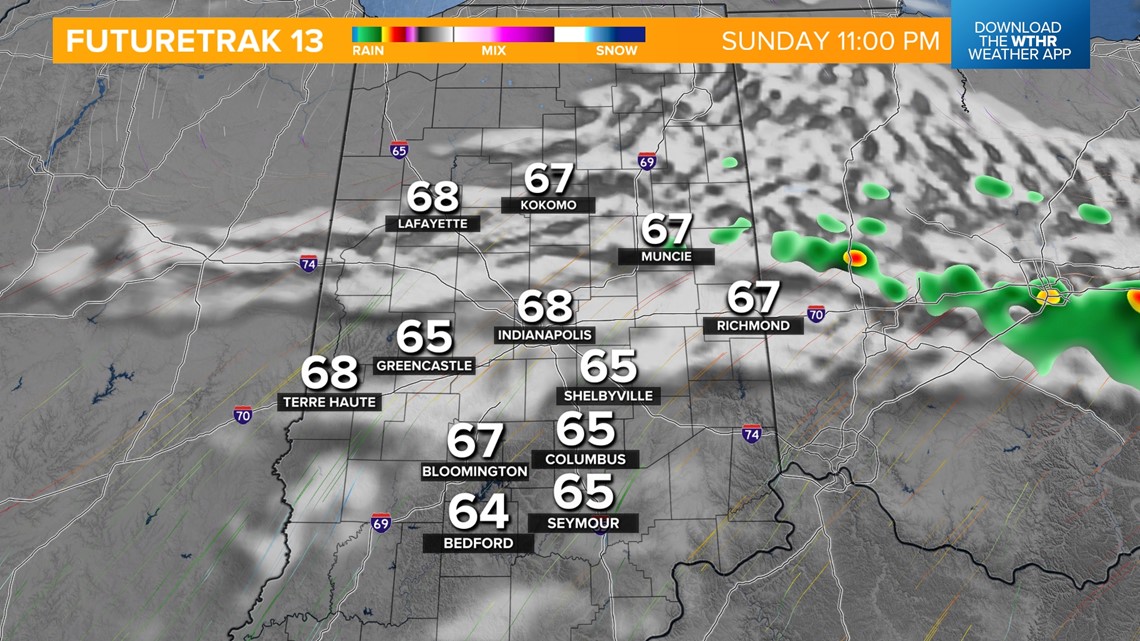
Very limited rain chance — mainly across eastern Indiana. The frontal boundary will push back south this evening and could initiate a stray shower or storm after 7 p.m.


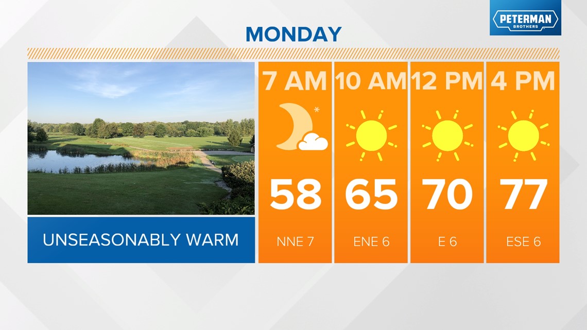
MONDAY: That boundary will then stall out south of central Indiana tomorrow allowing for another sunny and unseasonably warm day with highs in the upper 70s.

The pattern becomes more active starting Tuesday as showers and storms return to the forecast by daybreak. Temperatures remain above average despite the rain as we sit in the "warm sector" of this weather system Tuesday afternoon with highs in the mid 70s.


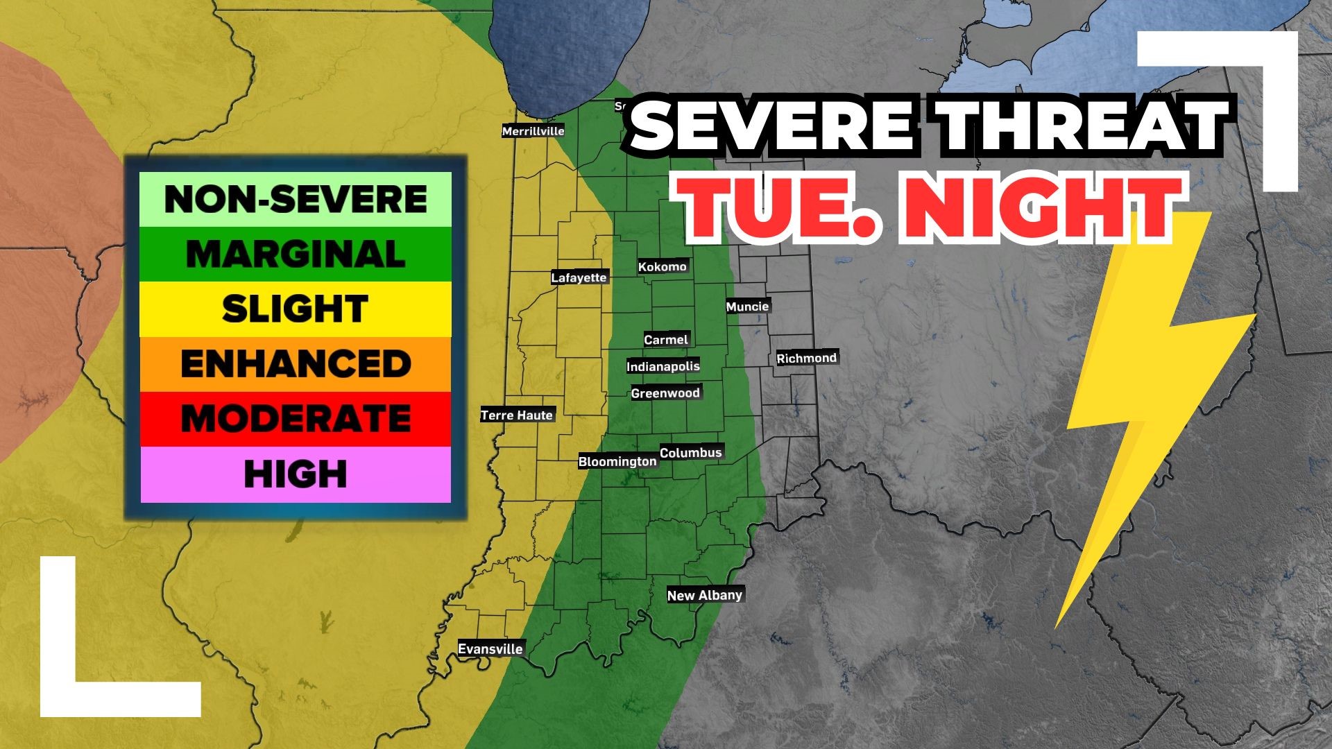
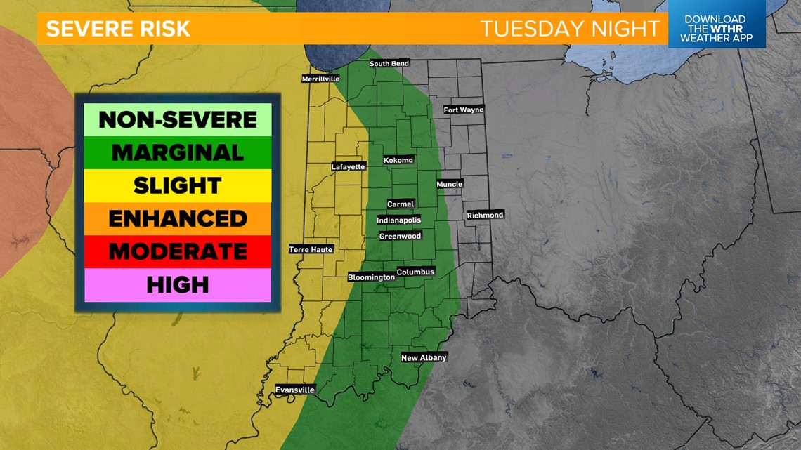
When are severe storms possible?
The Storm Prediction Center has already placed the western tier of the state under a level 2 of 5 for scattered strong to severe storms Tuesday night into Wednesday morning.


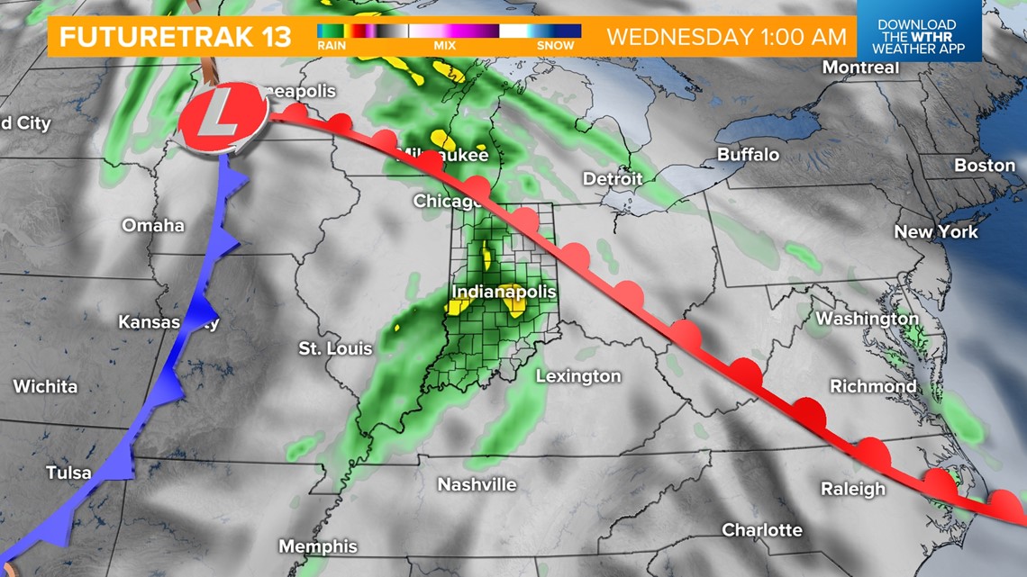
Scattered storms will then develop Wednesday afternoon as a cold front sweeps across the state. A few strong storms are possible but we'll have to see how the overnight storms work over the atmosphere and if parameters will be right for stronger storms to develop. Highs will still be near 70 ahead of the frontal passage.


How much does it cool off behind the cold front?
We get a break from the rain on Thursday but it will be more seasonal with highs in the mid 60s. The cooling trend continues with a secondary cold front set to move through Friday. This will bring a stray shower or storm chance as well as falling temperatures. Look for highs in the upper 50s Friday and only in the mid 50s next weekend. Overnight lows will be close to the frost line during next weekend, especially in outlying and rural areas.