INDIANAPOLIS — A tropical air mass has settled into the area as a warm front stalls out across Wisconsin and southern Michigan.

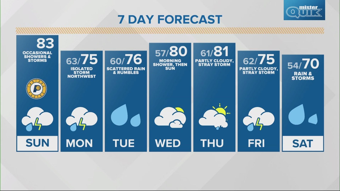
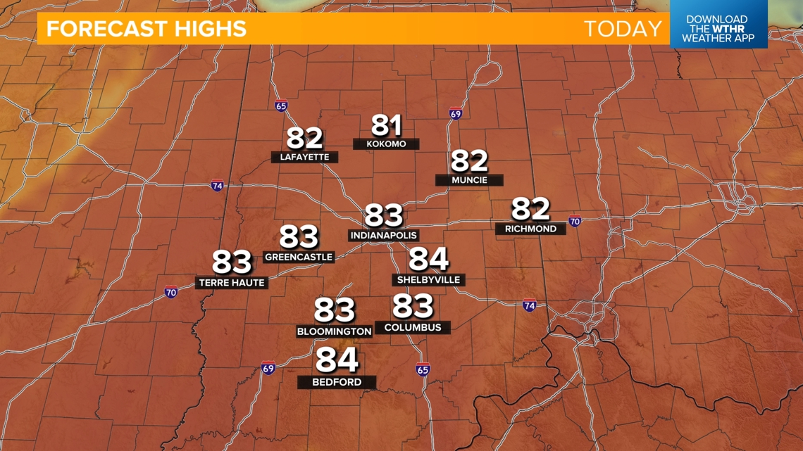
A few stray showers have developed across northern Indiana closer to that boundary, but today will otherwise be a mainly dry and very warm late-April day with highs in the low 80s. Plan to head downtown early and enjoy the mild temperatures ahead of the Pacers 7 p.m. tipoff.


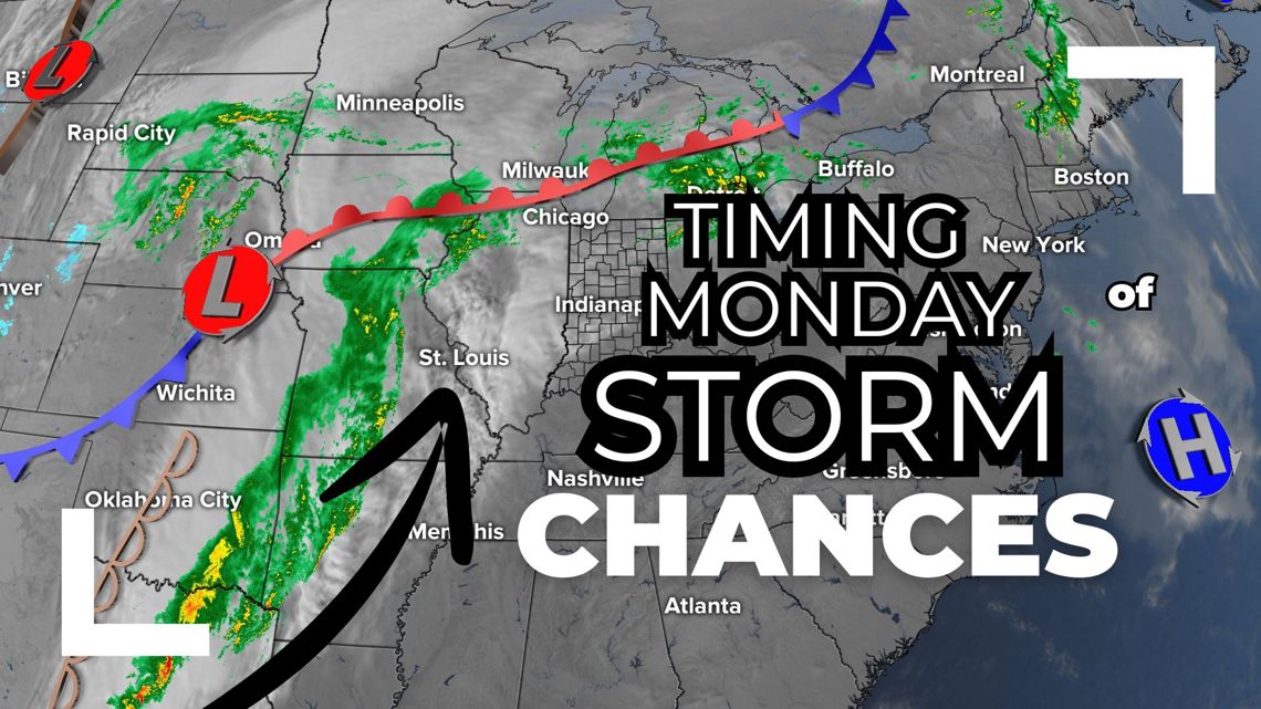
When should I expect rain Monday?
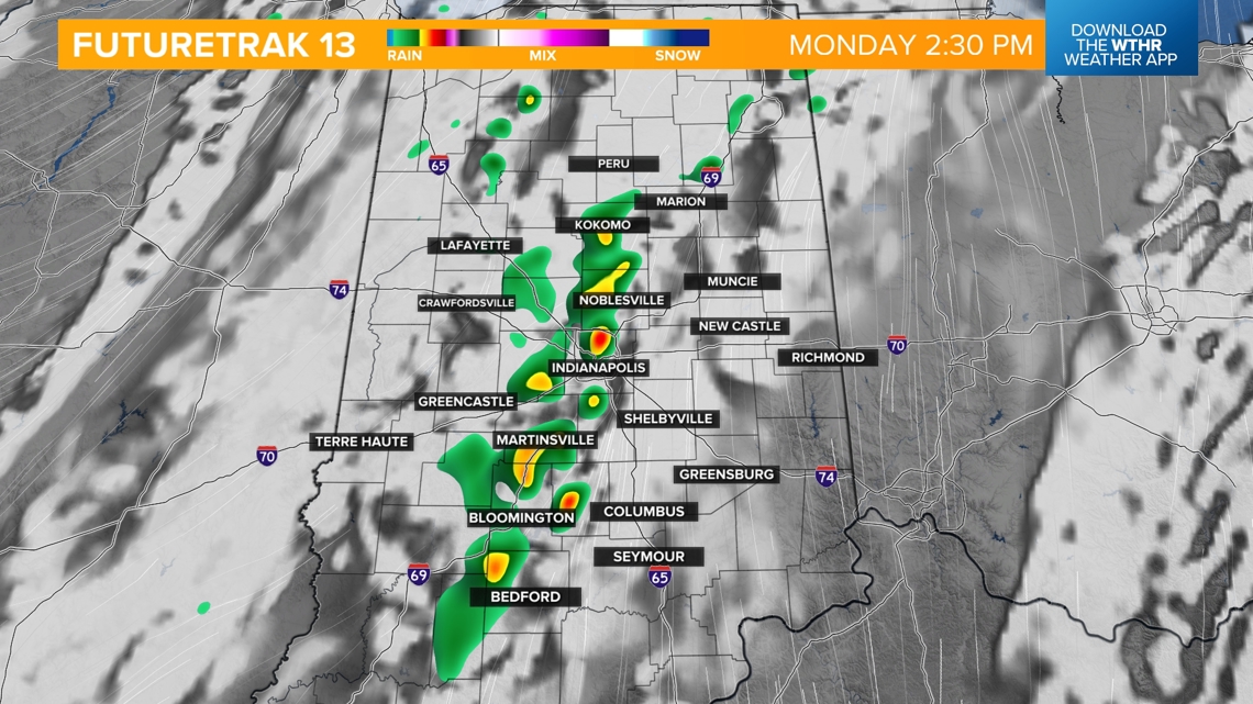
Prepare for rain to return overnight but it won't be widespread. Expect a few showers during the morning rush hour ahead of a bit of dry time in the late morning and early afternoon hours ahead of a cold front arriving.

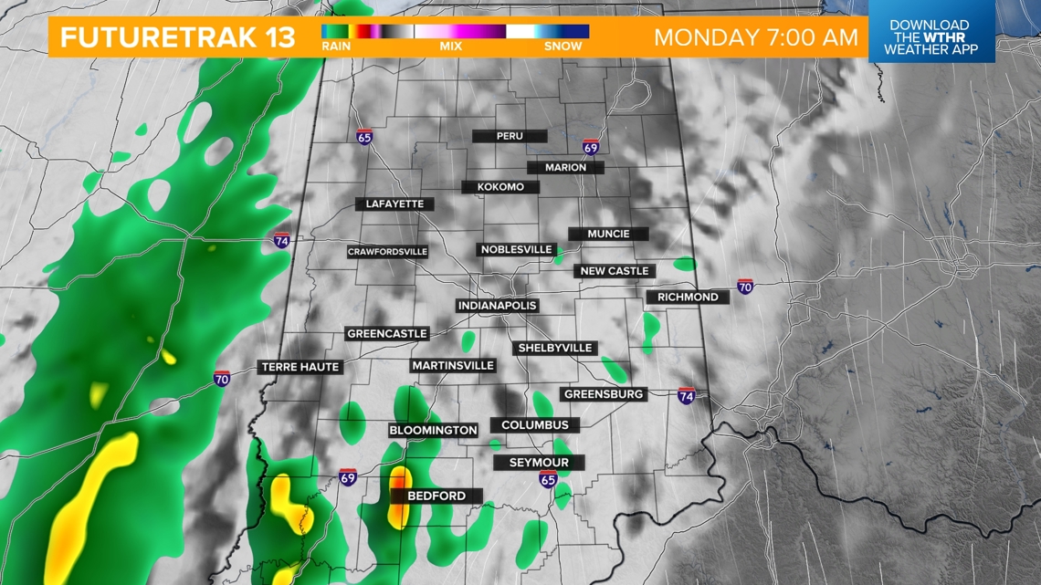
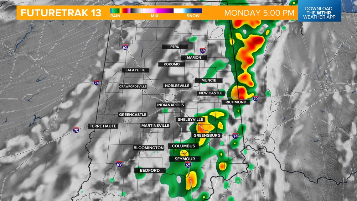
This front will prompt a round of storms mainly after 2 p.m. into the evening moving from west to east. Severe storms are not expected. Temperatures will still top out in the mid 70s despite the rain chances and increased clouds. While most of the rain exits by 8 p.m., the boundary will stall out just east of the area keeping a few stray showers around through early Tuesday across the far southeastern tier of the state.


TUESDAY:
Sunshine returns with highs in the mid 70s.
STAYING WARM NEXT WEEK:
Temperatures will climb well above average again with highs back in the low 80s for Wednesday and Thursday.

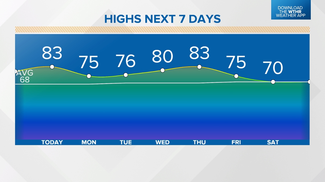
A stray shower or storm will be possible Wednesday as a weak wave moves through with a better chance of rain and storms Thursday night into Friday along a more impactful system. Slightly cooler in the mid 70s Friday. Rain looks to move out to start next weekend with more seasonal highs near 70.