
INDIANAPOLIS — The next weather system to impact central Indiana has brought clouds in already, and eventually stray showers during the first part of the day.
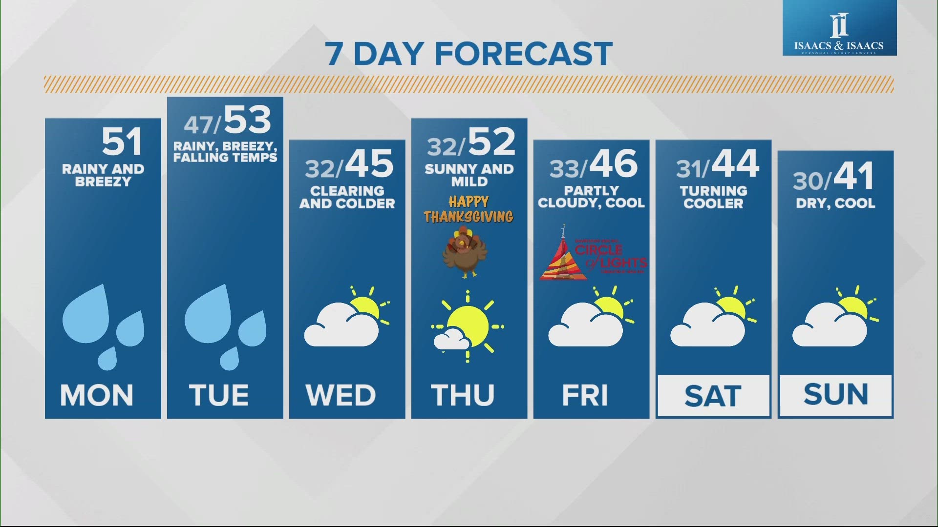
More widespread showers will then be possible during the afternoon, hindering high temperatures to the upper 40s/low 50s.


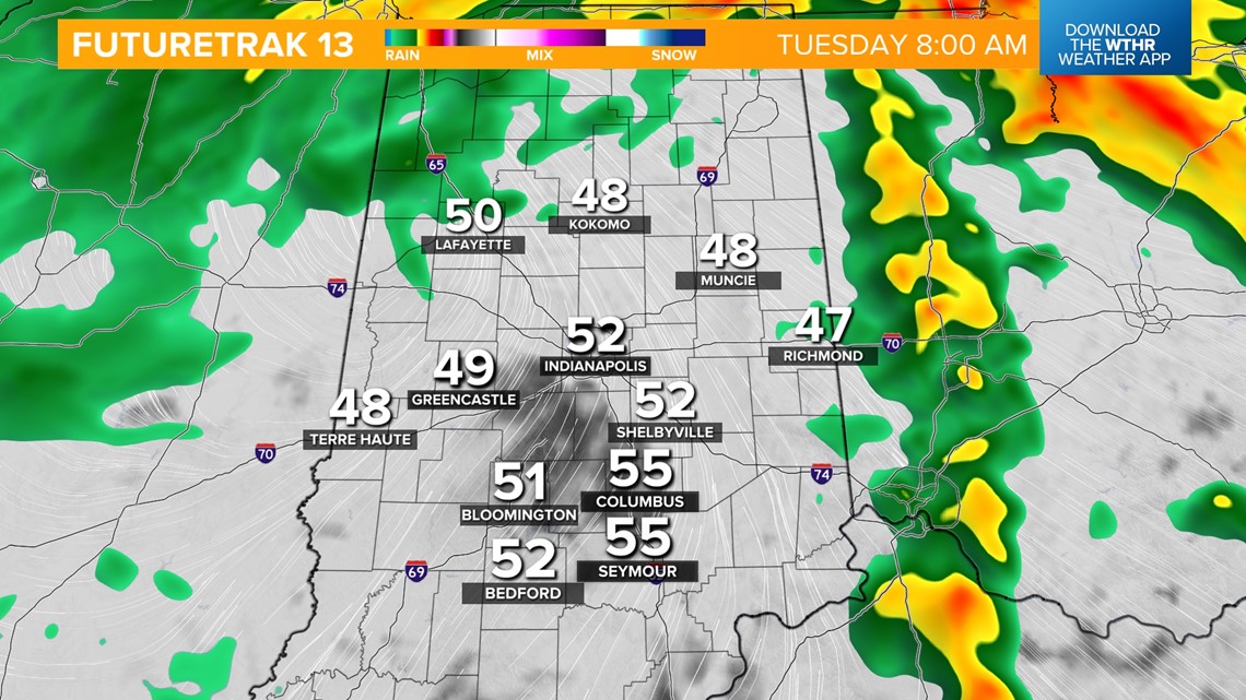
More widespread, heavy rain becomes likely after midnight, lasting through the early morning hours Tuesday. Temperatures hold steady in the upper 40s overnight.


The heaviest of the rainfall will stall north of the area after sunrise, but lingering scattered showers will be possible through the afternoon.
Central Indiana will briefly be in the "warm sector" of this storm system during the morning hours, allowing temperatures to recover to the low-to-mid-50s before falling through the 40s behind a cold front in the afternoon. This system departs Tuesday evening as a cold front sweeps through.
Rainfall potential from this system from start to finish will bring an estimated 0.75-1 inches total.


Temperatures fall behind this front for Wednesday with highs only in the mid-40s. Clouds will linger during the first part of the day before clearing in the late afternoon.
Thanksgiving Day looks fantastic this year with above-average highs in the low 50s under a sunny sky.


The forecast is looking good for Downtown Indy Inc.'s Circle of Lights presented by IBEW 481 slated to begin at 6 p.m. Friday. Look for partly cloudy skies and highs in the mid-40s Friday afternoon falling into the low 40s during the show.


A chilly snap takes over for next weekend with below average temperatures in the low-to-mid-40s. The forecast does look mainly dry though with partly cloudy skies for both Saturday and Sunday.

