

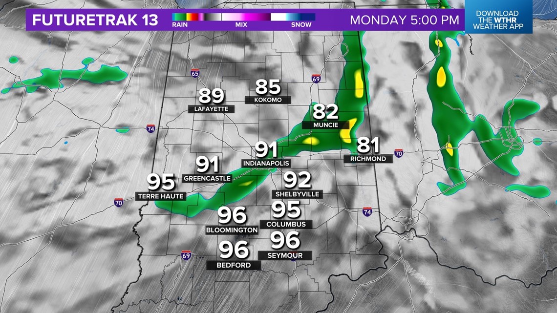
INDIANAPOLIS — Radar remains relatively quiet in central Indiana for now, but we're going to keep a slight chance of downpours/storms overnight with areas of fog developing by the morning commute.
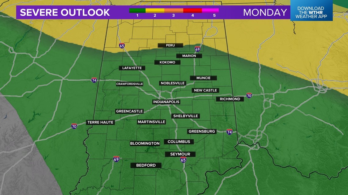
Please be Weather Aware Monday and check back with us for updates on the likelihood of a severe storm complex blasting through the Great Lakes... possibly impacting parts of central Indiana. It should be noted there remains a high level of uncertainty on timing/track of this feature, but destructive wind will be possible in its path.
We're now in the "air you can wear" with an air mass of dewpoints of 70°+ and the Muggy Meter remains oppressive until much later this week.
This miserably muggy air will be here until our next cool front passes through early Friday morning. Between now and then, we're going to be sweating through the hottest air we've experienced since the brutal summer of 2012.

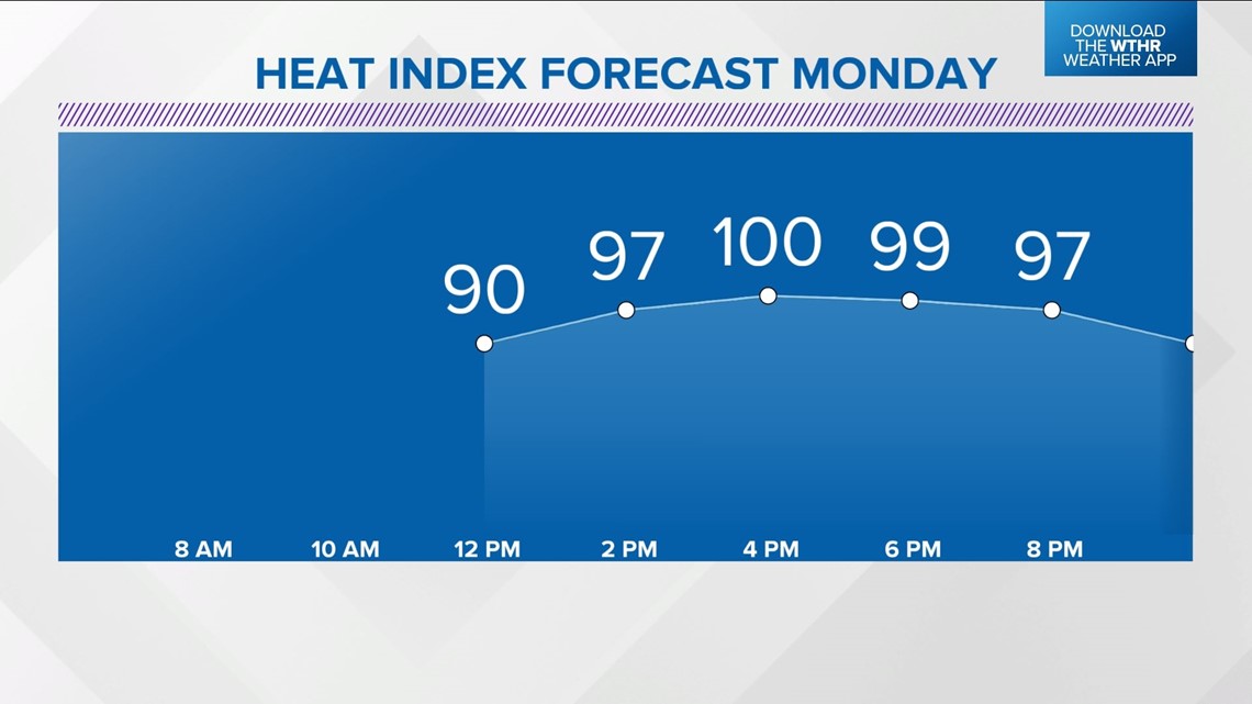
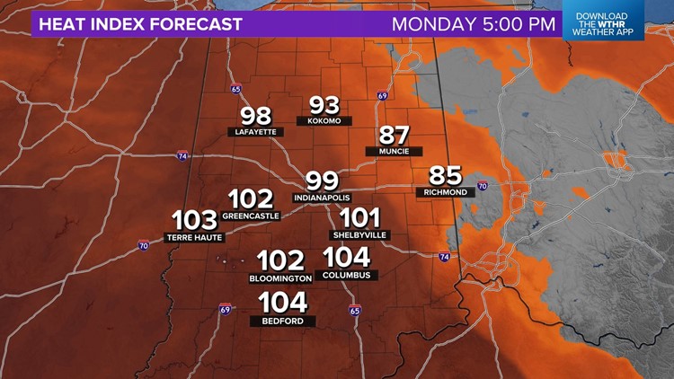
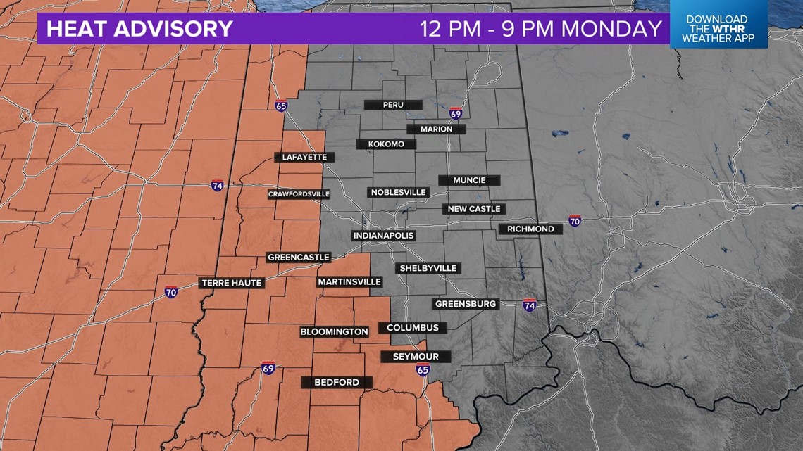
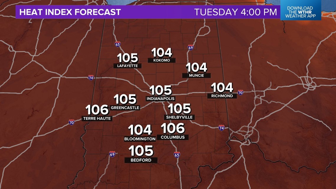
Parts of the WTHR viewing area are in a Heat Advisory on Monday with the expectation of heat indices of 105°+ being most probable west of I-65.
This is an area where there should be fewer impacts of cloud debris/remnant rain from potential heavy storms.

With that said, it's still going to be miserably muggy and dangerously hot around Indy, with heat indices of 100° during the afternoon.


All of central Indiana is at risk for severe storms, but there remains high uncertainty on where an expected heavy storm cluster will develop/track.
There will be a fine line Monday on where the potentially destructive wind will occur with this modeled heavy storm cluster to little/if any rain to its south-southwest.
It's too close to call for Indy right now, and we can't rule out heavy storms at times Monday.


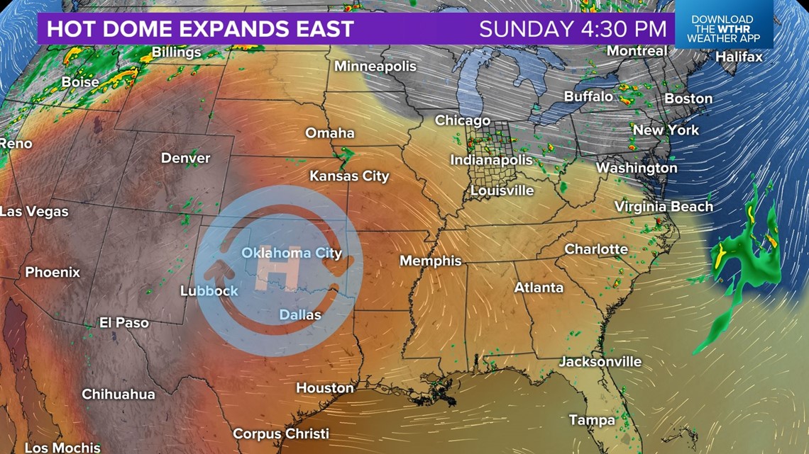
That storm cluster(s) will be erupting on the edge of the "hot dome" that's currently centered to our west-southwest in a similar fashion to steam emerging around the lid on a pot of boiling water.

The "lid" of hot air with the upper-level ridge will be more centered over the Ohio Valley on Tuesday and Wednesday.

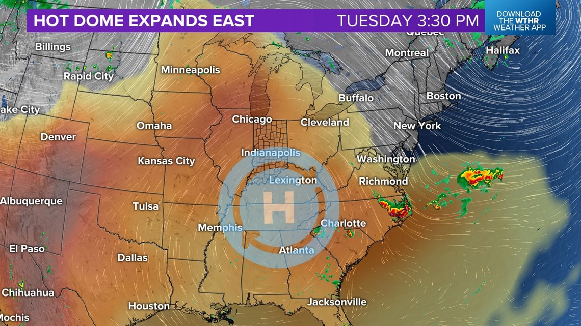
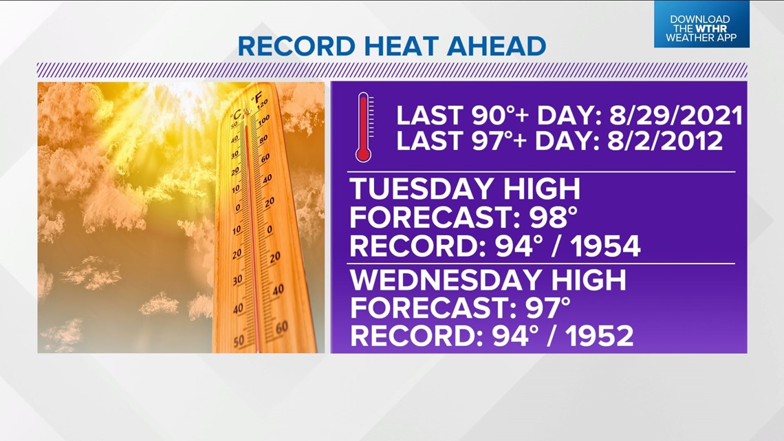
This will result in our hottest high/heat indices in 10 years. And, daily record highs are expected on both days.

Little if any storms are expected, but the juicy air would produce very heavy rain rates for any cells that could break through the lid.

Thursday is forecast to remain dangerously hot and humid with near-record highs in the mid/upper 90s and heat indices of 100°+.

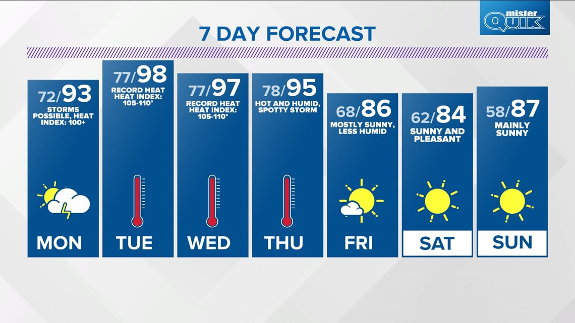
Between now and Friday morning (when less humid air returns) it's wise to limit your outdoor time. Take frequent hydration breaks if outdoors, seek shade, and spend time in A/C. Expect Heat Advisories and/or Excessive Warnings into Thursday afternoon.
Long-range guidance suggests a pleasant air mass returns for next weekend with plenty of sunshine.
