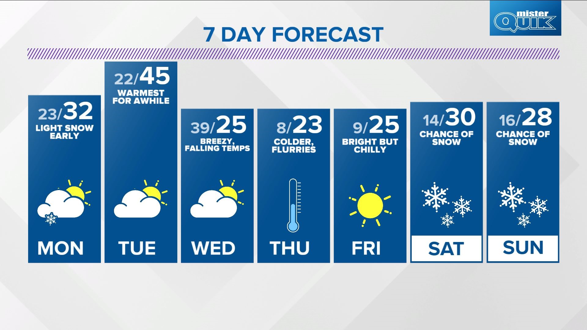
INDIANAPOLIS — A winter storm took an expected "curve" around central Indiana this weekend with the closest snow from its precipitation reaching far southeastern Indiana. Winter Weather Advisories and Winter Storm Warnings stretch nearly 1,400 miles from north Georgia to New England.
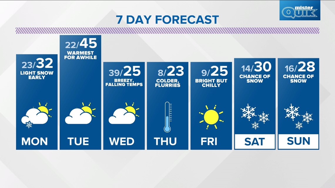
We missed out on heavy snow from that storm. However, we're in the path of an approaching disturbance from the northwest that brings another round of light but impactful snowfall.

Snow amounts will be light (especially compared to what's occurring east-southeast), from a dusting to under an inch, but it falls into temperatures well below freezing.

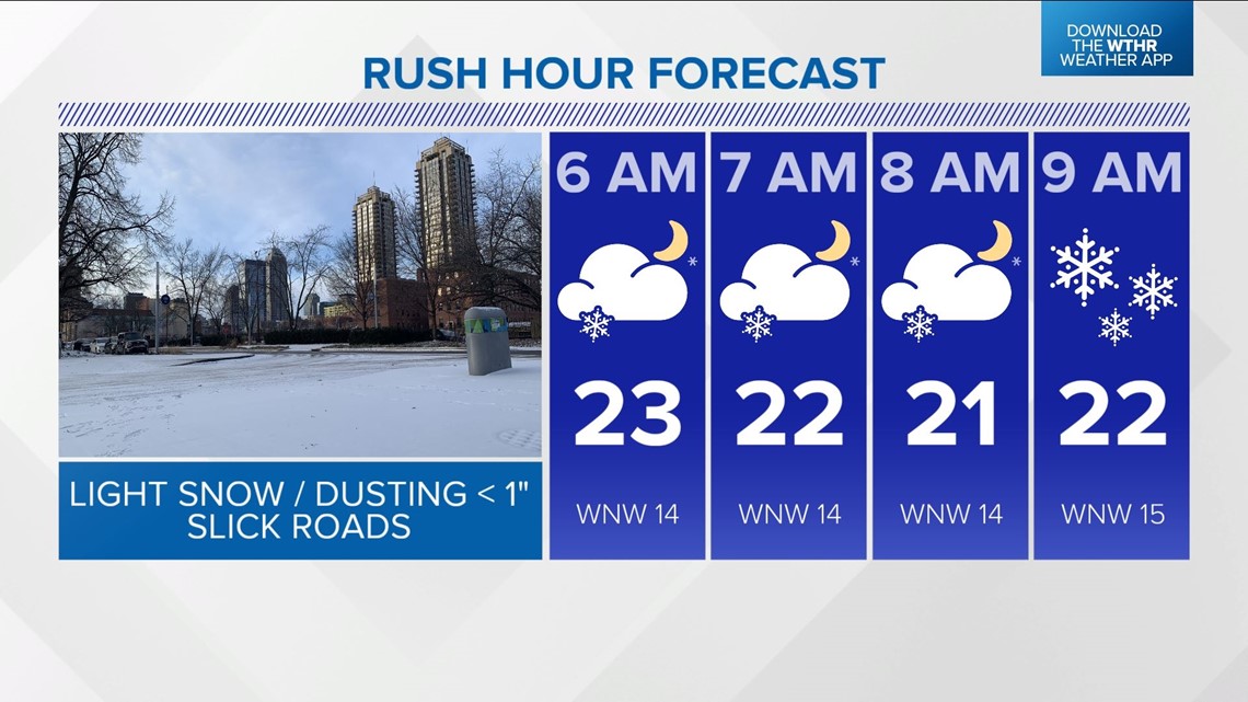
Untreated surfaces will become slick where the snow occurs and it could impact the Monday morning commute for some. Plan on extra time Monday morning to travel and check with Chuck on WTHR Sunrise beginning at 4 a.m. for radar updates.
A dusting of less than an inch is all that's expected, but that's also all it took Saturday morning to make the roads slick. This will be similar, but likely be more widespread.

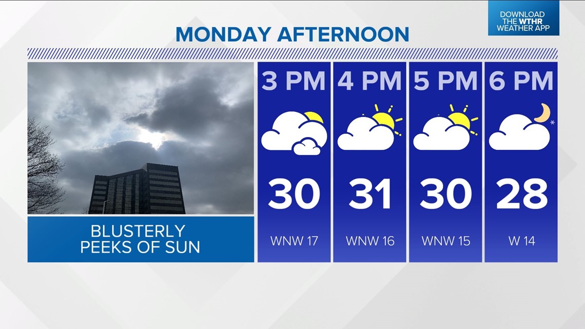
Snow diminishes Monday afternoon with late-day sun possible. We're still forecasting 40s for Tuesday and near 40° Tuesday night -- likely our warmest air for a while. The passage of a cold front Wednesday ushers in much colder air and possibly single-digit lows Thursday/Friday mornings.