

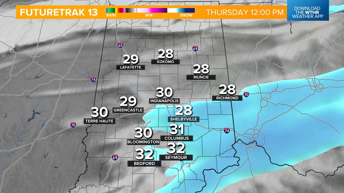
INDIANAPOLIS — For today, a weak wave has stalled across the state. While most accumulating snow associated with this disturbance stays north, we could see a few light snow showers through the morning and up to a dusting possible. Temperatures hold steady in the mid-20s through the morning. Skies stay mainly cloudy this afternoon with temperatures covering to near 30.

Wave two of this system arrives tonight and brings a better chance of more widespread accumulating snow. A Winter Weather Advisory will be in effect from 9 p.m. today through 10 a.m. Friday for the northern half of the state.

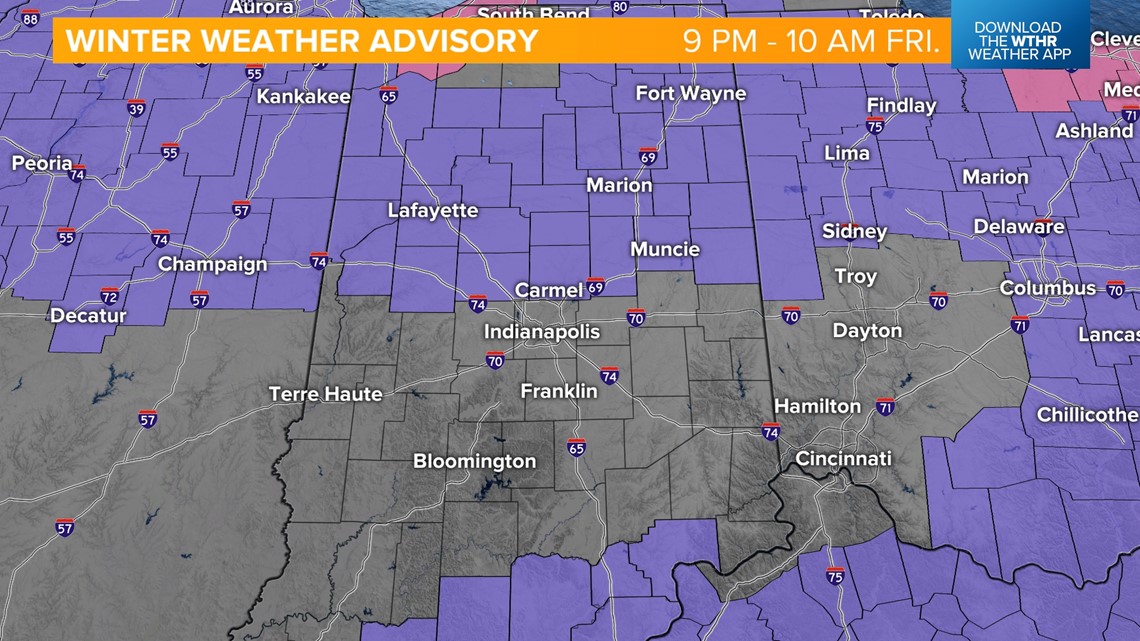
Scattered snow returns mainly after 9 p.m. and will then become widespread overnight, eventually tapering off during the Friday morning commute.


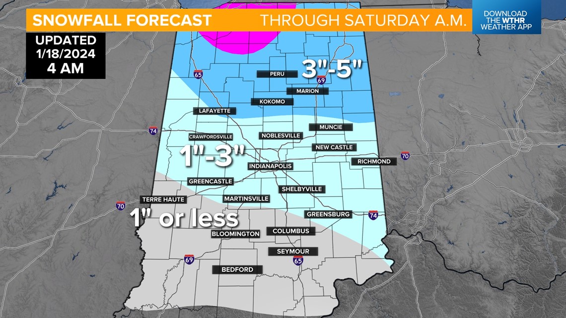
A lingering snow shower will then be possible Friday afternoon, especially to areas north, while we see cloudy skies elsewhere across the state. By the time snow comes to an end, snow totals between both waves will be near 3-5" across the northern half of the state including the advisory zone, 1-3" along the I-70 corridor including the Indy metro area, and up to 1" to areas south and west. Cold air returns as temperatures drop back into the teens through the day Friday.


Bitter air lingers through the start of next weekend with morning wind chills dropping to -15 to -10 and highs in the teens Saturday. Skies will be partly cloudy. It will be slightly less cold with highs in the mid-20s Sunday under a mainly sunny sky.
Temperatures finally look to get back above freezing by next Monday with forecast highs in the upper 30s. Temperatures will trend above average with highs mainly in the 40s next week, but with a more active pattern bringing several rain chances through mid-week.


