
INDIANAPOLIS — A much colder air mass has taken over central Indiana, bringing gusty winds, scattered rain and unseasonably chilly air.


TODAY'S TEMPERATURES: Steady in the upper 30s/low 40s, but feeling colder with 35 mph wind gusts through the day.
RAIN TIMELINE: Spotty rain will become more widespread after 1 p.m. Then, scattered showers will be likely through the day. Thunder will be possible in heavier rain showers.


You'll want to be rain-gear ready if you have tickets to the Indians 6:35 p.m. first pitch. Wear something warm as well, with temperatures dropping into the 30s.


OVERNIGHT: Mixed showers with snow, graupel and rain. Lows will be in the low 30s, with wind chill values falling into the 20s.


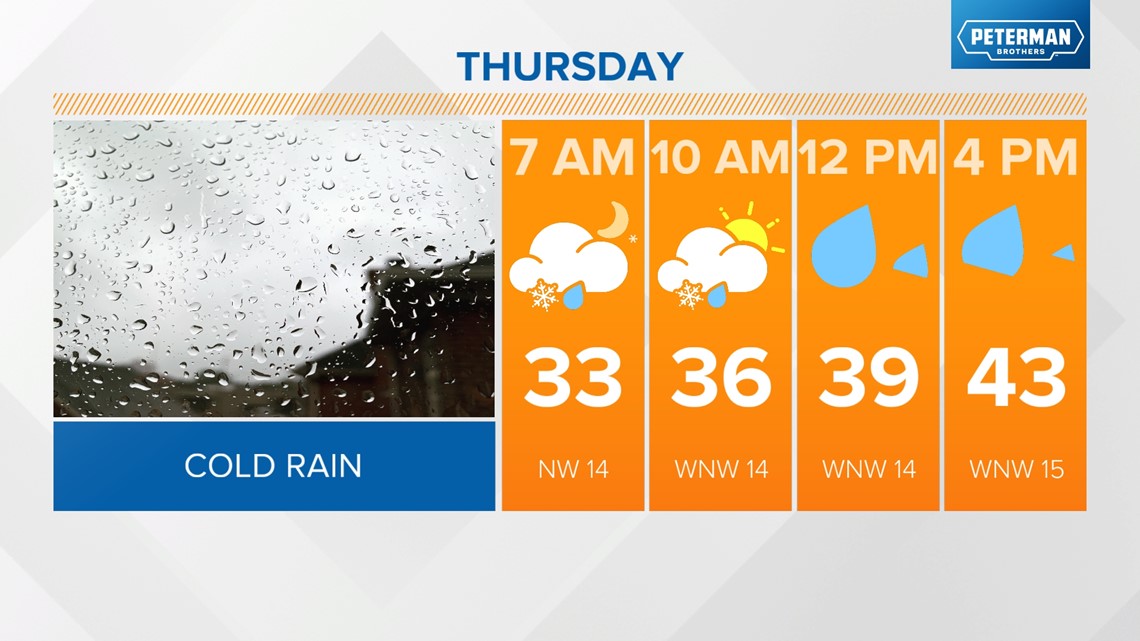
THURSDAY: Wintry mix early, with scattered rain showers likely in the afternoon. Breezy with highs in the low 40s.


FRIDAY: High pressure begins to build in. Starting cloudy with freezing temperatures with a slight clearing in the afternoon. Still unseasonably cold, with highs in the mid-40s.


THE WEEKEND: High pressure wins out on Saturday, bringing back sunny skies and a slight warming trend. Highs in the mid-50s. A weak wave could bring some showers in late Sunday but should exit by Monday morning.
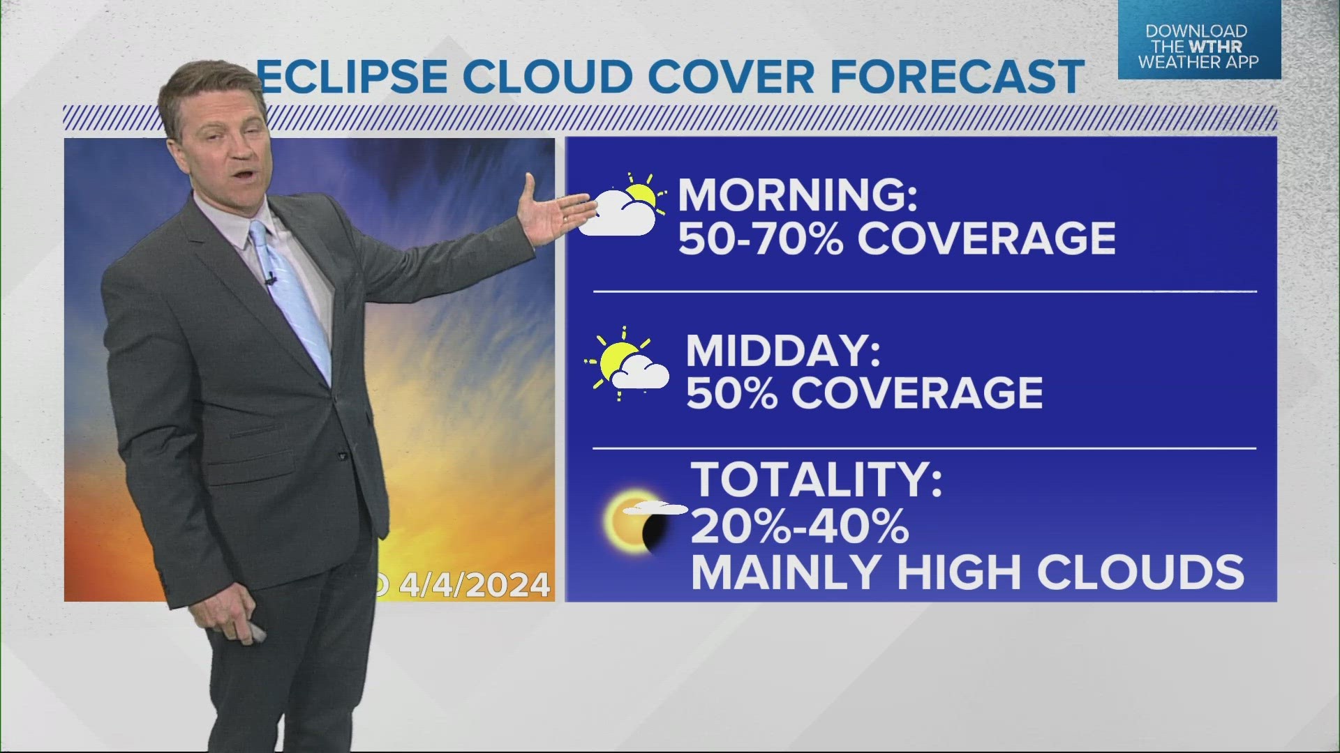
ECLIPSE OUTLOOK: It's still an early look as we watch Sunday night's system, but it's looking like we'll see partial sun beginning in the late morning. It will be much warmer, with highs nearing 70.

