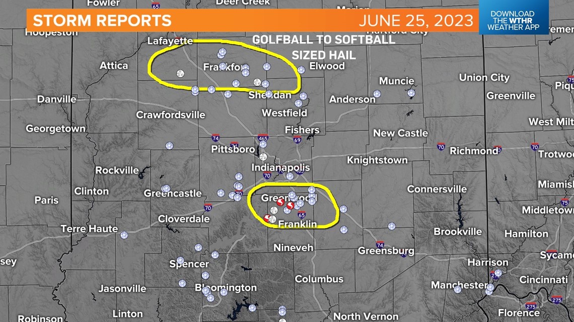
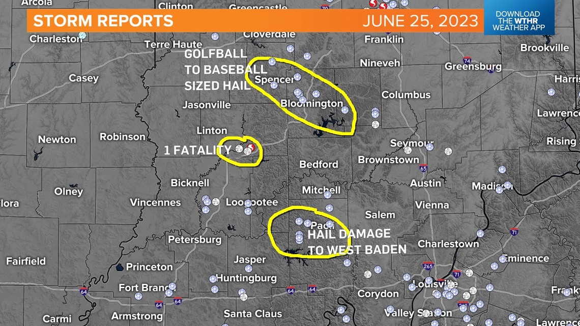
INDIANAPOLIS — Multiple NWS Indianapolis storm survey teams continue to assess damage from the multiple long-track supercells that crossed central and southern Indiana. In their path were several streaks of very large hail and at least two tornadoes.
One of those was the well-captured tornado in Johnson County and the other was near the Martin/Dubois county line. The latter sadly claimed one life.


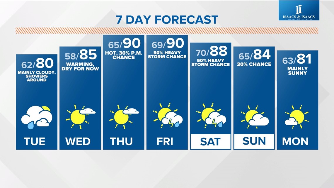
A much quieter weather set-up today in central Indiana as we're on the backside of the departing storm system.
It's the cooler and less humid side too with highs near 80° and dewpoints near 60° versus the miserable Muggy Meter of Sunday.
We're still expecting an increase of quick-moving showers and possibly some thunderstorms too, the latter of which could produce small hail.
Any showers diminish overnight after the atmosphere stabilizes. Clouds linger into midday Tuesday, and possibly some stray showers, before a brightening a sky.
Model guidance shows the likelihood of hotter air and increasing odds of heavy storm clusters emerging later this week with central Indiana possibly being in the path of "ridge runners" that bubble-up on the edge on another brutal hot dome in the southern U.S.
This is similar to the steam that escapes a lidded pot of boiling water on the stove.
We'll narrow down rain odds, amounts, locations, etc later in the week when our confidence grows on where the best track will be.