

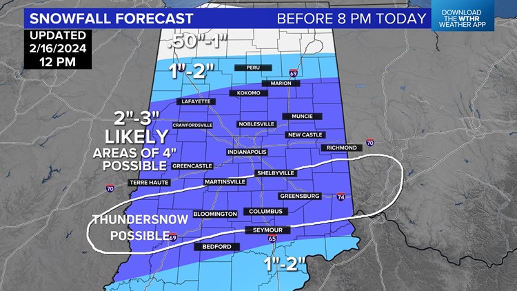
INDIANAPOLIS — A snowy Friday is in progress, and snow falls heavily at times between now and 6 p.m. During that time, snow rates of .50" to locally 1" per hour are possible in heavier bands that are evident on radar now (near/north of I-70) and in modeling farther south of I-70 later this afternoon.
The secondary band that's expected to develop in south-central Indiana within a zone of increased atmospheric lift could potentially have some thunder embedded. If that does materialize, it will be associated with 1.5"-2" per hour snow rates.


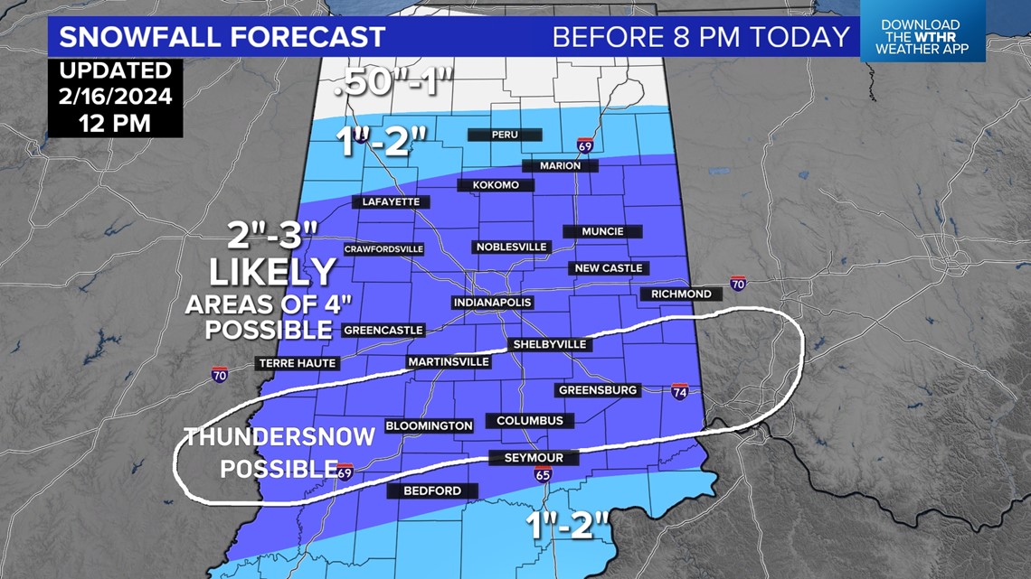
It should be noted that outside of heavier snowfall areas/times, roads will mainly be wet. But within heavier bands, road conditions will deteriorate rapidly and become slick/dangerous quickly. Use caution if traveling today, and know that slow travel is likely within those heavier bands.
We're expecting a widespread 2"-3" accumulation with areas of 4"+ possible, especially where any thundersnow occurs. Snow tapers from north-to-south between 5 p.m. and 9 p.m.

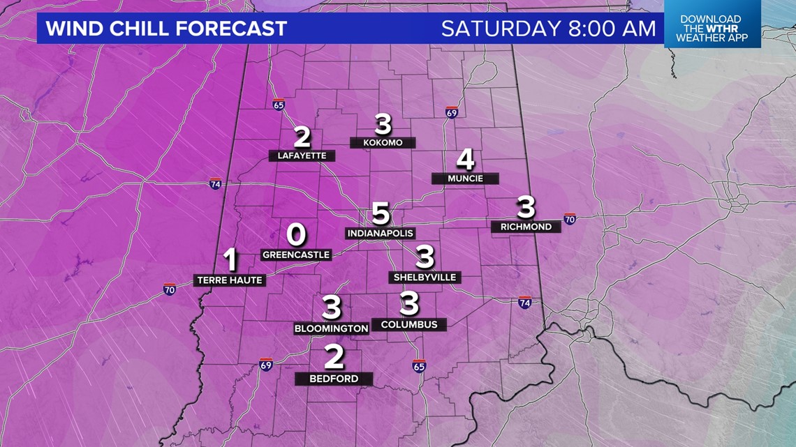

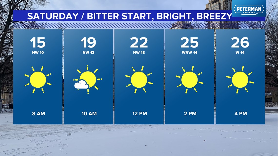
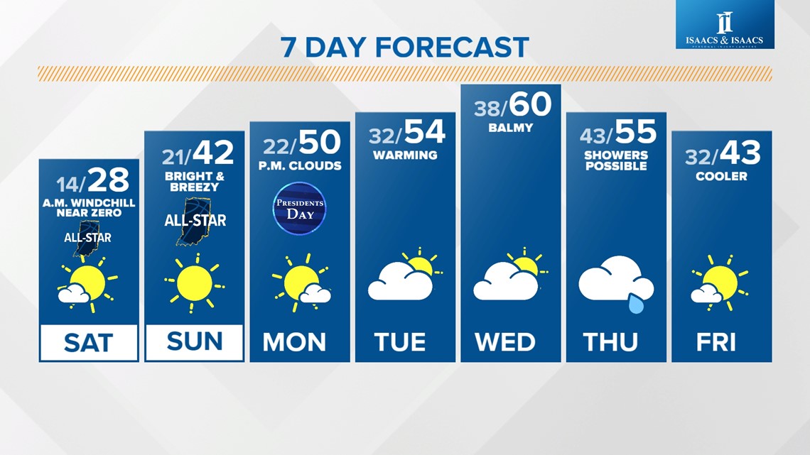
Clouds clear overnight and sets the stage for a bitter open to Saturday with windchills near zero several hours in the morning. All-Star Weekend will be sunny, and we'll need every bit of it on Saturday just to get "highs" back in the upper 20s.
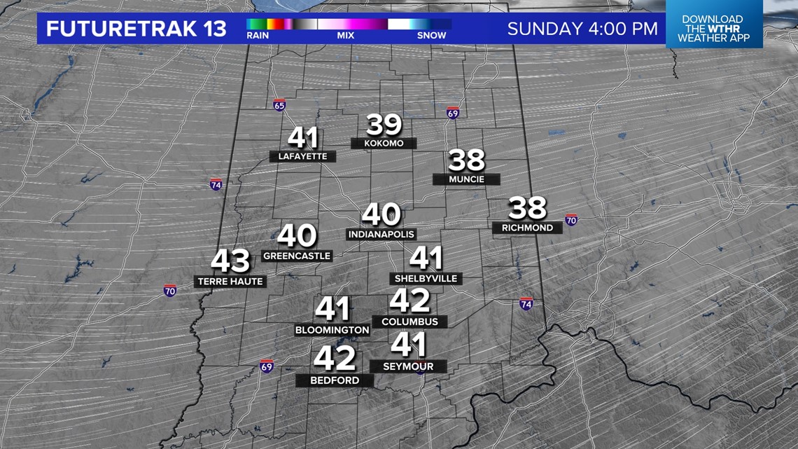
The breeze ramps up Saturday night into Sunday to deliver "warmer" highs in the lower 40s to finish the weekend.
We're still on target for another round of unseasonably mild highs next week that peak near 60 on Wednesday.


RELATED: Winter driving safety: 5 Fast Facts
RELATED: Dog winter safety: VERIFY Fact Sheet
