INDIANAPOLIS — It is going to be an active week of weather for central Indiana.
We had record-breaking warmth on Monday and rain and snow chances by Wednesday morning. This big swing is due to a strong storm system that will also bring the threat of severe storms on Tuesday.
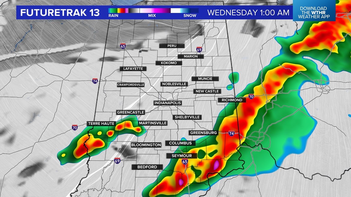
There is a chance a cluster of storms develops after midnight, so we will include a few storms from midnight to 4 a.m. Tuesday.
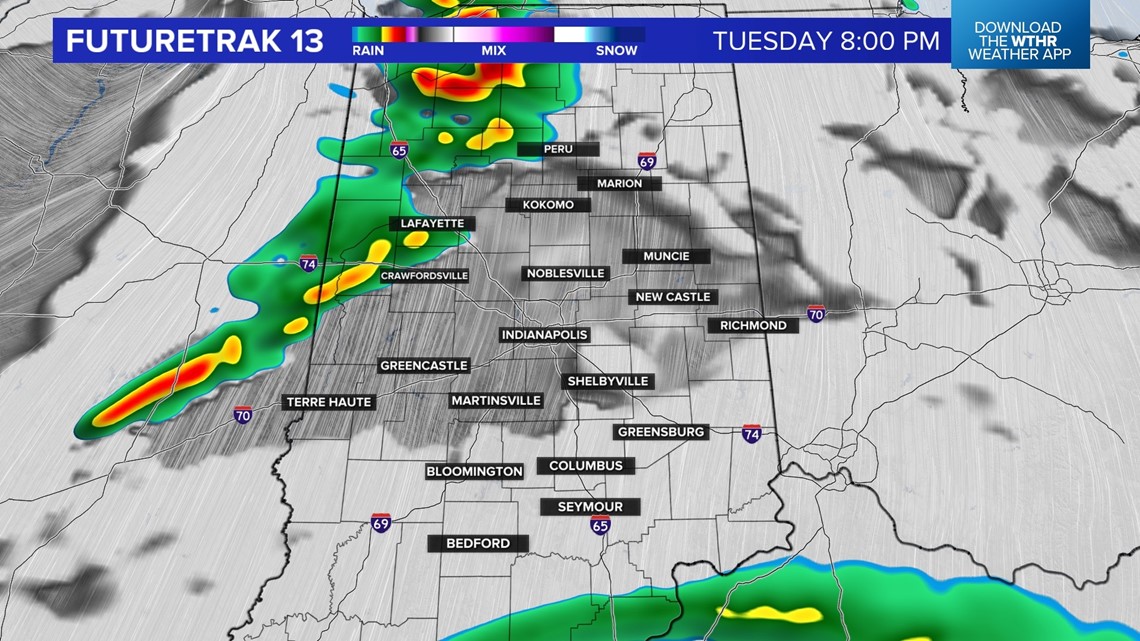
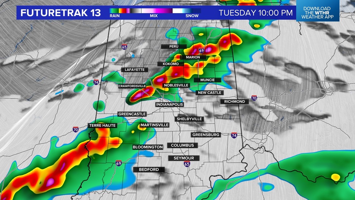
There will be lots of dry time on Tuesday, with highs near 70, but also that threat of severe storms. We will be watching Live Doppler 13 Radar all day and keeping you weather aware.

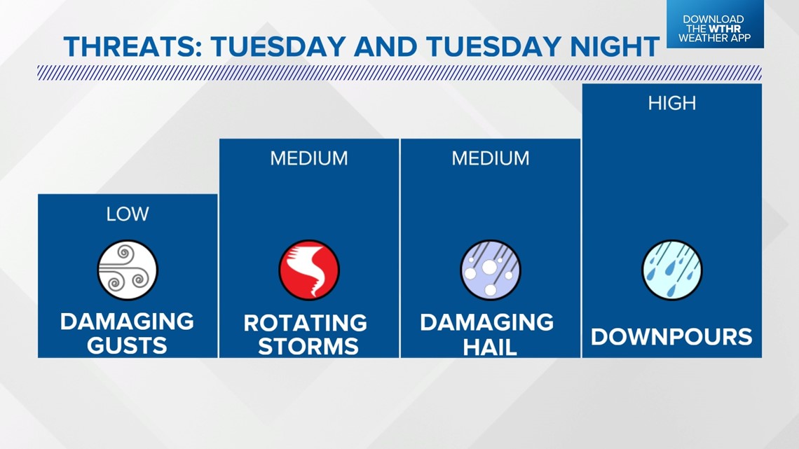
One weather feature that would increase the severe threat, including tornadoes, is a warm front. If that front is over central Indiana, that threat is higher locally. If the front is farther north, that higher threat also moves north.
We are more confident in the timing of the cold front. That timeline is Tuesday evening through early Wednesday morning. There will be a line of rain and storms along the front and some storms may reach severe limits. Tuesday is a day to stay weather aware and check back with the 13 Weather Team for updates.


Much colder air arrives behind that front and highs will only be in the 30s on Wednesday. It will stay cool through Friday. Forecast highs are in the 40s on Thursday and Friday. A sunny sky is expected on Thursday, but a few rain and snow showers are possible on Friday.