


On this date 5 years ago southern Indiana was within a rare High Risk for severe weather. Unfortunately the forecast of long-track violent tornadoes verified during the afternoon hours of March 2nd, 2012.

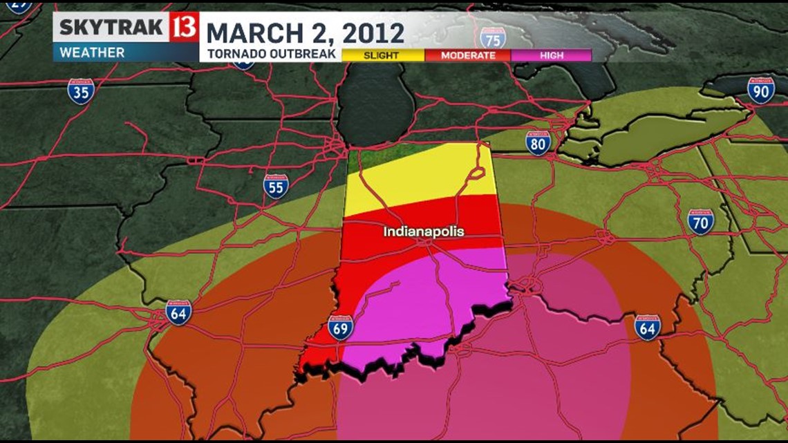

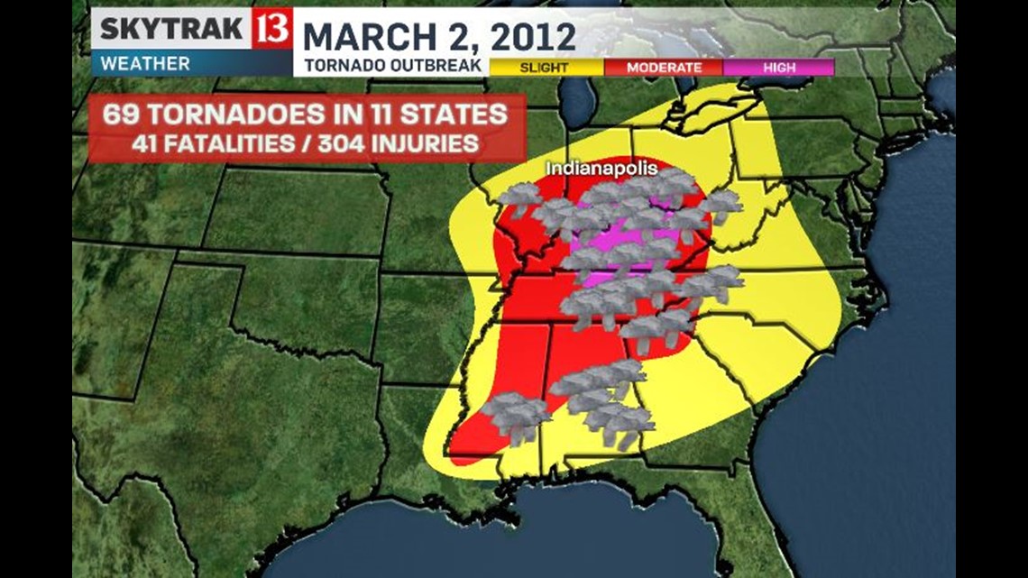
In all there were 69 tornadoes in 11 states that claimed 41 lives and injured another 300. Please take some time now to remember those lost that day before reading further.

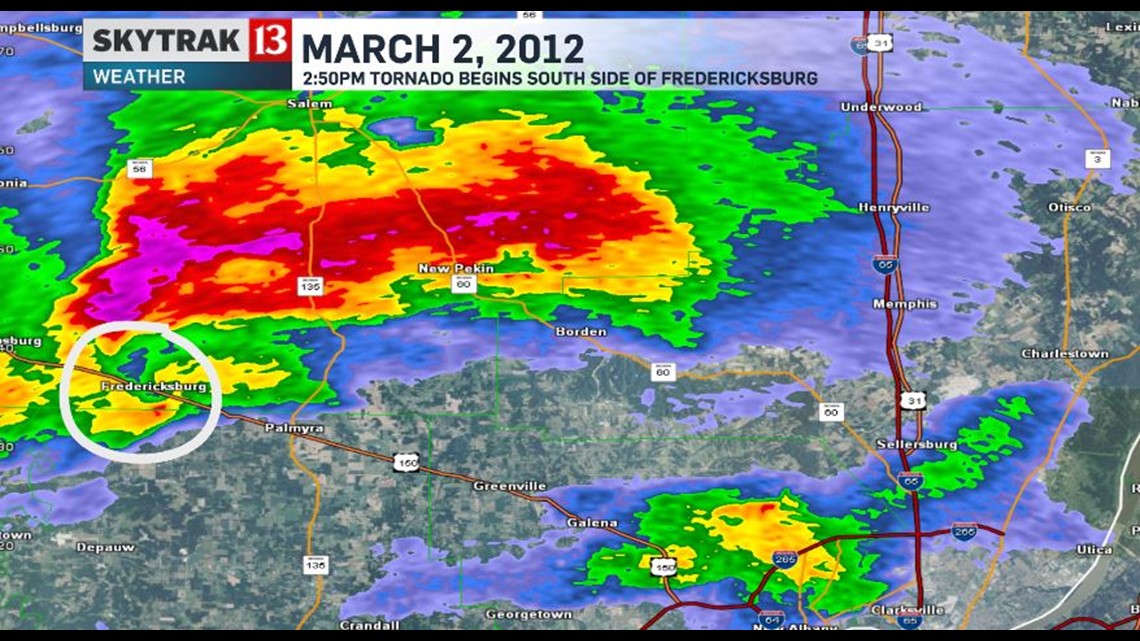
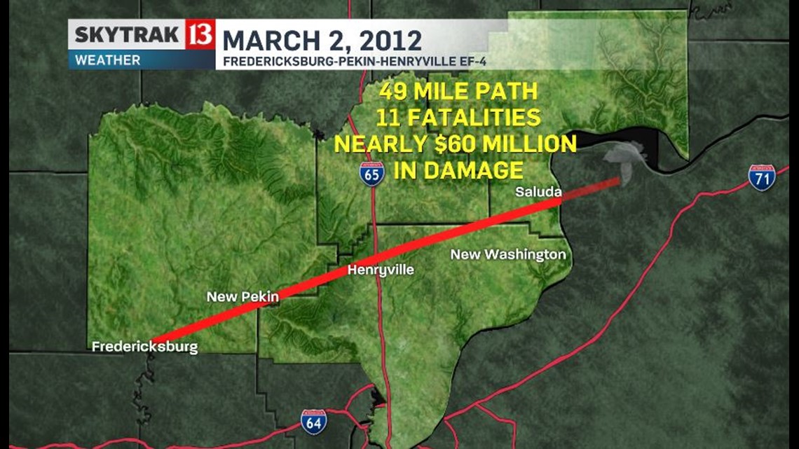
At 2:50pm a supercell thunderstorm spawned a tornado just south of Fredericksburg in Washington County, Indiana which is 122 miles south of Indianapolis.

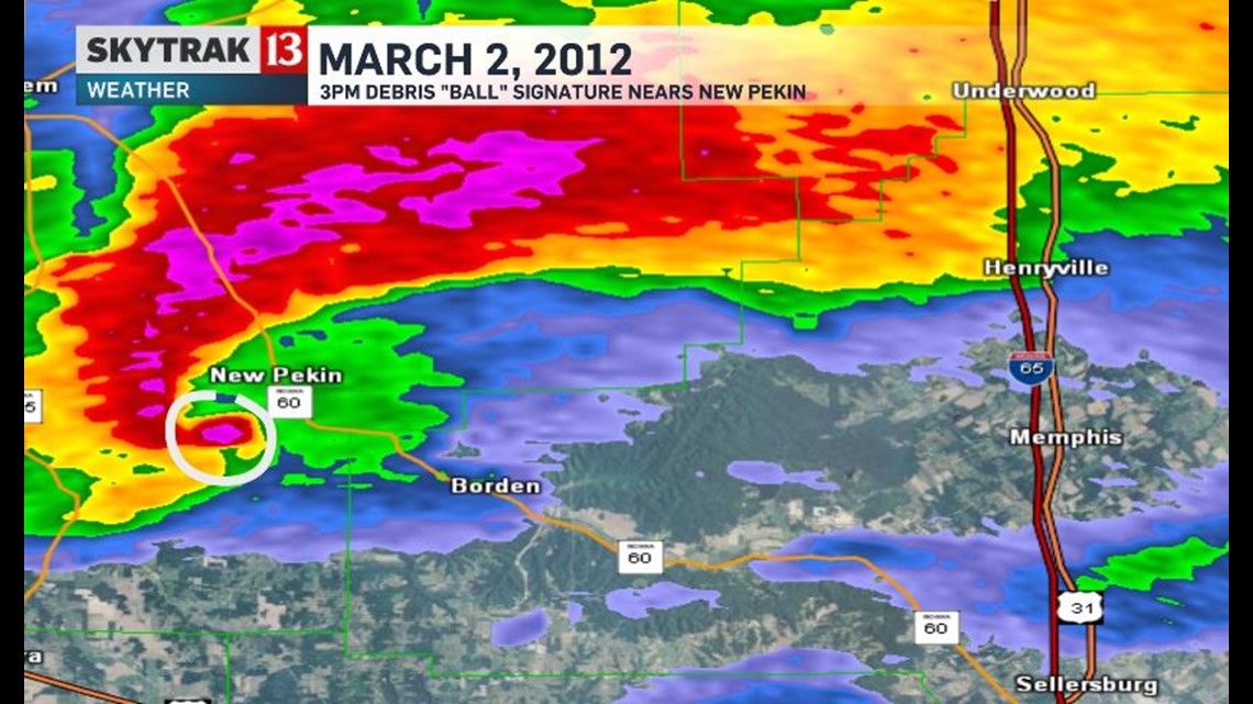
Just 10 minutes later the tornado was now very evident on radar reflectivity by what's called a "debris ball"....which essentially is pieces of homes, trees, and other non-meteorological objects wrapping around the tornado's circulation in the shape of a ball. These radar signatures are typically reserved for more violent tornadoes and that was the case this day as wind speeds reached 170mph as hit just south of New Pekin. Sadly it killed 5 people in a mobile home as it grew to nearly a half-mile wide.

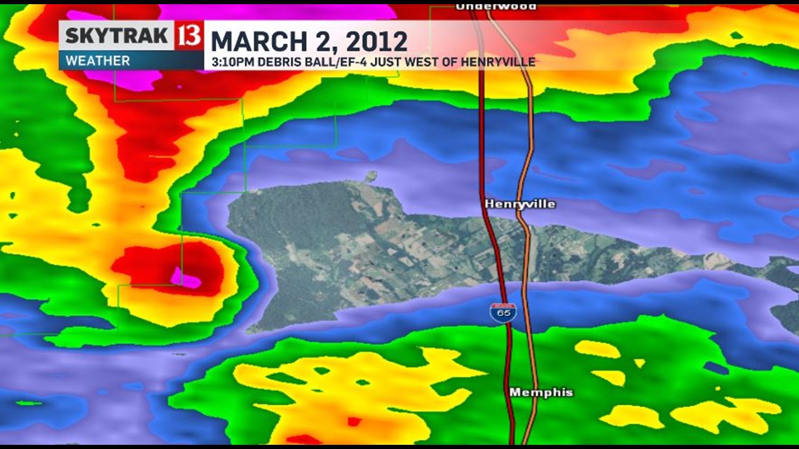
At 3:10pm the debris signature was just west of the town of Henryville and about to cross I-65.

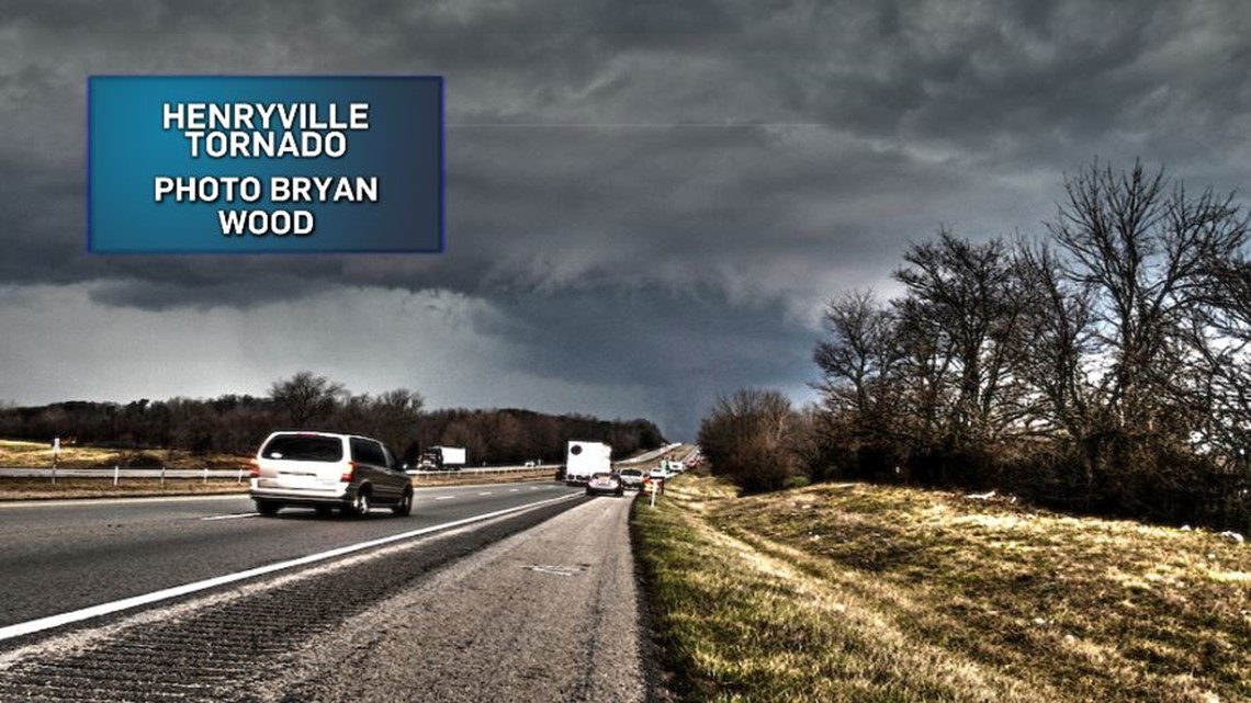
Meteorologist Bryan Wood captured this shot of the EF-4 tornado crossing I-65. He was two miles south on I-65 and Bryan tweeted earlier today the impact that day had on his meteorological career.
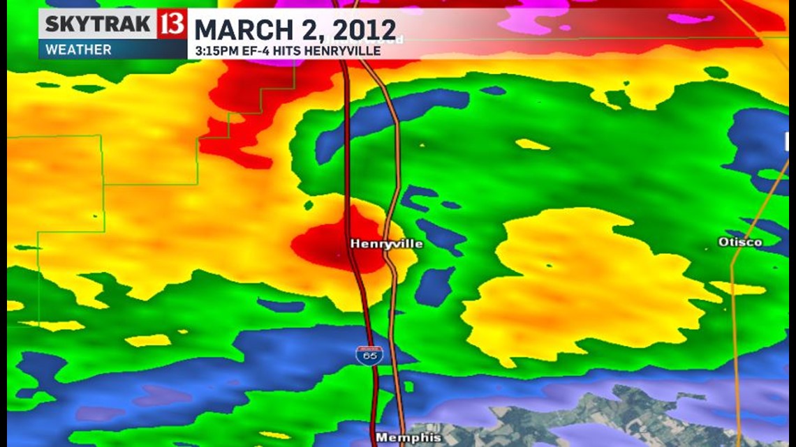
The radar image below is at roughly the same time Bryan snapped his picture and when the tornado was impacted Henryville.

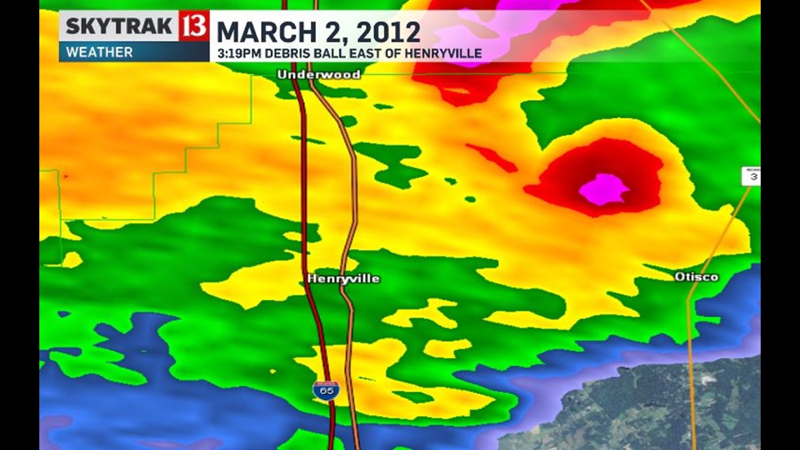
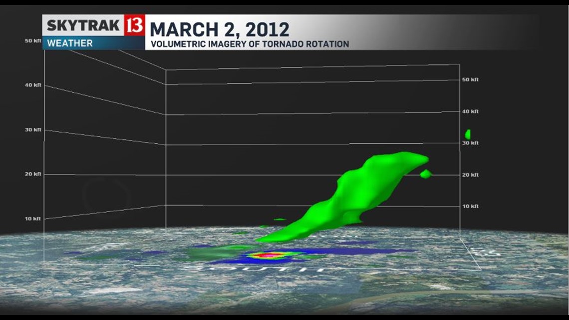
Wind speeds peaked at 175mph just east of I-65 and the radar from 3:19pm shows another large debris ball signature.

Volumetric imagery of the tornado's at this time shows a deep rotation up to 20-30,000 feet with an intense mesocyclone.

It would continue into Jefferson County, Indiana before eventually crossing the Ohio River into Northern Kentucky where it finally dissipated near Bedford, KY. Remarkably a second tornadic supercell dropped softball sized hail on many areas devastated by the prior storm and also produced an EF-1 tornado between 3:30pm and 3:36pm near Henryville.


In all...the lead supercell tornado was on the ground for 49 minutes, covering nearly 50 miles, claimed 11 lives, and did nearly $60 million in damage.

http://www.weather.gov/images/lmk/past_events/mar2_2012/KLVX_SRM_Loop_02Mar2012.png


It's one of only 33 EF-4 tornadoes since 1956 and the last to occur pending damage surveys in southern Indiana from the recent February 28-March 1 event. A day that will never be forgotten - Sean Ash
Also please visit the NWS Louisville's page for more great analysis, information, and pictures of the southern Indiana/northern Kentucky impacts here: http://www.weather.gov/lmk/03022012_EF4.htm
