INDIANAPOLIS — Just a few days after a tornado outbreak that included at least four powerful EF-3 tornadoes in Indiana, the risk of severe storms – including tornadoes – has returned Wednesday.
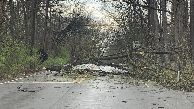
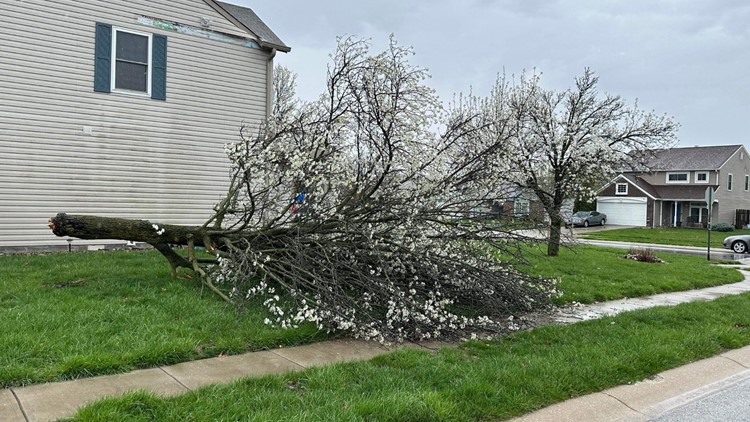
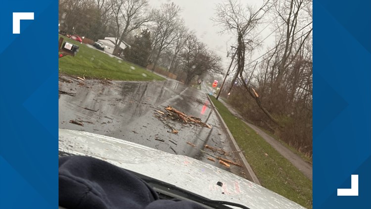
PHOTOS: Severe storm coverage on Wednesday, April 5, 2023


Track the latest updates in our storm blog:
Wednesday, April 5, 2023
6 p.m. - The National Weather Service confirmed Wednesday evening an EF0 tornado touched down just before noon near New Ross, Indiana in eastern Montgomery County. The 20-yard-wide tornado traveled a quarter-mile.
3:32 p.m - Tornado watches remain in Wayne and Fayette counties, but canceled everywhere else in Indiana.
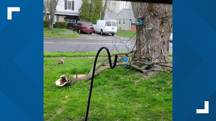
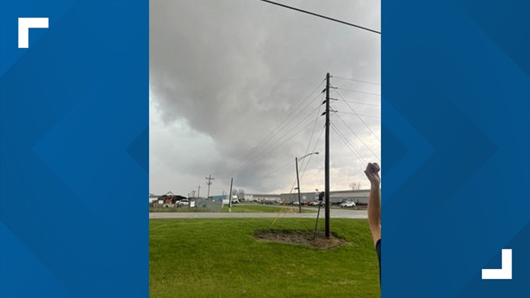
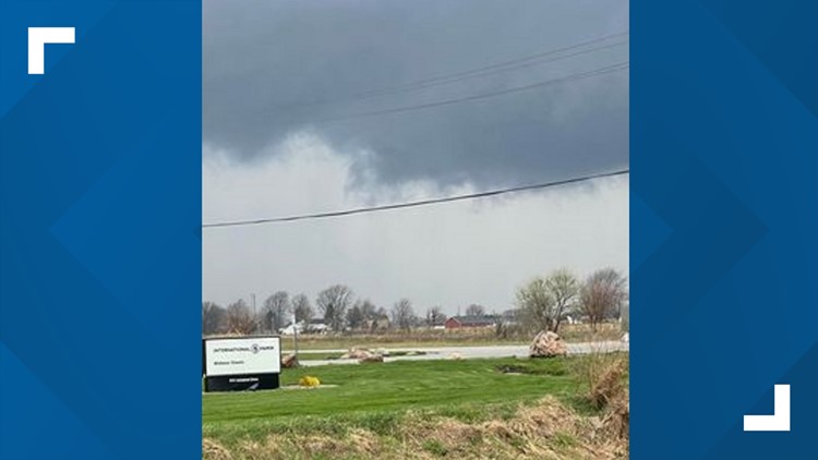
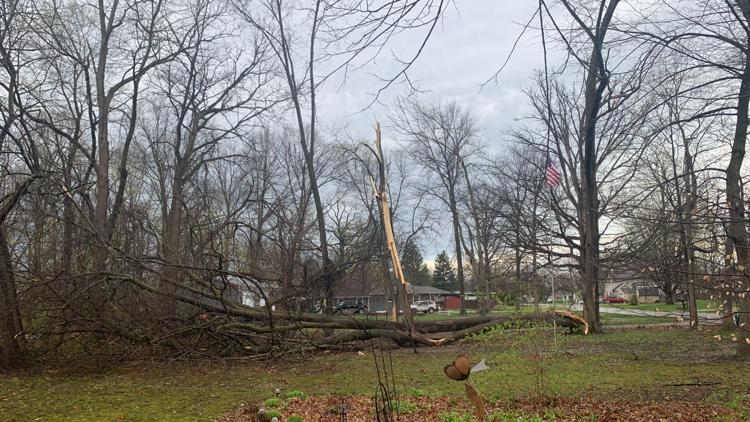
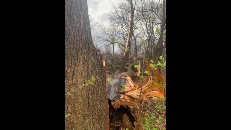
2:35 p.m. - AES shares images of storm damage in Indiana
2:34 p.m. - AES is reporting 2,145 customers without power. Duke Energy reports 1,259 customers without power.
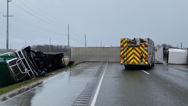
2 p.m. - Two of the three northbound lanes of I-65 are now open. The far right lane will continue to be closed until further notice.
1:52 p.m. - A Tornado Watch remains in effect until 5 p.m. for Bartholomew, Brown, Decatur, Fayette, Henry, Lawrence, Randolph, Rush, Shelby & Wayne counties.
There's no longer a Tornado Watch in central Indiana counties including Boone, Hamilton, Hancock, Hendricks, Johnson, Marion, Morgan Putnam and Shelby counties.
1:32 p.m. - The Tornado Warnings in Blackford and Wells counties have expired.
A Severe Thunderstorm Warning is in effect in Blackford and Grant counties until 1:45 p.m.
A Tornado Watch remains in effect through most of central Indiana until 5 p.m.
1:10 p.m. - A Tornado Warning has been issued for Blackford and Wells counties in northeastern Indiana until 1:30 p.m. A severe thunderstorm capable of producing a tornado was located near Hartford City, moving northeast at 50 mph.
1:02 p.m. - 13News meteorologist Sean Ash shares the latest update on the severe storm projections.
1 p.m. - A Severe Thunderstorm Warning has been issued until 1:45 p.m. for Blackford and Grant counties.
12:56 p.m. - A Severe Thunderstorm Warning is in effect until 1 p.m. in Delaware, Hamilton, Madison and Tipton counties.
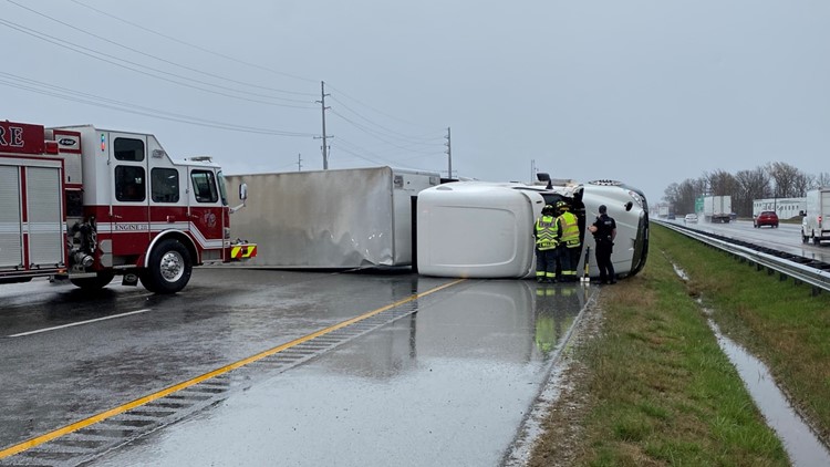
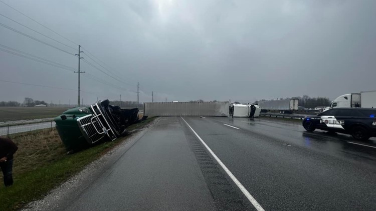
12:50 p.m. - All lanes of I-65 north in Lebanon are closed due to two overturned semis.
12:48 p.m. - 13News meteorologist Sean Ash said there are a couple of areas of rotation in Grant County.
12:40 p.m. - 13News anchor/reporter Karen Campbell is in Avon for the storm coverage.
12:37 p.m. - A Severe Thunderstorm Warning remains in effect until 1 p.m. in Delaware, Hamilton, Howard, Madison and Tipton counties.
12:25 p.m. - The Tornado Warning has ended in Boone County.
A Severe Thunderstorm Warning remains in effect until 1 p.m. in Boone, Delaware, Hamilton Howard, Madison and Tipton counties.
12:17 p.m. - Clinton County is no longer under a Severe Thunderstorm Warning.
12:15 p.m. - High winds damaged a chimney at a home on Creekshore Lane, near West 62nd Street and Michigan Road, on the north side of Indianapolis.


12:05 p.m. - A Tornado Warning is in effect until 12:15 p.m. in Boone County.
The following counties are under a Severe Thunderstorm Warning until 12:30 p.m.: Boone, Clinton, Hamilton, Hendricks, Howard, Marion and Tipton.
11:55 a.m. - A Tornado Warning has been issued for southeastern Montgomery County. The National Weather Service said a severe thunderstorm capable of producing a tornado was located eight miles southeast of Crawfordsville, moving at 45 mph.
The storm is expected to reach Jamestown and Advance around 12:05 p.m. Other areas in the path of the storm include Lebanon and Ulen.
11:53 a.m. - A Severe Thunderstorm Warning is in effect until 12:30 p.m. for Boone, Hamilton, Hendricks, Marion and Montgomery counties.
11:44 a.m. - A Severe Thunderstorm Warning is in effect until 12:30 p.m. for Carroll, Clinton, Howard and Tipton counties.
10:26 a.m. - All of central Indiana is now under a tornado watch until 5 p.m. Wednesday.
9:29 a.m. - The number of AES outages has dropped to around 3,400, the majority on the north/northwest side of Indianapolis. Duke Energy reports around 1,000 outages in the Danville area.
9:24 a.m. - All local warnings have been allowed to expire.
9:15 a.m. - The severe thunderstorm warnings for Hamilton, Hancock, Johnson, Marion and Morgan counties have expired.
9:03 a.m. - The severe thunderstorm warning for Hendricks County has been canceled.
9 a.m. - AES Indiana reports roughly 6,300 outages. Duke Energy reports around 1,000 outages in the Danville area.
8:54 a.m. - A severe thunderstorm warning has been issued for Hamilton, Hancock, Hendricks, Johnson, Marion and Morgan counties until 9:15 a.m.
8:52 a.m. - The severe thunderstorm warnings for Monroe and Owen counties have been canceled.
8:43 a.m. - A tornado watch is been issued for Blackford, Cass, Grant, Miami and White counties until 4 p.m.
8:32 a.m. - A severe thunderstorm warning has been issued for Hendricks, Johnson, Monroe, Morgan and Owen counties until 9 a.m.
8:22 a.m. - Winds may gust over 50 mph with showers in central Indiana this morning before a line of storms with additional strong winds arrives.
8:15 a.m. - Strong thunderstorms are moving into northwestern Indiana.