
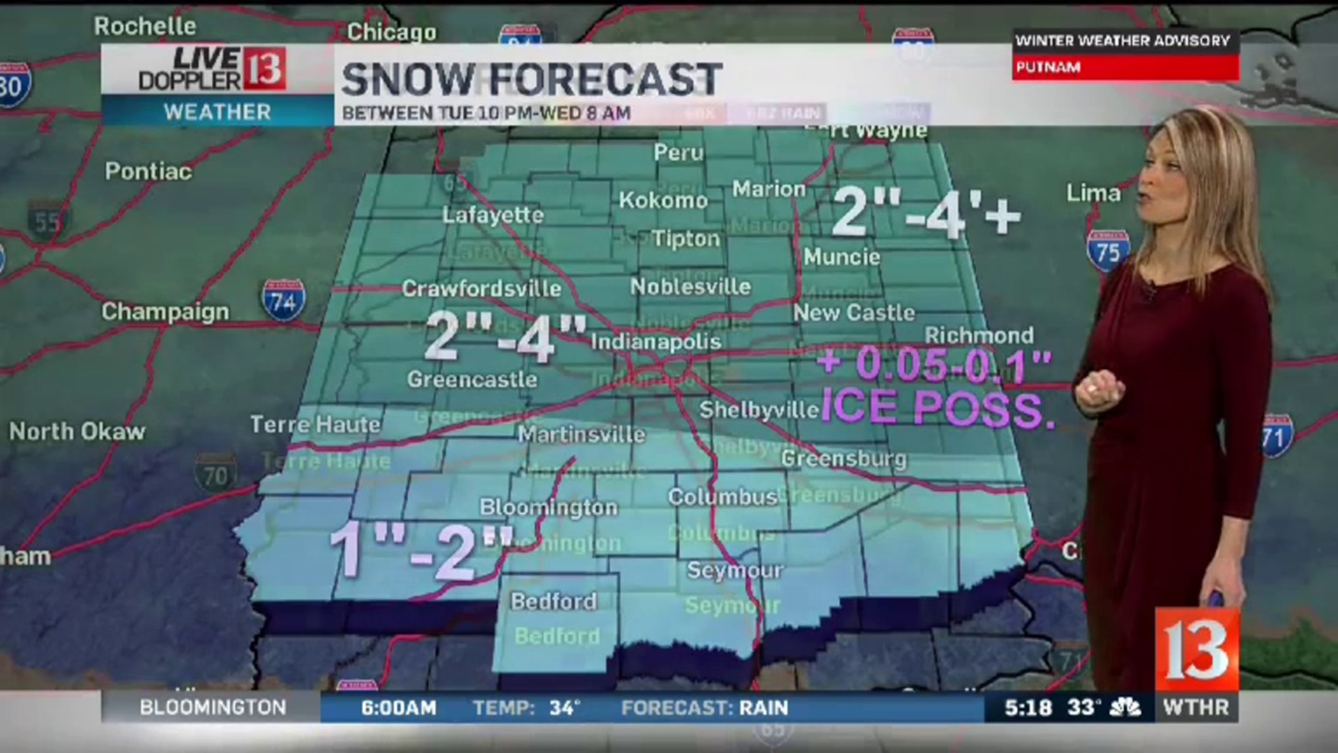
By 9pm Tuesday, temperatures across central Indiana were running in the upper 20s and lower 30s. The leading edge of a developing winter weather system was bringing snow to south central Illinois and southwestern Indiana. The moisture with this weather system will continue to move north. The atmosphere is cold enough for snow to start. Central and southern Indiana will have the potential for several hours of heavy snow from about midnight through 4am. As warmer air arrives, the snow will change to freezing rain and sleet. Where this happens first, snow totals are forecast to be an inch or 2. There will be some sleet and ice accumulations on top of the couple of inches of snow for the southern part of the state.
The transition from snow to a wintry mix will happen for central Indiana around 6am. This will shift the heavier snow north. Before the transition, there is the potential for 2-4 inches of snow for a good part of central Indiana. There will be some sleet and ice accumulations on top of the snow too. It will be slow, snowy and icy morning drive on Wednesday. It will be a good idea to allow extra time.
The warmer air will eventually change all of the wintry precipitation to all rain, but this won't happen until midmorning Wednesday.
Forecast afternoon temperatures will be in the lower 40s on Wednesday, with the chance for additional rain showers.
Central Indiana gets a chance to dry out on Thursday and Friday. It will be in the 40s both days.
Rain and storms are in the Saturday forecast.