Strong storms moved over central Indiana last night and the active weather will continue this holiday weekend. Make sure you have the SkyTrak13 Weather App to be notified if severe weather is approaching your area.
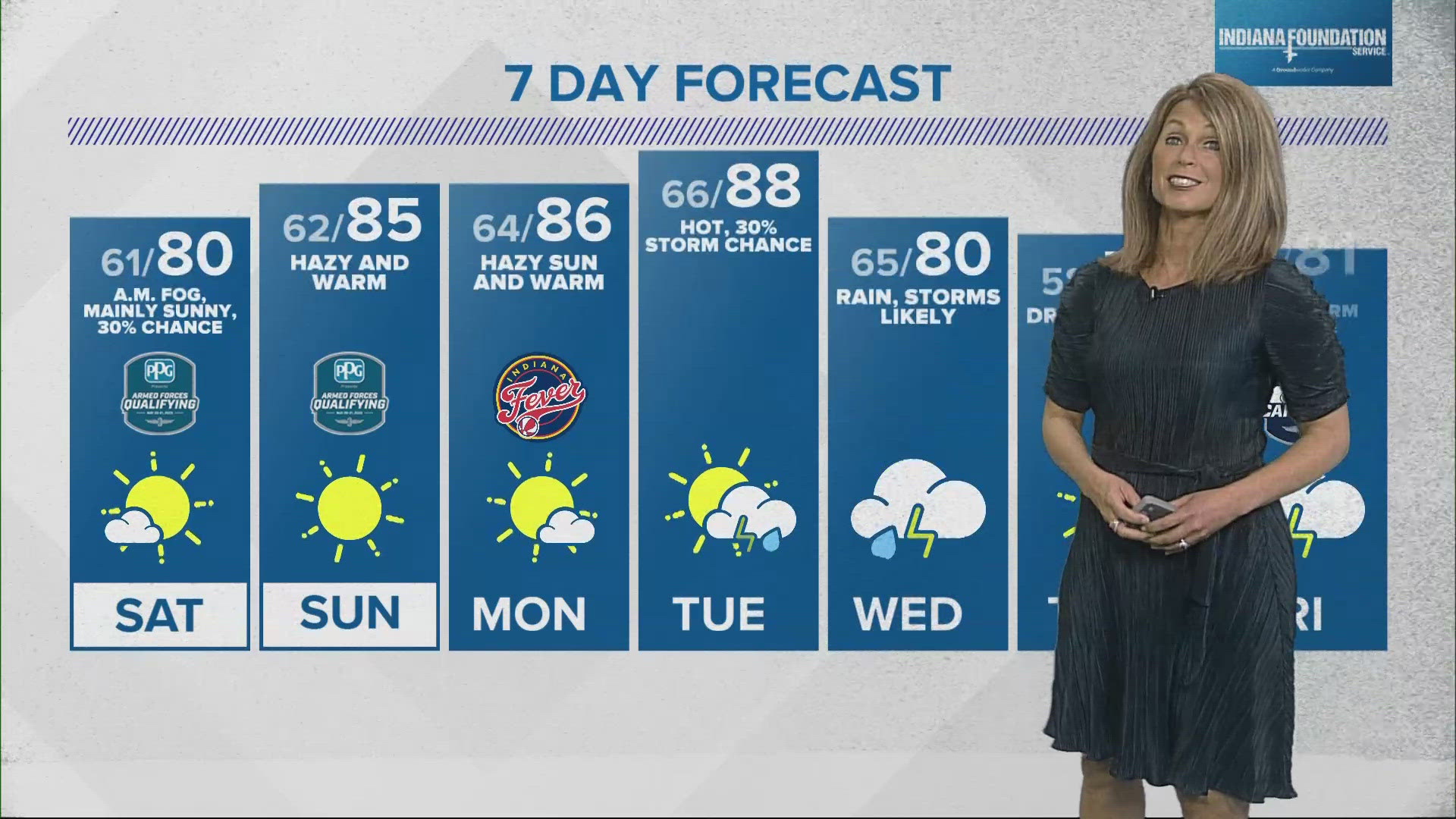
Most of today will be dry, warm and humid. There will be a mix of sun and clouds with highs in the low 80s.
The next complex of storms will arrive later tonight. There is a chance of a few scattered storms developing in south central Indiana this evening but the main storm development will be after midnight. Storms will arrive from southwest and push to the northeast early Sunday morning. The storms have the potential to be strong to severe with damaging winds the main threat. Temperatures will only fall into the mid 60s.
While the overnight round of storms will likely end by mid morning Sunday, more scattered storms will be likely Sunday afternoon, some could be strong to severe. If you are heading to the Indianapolis 500, bring the rain gear and your patience. There will be windows of dry time but there may be some starts and stops due to pop up storms. Also make sure you have identified your safe place to go if a strong to severe storm arrives. Afternoon highs will climb into the upper 70s.
Another round of strong to severe storms will be possible along the cold front Sunday evening.
Memorial Day does look mainly dry, with just a chance of some isolated storms in the evening. It will be breezy with mostly cloudy skies and highs in the upper 70s.
On this date in Indiana weather history -1961: Low temperatures below freezing mark the latest spring freeze on record for Indianapolis.