

INDIANA, USA — It was quite the wet stretch for central Indiana and parts of Marion and Johnson counties took the rainfall bullseye of 2"-4" over the past 24 hours. That caused localized flooding in some areas, but thankfully that water has receded after a drying afternoon.
And thankfully drivers were able to take advantage of the departure of the low pressure system that delivered the heavy rain. In its wake this afternoon was a less humid northeasterly breeze, peeks of sun, and highs in the 70s.
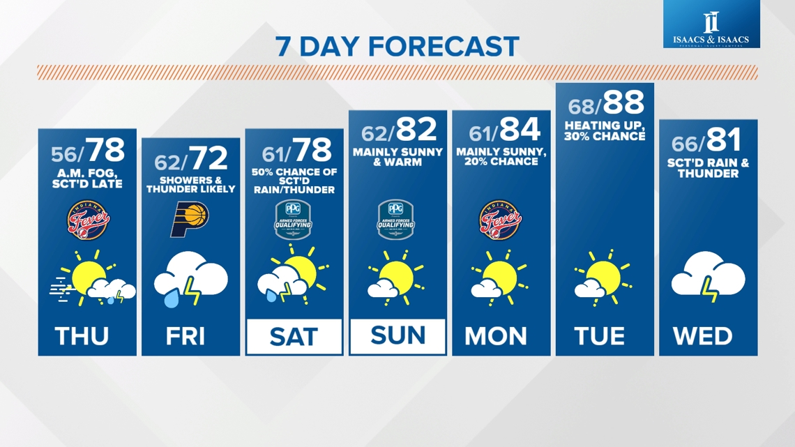
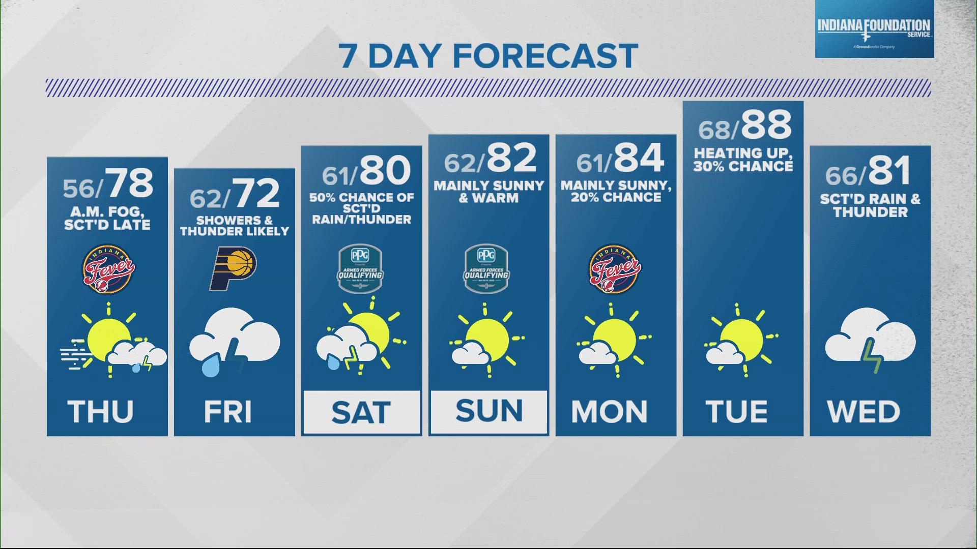
Only spotty showers expected in an otherwise pleasant evening. Locally dense fog possible tonight as clouds partial clear, the wind eases, and moisture from the saturated soil causes the low levels to saturate.
That's the only potential fly-in-ointment for drivers at IMS early Friday with many rain-free radar hours expected. However, we're still planning on at least widely scattered showers and/or thunderstorms around by 3-4 p.m.
Coverage increases Thursday evening and again during the Friday which doesn't bode well for laps at IMS on Fast Friday... which is increasingly looking like wet Friday.
The departure of that system remains a bit uncertain and dictates whether Saturday will be mainly dry or if it too will have scattered rain/thunderstorms. We're forecasting a 50% chance right now, but please know that could up and/or down as we get new data.
Sunday is looking summer-ish with hazy sun and unseasonably warm temperatures in the 80s. 80s continue into the middle of next week.