
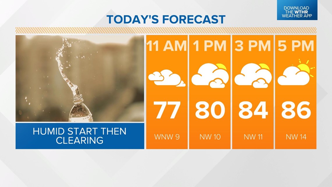
INDIANAPOLIS — Rain cleared the state Sunday morning but a slow-moving cold front could prompt a few additional pop-up showers on the eastern and southern parts of the state this afternoon. Skies will gradually clear through the day as temperatures recover to the mid 80s.

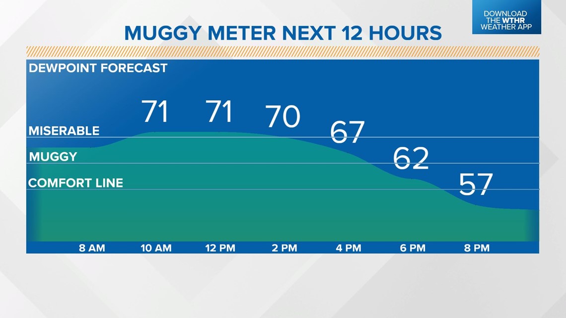
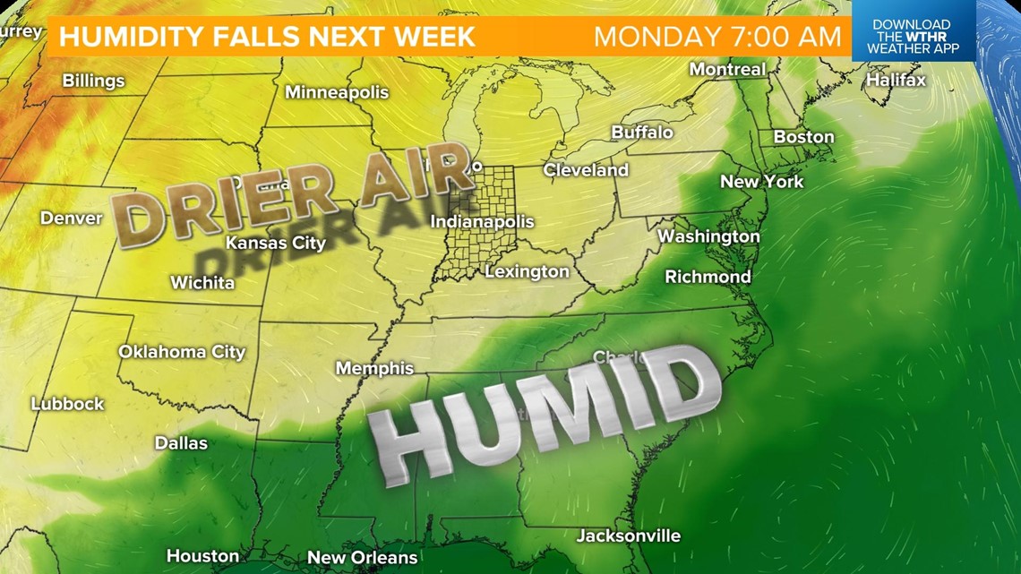
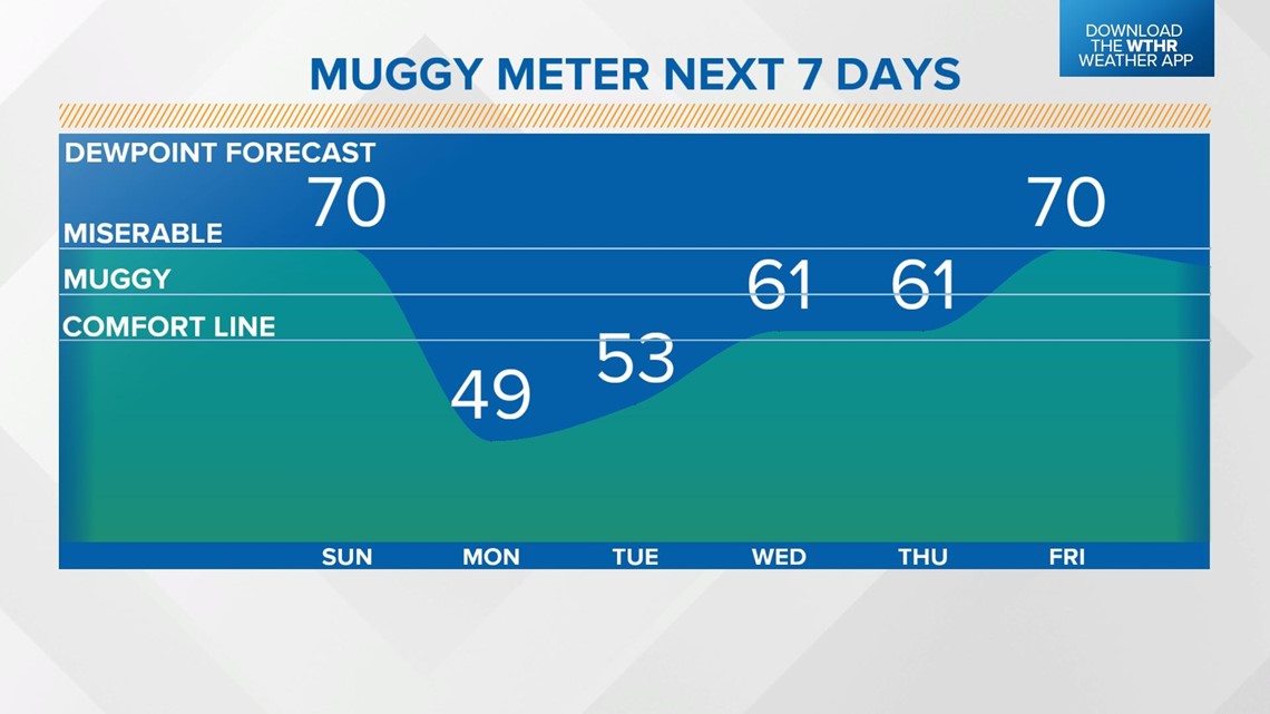
Drier air will continue to take over by this evening making it feel much more comfortable outside. Dew point temperatures will drop from the low 70s in that "miserable" category back into the 50s.

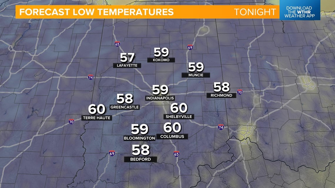
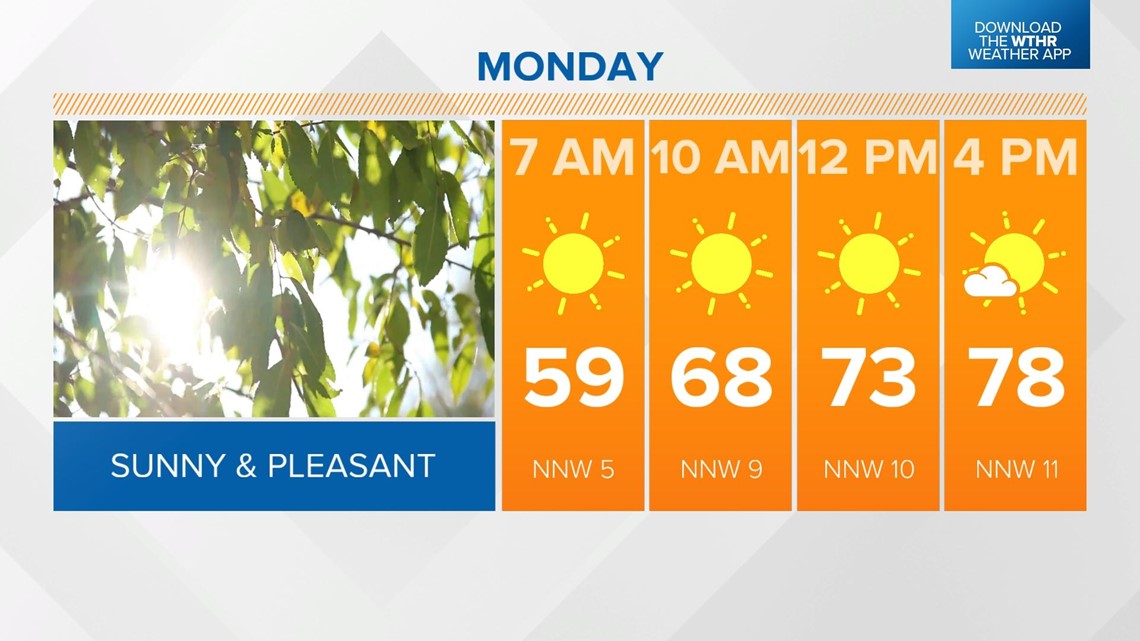
Temperatures will drop all the way back into the upper 50s overnight.

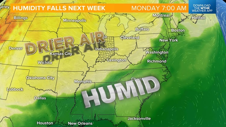
Drier air continues to settle in on Monday as dew point temperatures drop into the 40s.

Monday will be the coolest day of the week with highs in the upper 70s.

Temperatures will slowly trend upward through the week with highs back in the low 80s Tuesday and into the upper 80s by Wednesday. Even with highs in the low 90s Thursday, the humidity remains low as a dry air mass continues to dominate.

Our next best chance of rain will be Friday with pop-up storms developing in the late afternoon. It'll still be hot with highs in the low 90s. A slightly unsettled pattern keeps rain and storm chances in the forecast through next Saturday to kickoff the holiday weekend.
