
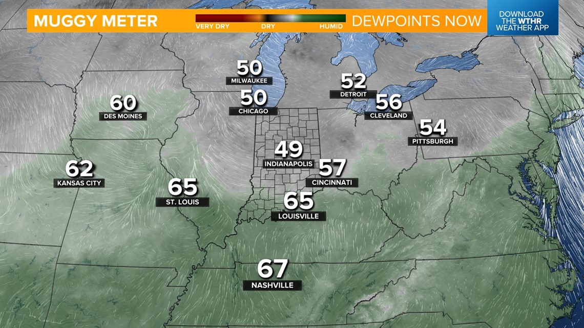
INDIANAPOLIS — We'll need to be weather aware this afternoon as strong to severe storms are possible. A storm system out west is tracking toward central Indiana this morning as an attached warm front begins to lift north through the state. This will bring a surge of moisture and increasing dew points which will serve as fuel for storms today. Notice the dew points in the 60s already in St. Louis and Louisville.

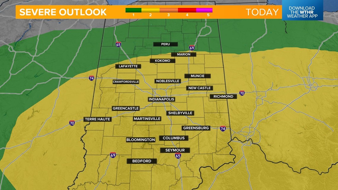
The Storm Prediction Center has placed most of central Indiana under a level 2 of 5 risk of scattered severe storms with the primary threat being damaging straight line wind gusts. Rotating storms, hail, and localized flooding due to heavy rain are possible as well. The time frame of severe weather is from 3 p.m. to 9 p.m.

Rain from a leftover storm system will continue to fall apart as it tracks into western Indiana. This could bring a few stray showers around lunchtime before the main threat of storms begins.


Storms will begin to initiate after 2 p.m.

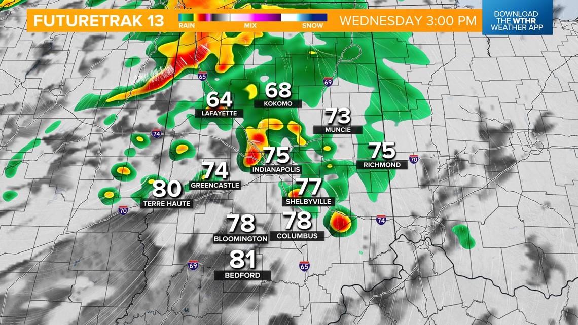
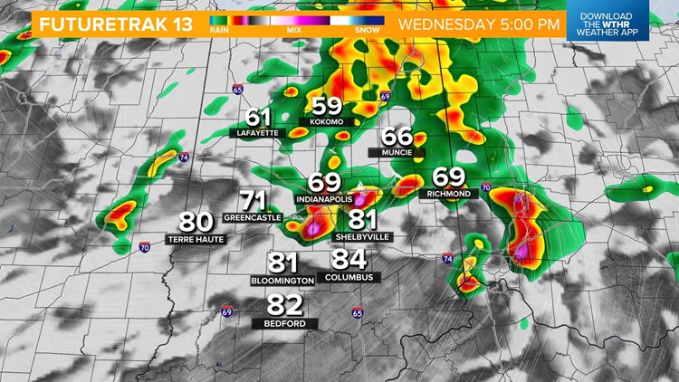
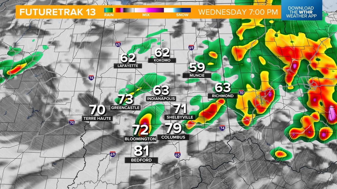
The storms will become more widespread and the severe threat increases in the late afternoon. This will impact the evening commute.


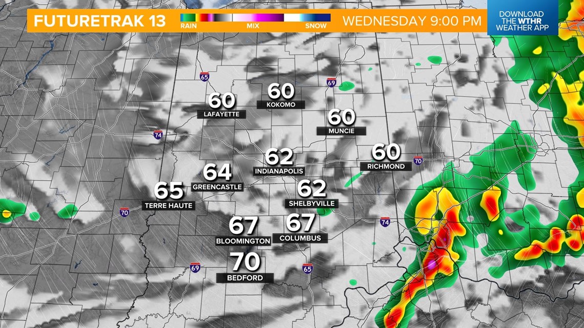
This system will begin to exit the state around sunset with the severe threat coming to an end after 9-10 p.m.

The sky will clear during the overnight hours with temperatures dropping into the mid 50s.
